Estimated Value: $292,000 - $384,000
3
Beds
2
Baths
1,968
Sq Ft
$175/Sq Ft
Est. Value
About This Home
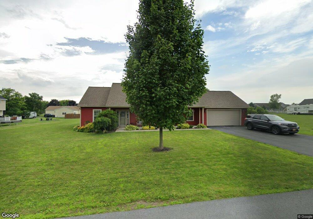
This home is located at 2 Carol Dr, Adams, NY 13605 and is currently estimated at $344,027, approximately $174 per square foot. 2 Carol Dr is a home located in Jefferson County with nearby schools including South Jefferson High School.
Ownership History
Date
Name
Owned For
Owner Type
Purchase Details
Closed on
May 19, 2021
Sold by
Perry Stephen R and Perry Patricia E
Bought by
Houghmaster Robert A and Houghmaster Julie A
Current Estimated Value
Purchase Details
Closed on
Nov 11, 2009
Sold by
Roberts John
Bought by
Perry Stephen
Create a Home Valuation Report for This Property
The Home Valuation Report is an in-depth analysis detailing your home's value as well as a comparison with similar homes in the area
Home Values in the Area
Average Home Value in this Area
Purchase History
| Date | Buyer | Sale Price | Title Company |
|---|---|---|---|
| Houghmaster Robert A | $270,000 | None Listed On Document | |
| Houghmaster Robert A | $270,000 | None Available | |
| Perry Stephen | $229,000 | -- |
Source: Public Records
Tax History Compared to Growth
Tax History
| Year | Tax Paid | Tax Assessment Tax Assessment Total Assessment is a certain percentage of the fair market value that is determined by local assessors to be the total taxable value of land and additions on the property. | Land | Improvement |
|---|---|---|---|---|
| 2024 | $6,380 | $232,500 | $30,500 | $202,000 |
| 2023 | $6,556 | $232,500 | $30,500 | $202,000 |
| 2022 | $6,569 | $232,500 | $30,500 | $202,000 |
| 2021 | $6,532 | $231,000 | $30,500 | $200,500 |
| 2020 | $6,216 | $231,000 | $30,500 | $200,500 |
| 2019 | $6,002 | $231,000 | $30,500 | $200,500 |
| 2018 | $6,002 | $231,000 | $30,500 | $200,500 |
| 2017 | $5,956 | $231,000 | $30,500 | $200,500 |
| 2016 | $5,918 | $231,000 | $30,500 | $200,500 |
| 2015 | -- | $231,000 | $30,500 | $200,500 |
| 2014 | -- | $224,500 | $30,400 | $194,100 |
Source: Public Records
Map
Nearby Homes
- 1 Carol Dr
- 7 Roberts St
- 97 E Church St
- 37 Wardwell St
- 10384 US Route 11 Unit 386
- 0 Grange Ave
- 32 Prospect St
- 63 Spring St
- 00 W Us Rt 11 St
- 0 N Adams Unit S1306940
- 0 N Adams Unit S1306938
- 0 N Adams Unit S1306936
- 0 N Adams Unit S1306918
- 0 N Adams Unit S1306912
- 0 N Adams Unit S1306904
- 0 N Adams Unit S1571495
- 11 Grove St
- 34 Grove St
- 35 Grove St
- 36 Grove St