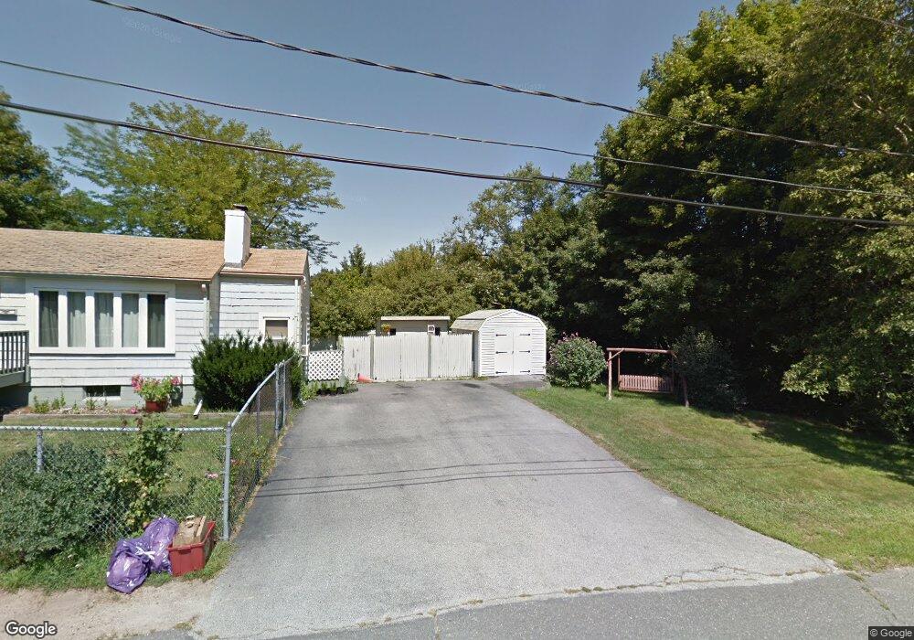
2 Cherry Hill Rd Gloucester, MA 01930
Estimated Value: $595,000 - $734,000
3
Beds
1
Bath
1,086
Sq Ft
$595/Sq Ft
Est. Value
About This Home
This home is located at 2 Cherry Hill Rd, Gloucester, MA 01930 and is currently estimated at $646,449, approximately $595 per square foot. 2 Cherry Hill Rd is a home located in Essex County with nearby schools including Beeman Memorial, Ralph B O'maley Middle School, and Gloucester High School.
Ownership History
Date
Name
Owned For
Owner Type
Purchase Details
Closed on
Sep 14, 2007
Sold by
Lawless Christina R and Lawless Michael J
Bought by
Deprimio Paul F and Deprimio Cheryl A
Current Estimated Value
Home Financials for this Owner
Home Financials are based on the most recent Mortgage that was taken out on this home.
Original Mortgage
$230,000
Interest Rate
6.7%
Mortgage Type
Purchase Money Mortgage
Purchase Details
Closed on
May 15, 2002
Sold by
Landry Mary A and Forgette Florence E
Bought by
Lawless Michael J and Lawless Christina R
Create a Home Valuation Report for This Property
The Home Valuation Report is an in-depth analysis detailing your home's value as well as a comparison with similar homes in the area
Purchase History
| Date | Buyer | Sale Price | Title Company |
|---|---|---|---|
| Deprimio Paul F | $329,000 | -- | |
| Lawless Michael J | $272,500 | -- |
Source: Public Records
Mortgage History
| Date | Status | Borrower | Loan Amount |
|---|---|---|---|
| Open | Lawless Michael J | $275,000 | |
| Closed | Lawless Michael J | $230,000 | |
| Previous Owner | Lawless Michael J | $266,000 | |
| Previous Owner | Lawless Michael J | $196,000 |
Source: Public Records
Tax History Compared to Growth
Tax History
| Year | Tax Paid | Tax Assessment Tax Assessment Total Assessment is a certain percentage of the fair market value that is determined by local assessors to be the total taxable value of land and additions on the property. | Land | Improvement |
|---|---|---|---|---|
| 2025 | $4,654 | $478,800 | $185,600 | $293,200 |
| 2024 | $4,529 | $465,500 | $176,800 | $288,700 |
| 2023 | $4,548 | $429,500 | $157,800 | $271,700 |
| 2022 | $4,306 | $367,100 | $137,300 | $229,800 |
| 2021 | $4,328 | $347,900 | $124,800 | $223,100 |
| 2020 | $4,022 | $326,200 | $124,800 | $201,400 |
| 2019 | $3,976 | $313,300 | $124,800 | $188,500 |
| 2018 | $3,911 | $302,500 | $124,800 | $177,700 |
| 2017 | $3,940 | $298,700 | $118,800 | $179,900 |
| 2016 | $3,916 | $287,700 | $124,000 | $163,700 |
| 2015 | $3,860 | $282,800 | $124,000 | $158,800 |
Source: Public Records
Map
Nearby Homes
- 2 Finch Ln
- 672 Washington St
- 78 Grove St
- 98 Maplewood Ave
- 6 Monroe Ct
- 16 Cleveland Place Unit 11
- 40 Sargent St
- 145 Essex St Unit 622
- 196 Washington St
- 33 Maplewood Ave Unit 16
- 10 Oak St Unit 3
- 226 Atlantic St
- 15 Harvard St
- 29 Harrison Ave
- 4 Mount Vernon St
- 22 Taylor St Unit 1
- 118 Prospect St
- 84 Centennial Ave
- 20 Beacon St Unit 2
- 20 Beacon St Unit 1
- 131 Cherry St
- 1 Cherry Hill Rd Unit 2
- 1 Cherry Hill Rd
- 1 Cherry Hill Rd Unit 1
- 4 Cherry Hill Rd
- 133 Cherry St
- 125 Cherry St
- 6 Cherry Hill Rd
- 5 Cherry Hill Rd
- 135 Cherry St
- 18 Macomber Rd
- 7 Cherry Hill Rd
- 123 Cherry St
- 137 Cherry St
- 16 Macomber Rd
- 12 Macomber Rd
- 139 Cherry St
- 121 Cherry St
- 10 Macomber Rd
- 144 Cherry St