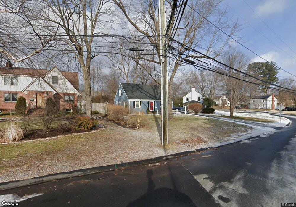
2 Cherryfield Dr West Hartford, CT 06107
Estimated Value: $475,000 - $522,000
4
Beds
2
Baths
1,337
Sq Ft
$375/Sq Ft
Est. Value
About This Home
This home is located at 2 Cherryfield Dr, West Hartford, CT 06107 and is currently estimated at $500,841, approximately $374 per square foot. 2 Cherryfield Dr is a home located in Hartford County with nearby schools including Duffy School, Sedgwick Middle School, and Conard High School.
Ownership History
Date
Name
Owned For
Owner Type
Purchase Details
Closed on
Jan 31, 2007
Sold by
Senecal Diane R
Bought by
Bayley Kimberly L
Current Estimated Value
Home Financials for this Owner
Home Financials are based on the most recent Mortgage that was taken out on this home.
Original Mortgage
$228,000
Interest Rate
6.16%
Purchase Details
Closed on
Aug 31, 2004
Sold by
Henderson Robert P
Bought by
Senecal Diane R
Purchase Details
Closed on
Aug 1, 1995
Sold by
Burkett Timothy and Burkett Kristine
Bought by
Henderson Robert
Purchase Details
Closed on
Sep 15, 1993
Sold by
Moeller Gwendolyn and Moeller Richard
Bought by
Burkett Timothy and Burkett Kristine
Purchase Details
Closed on
Jun 24, 1992
Sold by
Ronan Joseph and Ronan Marie
Bought by
Moeller Richard and Moeller Gwendolyn
Create a Home Valuation Report for This Property
The Home Valuation Report is an in-depth analysis detailing your home's value as well as a comparison with similar homes in the area
Home Values in the Area
Average Home Value in this Area
Purchase History
| Date | Buyer | Sale Price | Title Company |
|---|---|---|---|
| Bayley Kimberly L | $285,000 | -- | |
| Senecal Diane R | $272,000 | -- | |
| Henderson Robert | $157,000 | -- | |
| Burkett Timothy | $156,500 | -- | |
| Moeller Richard | $129,600 | -- |
Source: Public Records
Mortgage History
| Date | Status | Borrower | Loan Amount |
|---|---|---|---|
| Open | Moeller Richard | $221,250 | |
| Closed | Moeller Richard | $228,000 | |
| Previous Owner | Moeller Richard | $70,000 |
Source: Public Records
Tax History Compared to Growth
Tax History
| Year | Tax Paid | Tax Assessment Tax Assessment Total Assessment is a certain percentage of the fair market value that is determined by local assessors to be the total taxable value of land and additions on the property. | Land | Improvement |
|---|---|---|---|---|
| 2025 | $10,275 | $229,460 | $111,160 | $118,300 |
| 2024 | $9,718 | $229,460 | $111,160 | $118,300 |
| 2023 | $9,390 | $229,460 | $111,160 | $118,300 |
| 2022 | $9,334 | $229,460 | $111,160 | $118,300 |
| 2021 | $8,953 | $211,050 | $114,450 | $96,600 |
| 2020 | $8,360 | $199,990 | $107,170 | $92,820 |
| 2019 | $8,360 | $199,990 | $107,170 | $92,820 |
| 2018 | $7,979 | $194,600 | $107,170 | $87,430 |
| 2017 | $7,986 | $194,600 | $107,170 | $87,430 |
| 2016 | $7,420 | $187,810 | $90,160 | $97,650 |
| 2015 | $7,195 | $187,810 | $90,160 | $97,650 |
| 2014 | $7,018 | $187,810 | $90,160 | $97,650 |
Source: Public Records
Map
Nearby Homes
- 19 Sulgrave Rd
- 126 Westminster Dr
- 26 Pheasant Hill Dr
- 1925 Boulevard
- 88 Spring Ln
- 14 Hedwig Ct
- 7 Buena Vista Rd
- 29 Fairwood Farms Dr
- 41 Sedgwick Rd
- 42 Fairwood Farms Dr
- 1782 Boulevard
- 26 Garland Rd
- 3 Staples Place
- 236 Ridgewood Rd
- 61 Waterside Ln
- 31 Everett Ave
- 632 Park Rd
- 6 Greenhurst Rd
- 32 Miles Standish Dr
- 2 Arapahoe Rd Unit 308