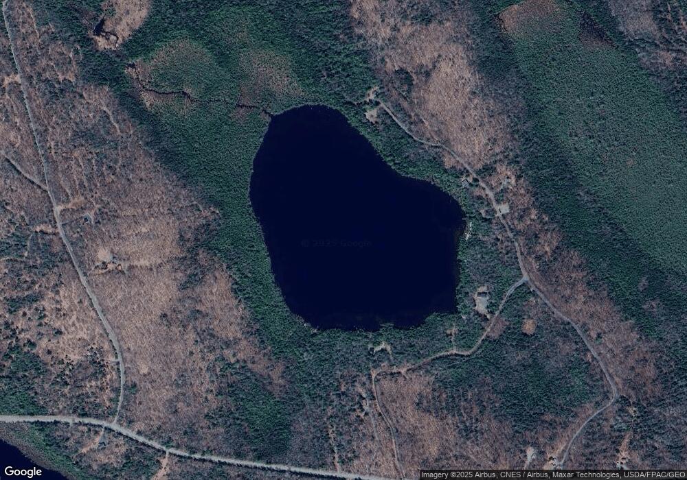
2 Doe Pond Rd Monson, ME 04464
Estimated Value: $146,000 - $332,000
--
Bed
--
Bath
--
Sq Ft
2.5
Acres
About This Home
This home is located at 2 Doe Pond Rd, Monson, ME 04464 and is currently estimated at $266,611. 2 Doe Pond Rd is a home with nearby schools including Se Do Mo Cha Elementary School and Se Do Mo Cha Middle School.
Ownership History
Date
Name
Owned For
Owner Type
Purchase Details
Closed on
May 16, 2025
Sold by
Murtough Lt and Murtough
Bought by
Cray Chad
Current Estimated Value
Home Financials for this Owner
Home Financials are based on the most recent Mortgage that was taken out on this home.
Original Mortgage
$255,200
Outstanding Balance
$254,295
Interest Rate
6.64%
Mortgage Type
Purchase Money Mortgage
Estimated Equity
$12,316
Purchase Details
Closed on
Oct 11, 2011
Sold by
Murtough Kathleen E and Murtough David M
Bought by
Murtough Lt and Murtough
Purchase Details
Closed on
Jan 26, 2006
Sold by
Security Ent Inc
Bought by
Murtough David M and Murtough Kathleen E
Create a Home Valuation Report for This Property
The Home Valuation Report is an in-depth analysis detailing your home's value as well as a comparison with similar homes in the area
Home Values in the Area
Average Home Value in this Area
Purchase History
| Date | Buyer | Sale Price | Title Company |
|---|---|---|---|
| Cray Chad | $319,000 | None Available | |
| Cray Chad | $319,000 | None Available | |
| Murtough Lt | -- | -- | |
| Murtough Lt | -- | -- | |
| Murtough David M | -- | -- | |
| Murtough David M | -- | -- |
Source: Public Records
Mortgage History
| Date | Status | Borrower | Loan Amount |
|---|---|---|---|
| Open | Cray Chad | $255,200 | |
| Closed | Cray Chad | $255,200 |
Source: Public Records
Tax History Compared to Growth
Tax History
| Year | Tax Paid | Tax Assessment Tax Assessment Total Assessment is a certain percentage of the fair market value that is determined by local assessors to be the total taxable value of land and additions on the property. | Land | Improvement |
|---|---|---|---|---|
| 2024 | $2,262 | $111,150 | $22,930 | $88,220 |
| 2022 | $1,884 | $111,150 | $22,930 | $88,220 |
| 2020 | $1,945 | $111,150 | $22,930 | $88,220 |
| 2019 | $1,245 | $50,620 | $13,130 | $37,490 |
| 2018 | $871 | $50,620 | $13,130 | $37,490 |
| 2017 | $861 | $50,620 | $13,130 | $37,490 |
| 2016 | $785 | $50,620 | $13,130 | $37,490 |
| 2014 | $763 | $53,540 | $16,050 | $37,490 |
Source: Public Records
Map
Nearby Homes
- 1 Blanchard Rd
- 51 N Guilford Rd
- 9 Tenney Hill Rd
- 42 Greenville Rd
- 3A Winter Hill Ln
- Lot 8 Winter Hill Ln
- 283 Tenney Hill Rd
- 180 Pleasant St
- 95 Ruksznis Ln
- 10 Hammond Brook Rd
- Lot #8 Hammond Brook Rd Unit 8
- 5 Tenney Hill Rd
- Lot #7 Hammond Brook Rd
- 41 Thomas Rd
- 6 Maple Dr
- 978 N Rd
- # Pond Rd
- 2 Piper Ln
- 22 Point Rd
- 7 Pond Rd
- 121 Tenney Hill Rd
- 135 Tenney Hill Rd
- 115 Tenney Hill Rd
- 128 Tenney Hill Rd
- 124 Tenney Hill Rd
- 118 Tenney Hill Rd
- Lot 18 Tenney Hill Rd
- 147 Tenney Hill Rd
- 103 Tenney Hill Rd
- 106 Tenney Hill Rd
- 68 Blanchard Rd
- 153 Tenney Hill Rd
- Lot 5 Stevens Ln
- 31 Blanchard
- 93 Blanchard Rd
- 49 Blanchard Rd
- 91 Tenney Hill Rd
- 96 Tenney Hill Rd
- 159 Tenney Hill Rd
- 88 Tenney Hill Rd
