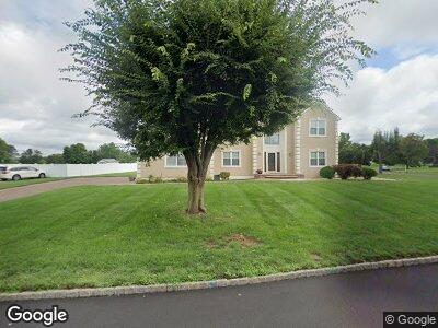
2 Grouser Rd Somerset, NJ 08873
Estimated Value: $935,000 - $992,151
4
Beds
3
Baths
3,077
Sq Ft
$311/Sq Ft
Est. Value
About This Home
This home is located at 2 Grouser Rd, Somerset, NJ 08873 and is currently estimated at $955,788, approximately $310 per square foot. 2 Grouser Rd is a home located in Somerset County with nearby schools including Franklin High School, Central Jersey College Prep Charter School, and Rutgers Preparatory School.
Ownership History
Date
Name
Owned For
Owner Type
Purchase Details
Closed on
Apr 2, 2007
Sold by
Wells Fargo Bank Na
Bought by
Eftoski Zvezda
Current Estimated Value
Home Financials for this Owner
Home Financials are based on the most recent Mortgage that was taken out on this home.
Original Mortgage
$410,400
Interest Rate
5.37%
Mortgage Type
Purchase Money Mortgage
Purchase Details
Closed on
Oct 18, 2000
Sold by
Middlebush Village Estates
Bought by
Velez Carlos
Home Financials for this Owner
Home Financials are based on the most recent Mortgage that was taken out on this home.
Original Mortgage
$150,000
Interest Rate
7.88%
Purchase Details
Closed on
Aug 30, 1996
Sold by
Sunrise Comm
Bought by
Wusu Neil
Home Financials for this Owner
Home Financials are based on the most recent Mortgage that was taken out on this home.
Original Mortgage
$226,000
Interest Rate
8.11%
Create a Home Valuation Report for This Property
The Home Valuation Report is an in-depth analysis detailing your home's value as well as a comparison with similar homes in the area
Home Values in the Area
Average Home Value in this Area
Purchase History
| Date | Buyer | Sale Price | Title Company |
|---|---|---|---|
| Eftoski Zvezda | $570,000 | None Available | |
| Velez Carlos | $296,490 | -- | |
| Wusu Neil | $282,000 | -- |
Source: Public Records
Mortgage History
| Date | Status | Borrower | Loan Amount |
|---|---|---|---|
| Previous Owner | Eftoski Zvezda | $410,400 | |
| Previous Owner | Wusu Neil | $12,000 | |
| Previous Owner | Velez Carlos | $150,000 | |
| Previous Owner | Wusu Neil | $226,000 |
Source: Public Records
Tax History Compared to Growth
Tax History
| Year | Tax Paid | Tax Assessment Tax Assessment Total Assessment is a certain percentage of the fair market value that is determined by local assessors to be the total taxable value of land and additions on the property. | Land | Improvement |
|---|---|---|---|---|
| 2024 | $14,355 | $789,600 | $379,100 | $410,500 |
| 2023 | $14,757 | $764,200 | $354,100 | $410,100 |
| 2022 | $13,740 | $674,200 | $264,100 | $410,100 |
| 2021 | $12,826 | $624,200 | $214,100 | $410,100 |
| 2020 | $13,339 | $589,200 | $179,100 | $410,100 |
| 2019 | $13,563 | $589,200 | $179,100 | $410,100 |
| 2018 | $13,240 | $569,200 | $159,100 | $410,100 |
| 2017 | $13,285 | $569,200 | $159,100 | $410,100 |
| 2016 | $13,010 | $553,400 | $159,100 | $394,300 |
| 2015 | $12,819 | $549,000 | $159,100 | $389,900 |
| 2014 | $13,623 | $591,800 | $159,100 | $432,700 |
Source: Public Records
Map
Nearby Homes
- 8 Staudt Ct
- 34 Bering Way
- 34 Cornelius Way
- 623 Elizabeth Ave
- 9 Miller Farm Rd
- 126 Smith Rd
- 6 Miller Farm Rd
- 1 Miller Farm Rd
- 1868 Amwell Rd
- 521 Canal Rd
- 80 Van Doren Ave
- 585 Elizabeth Ave
- 180 Blackwells Mills Rd
- 479 Skillmans Ln
- 298 Cedar Grove Ln
- 29 Olcott St
- 287 Cedar Grove Ln
- 441 Skillmans Ln
- 2 Kristen Ct
- 28 Valley Wood Dr