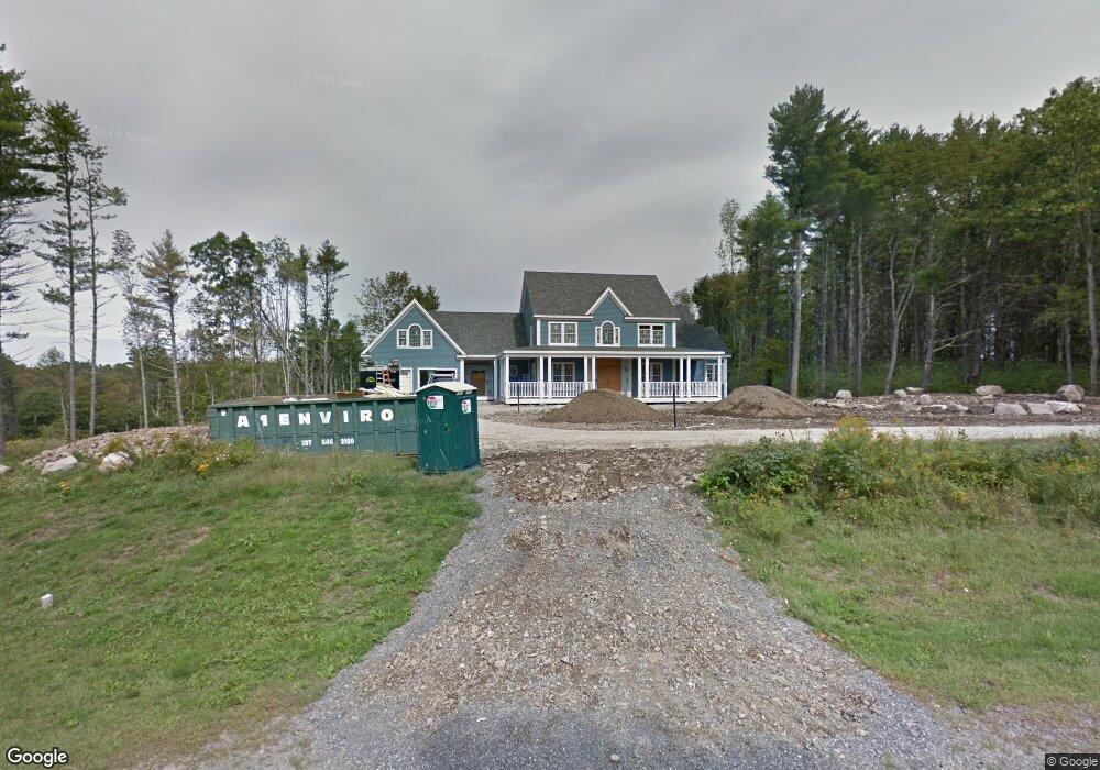
2 Harbor Side Dr Unit 1 York, ME 03909
York NeighborhoodEstimated Value: $1,939,905 - $2,217,000
3
Beds
4
Baths
4,373
Sq Ft
$473/Sq Ft
Est. Value
About This Home
This home is located at 2 Harbor Side Dr Unit 1, York, ME 03909 and is currently estimated at $2,067,476, approximately $472 per square foot. 2 Harbor Side Dr Unit 1 is a home located in York County with nearby schools including Village Elementary School, Coastal Ridge Elementary School, and York Middle School.
Ownership History
Date
Name
Owned For
Owner Type
Purchase Details
Closed on
Dec 9, 2022
Sold by
Stark Richard E and Stark Jodi N
Bought by
Harborview Nt 2022 and Cormier
Current Estimated Value
Purchase Details
Closed on
Mar 7, 2006
Sold by
Ulm Michal W and Winton David S
Bought by
Sparhawk Realty Llc
Create a Home Valuation Report for This Property
The Home Valuation Report is an in-depth analysis detailing your home's value as well as a comparison with similar homes in the area
Home Values in the Area
Average Home Value in this Area
Purchase History
| Date | Buyer | Sale Price | Title Company |
|---|---|---|---|
| Harborview Nt 2022 | $1,570,000 | None Available | |
| Harborview Nt 2022 | $1,570,000 | None Available | |
| Harborview Nt 2022 | $1,570,000 | None Available | |
| Sparhawk Realty Llc | -- | -- | |
| Sparhawk Realty Llc | -- | -- |
Source: Public Records
Tax History Compared to Growth
Tax History
| Year | Tax Paid | Tax Assessment Tax Assessment Total Assessment is a certain percentage of the fair market value that is determined by local assessors to be the total taxable value of land and additions on the property. | Land | Improvement |
|---|---|---|---|---|
| 2024 | $12,623 | $1,502,700 | $619,100 | $883,600 |
| 2023 | $12,790 | $1,513,600 | $630,000 | $883,600 |
| 2022 | $10,990 | $1,285,400 | $351,700 | $933,700 |
| 2021 | $10,763 | $1,081,700 | $300,700 | $781,000 |
| 2020 | $8,523 | $882,300 | $259,900 | $622,400 |
| 2019 | $8,282 | $871,300 | $254,800 | $616,500 |
| 2018 | $9,715 | $871,300 | $254,800 | $616,500 |
| 2017 | $9,424 | $860,600 | $254,800 | $605,800 |
| 2016 | $9,666 | $866,900 | $254,800 | $612,100 |
| 2015 | $9,338 | $848,900 | $254,800 | $594,100 |
| 2014 | $9,083 | $848,900 | $254,800 | $594,100 |
| 2013 | $8,982 | $861,200 | $254,800 | $606,400 |
Source: Public Records
Map
Nearby Homes
- 25 Brave Boat Harbor Rd
- 4 Ice House Point
- 23 Harmon Park Rd
- 419 & 425 York St
- 425 York St
- 3 Sentry Hill Rd
- 8 Old Seabury Rd
- 60 Barrell Ln Unit 3
- 60 Barrell Ln Unit 1
- 357 Southside Rd
- 21 Starboard Ln
- 301 Route 103
- 294 York St Unit 1
- 294 York St Unit 2
- 294 York St Unit 3
- 281 York St
- 12 Norwood Farms Rd Unit 1
- 589 York St Unit 11
- 2 Roaring Rock Rd
- 8 Roaring Rock Rd
- 2 Harbor Side Dr
- 4 Harbor Side Dr Unit 2
- 23 Western Point Rd
- 6 Harbor Side Dr Unit 3
- 6 Harbor Side Dr
- 1 Harbor Side Dr Unit 7
- 1 Harbor Side Dr
- 31 Western Point
- 18 Windmill Acres Rd
- 22 Windmill Acres Rd
- 12 Windmill Acres Rd
- 34 Western Point Rd
- 196 Brave Boat Harbor Rd
- 21 Windmill Acres Rd
- 6 Brave Boat Harbor Rd
- 15 Windmill Acres Rd
- 26 Windmill Acres Rd
- 5 Harbor Side Dr
- 5 Harbor Side Dr Unit 6
- 5 Harbor Side Dr