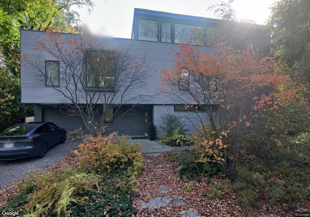
2 Hemlock Rd Cambridge, MA 02138
West Cambridge NeighborhoodEstimated Value: $3,783,000 - $5,784,000
3
Beds
3
Baths
2,885
Sq Ft
$1,772/Sq Ft
Est. Value
About This Home
This home is located at 2 Hemlock Rd, Cambridge, MA 02138 and is currently estimated at $5,110,834, approximately $1,771 per square foot. 2 Hemlock Rd is a home located in Middlesex County with nearby schools including Benjamin Banneker Charter Public School, St Peter School, and Cambridge Montessori School.
Ownership History
Date
Name
Owned For
Owner Type
Purchase Details
Closed on
Dec 2, 2010
Sold by
Helgesson Hemlock Nt and Medeiros Margaret D
Bought by
Miner Richard A and Nagy Corinne G
Current Estimated Value
Create a Home Valuation Report for This Property
The Home Valuation Report is an in-depth analysis detailing your home's value as well as a comparison with similar homes in the area
Home Values in the Area
Average Home Value in this Area
Purchase History
| Date | Buyer | Sale Price | Title Company |
|---|---|---|---|
| Miner Richard A | $1,750,000 | -- |
Source: Public Records
Tax History Compared to Growth
Tax History
| Year | Tax Paid | Tax Assessment Tax Assessment Total Assessment is a certain percentage of the fair market value that is determined by local assessors to be the total taxable value of land and additions on the property. | Land | Improvement |
|---|---|---|---|---|
| 2025 | $43,012 | $6,773,500 | $3,109,500 | $3,664,000 |
| 2024 | $39,118 | $6,607,800 | $3,084,600 | $3,523,200 |
| 2023 | $36,231 | $6,182,700 | $3,072,100 | $3,110,600 |
| 2022 | $32,750 | $5,532,100 | $2,780,300 | $2,751,800 |
| 2021 | $31,230 | $5,338,500 | $2,728,400 | $2,610,100 |
| 2020 | $29,225 | $5,082,600 | $2,611,100 | $2,471,500 |
| 2019 | $26,609 | $4,479,700 | $2,199,400 | $2,280,300 |
| 2018 | $27,438 | $4,362,200 | $2,188,100 | $2,174,100 |
| 2017 | $26,743 | $4,120,700 | $2,086,600 | $2,034,100 |
| 2016 | $25,576 | $3,659,000 | $1,804,600 | $1,854,400 |
| 2015 | $26,159 | $3,345,200 | $1,691,900 | $1,653,300 |
| 2014 | $16,632 | $1,984,700 | $1,646,700 | $338,000 |
Source: Public Records
Map
Nearby Homes
- 234 Huron Ave
- 153 Brattle St
- 148 Huron Ave
- 8 Holly Ave Unit 1
- 48 Hubbard Park Rd
- 15 Hubbard Park Rd
- 158 Brattle St
- 71-73 Reservoir St
- 422-424 Walden St
- 12-14 Gray Gardens W
- 18 Donnell St
- 92 Fayerweather St Unit 2
- 84 Garden St
- 172 Brattle St
- 3 Berkeley Place
- 202 Garden St
- 20 Maynard Place
- 52 Garden St Unit B2
- 32 Copley St Unit 2
- 31 Chilton St Unit 1