Estimated Value: $879,000 - $961,000
4
Beds
2
Baths
1,670
Sq Ft
$550/Sq Ft
Est. Value
About This Home
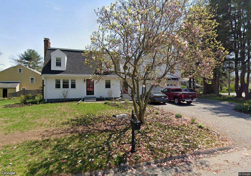
This home is located at 2 Heritage Rd, Acton, MA 01720 and is currently estimated at $919,067, approximately $550 per square foot. 2 Heritage Rd is a home located in Middlesex County with nearby schools including Acton-Boxborough Regional High School and Maynard Knowledge Beginnings.
Ownership History
Date
Name
Owned For
Owner Type
Purchase Details
Closed on
Jul 6, 2005
Sold by
Forda F Pappas T and Pappas Forda F
Bought by
Naidoo Jordan P and Naidoo Puventhrie
Current Estimated Value
Home Financials for this Owner
Home Financials are based on the most recent Mortgage that was taken out on this home.
Original Mortgage
$359,000
Outstanding Balance
$188,007
Interest Rate
5.71%
Mortgage Type
Purchase Money Mortgage
Estimated Equity
$731,060
Create a Home Valuation Report for This Property
The Home Valuation Report is an in-depth analysis detailing your home's value as well as a comparison with similar homes in the area
Home Values in the Area
Average Home Value in this Area
Purchase History
| Date | Buyer | Sale Price | Title Company |
|---|---|---|---|
| Naidoo Jordan P | $480,000 | -- |
Source: Public Records
Mortgage History
| Date | Status | Borrower | Loan Amount |
|---|---|---|---|
| Open | Naidoo Jordan P | $359,000 |
Source: Public Records
Tax History
| Year | Tax Paid | Tax Assessment Tax Assessment Total Assessment is a certain percentage of the fair market value that is determined by local assessors to be the total taxable value of land and additions on the property. | Land | Improvement |
|---|---|---|---|---|
| 2025 | $15,188 | $885,600 | $314,700 | $570,900 |
| 2024 | $14,158 | $849,300 | $314,700 | $534,600 |
| 2023 | $13,818 | $786,900 | $285,900 | $501,000 |
| 2022 | $13,055 | $671,200 | $248,500 | $422,700 |
| 2021 | $12,755 | $630,500 | $230,200 | $400,300 |
| 2020 | $12,114 | $629,600 | $230,200 | $399,400 |
| 2019 | $11,545 | $596,000 | $230,200 | $365,800 |
| 2018 | $11,328 | $584,500 | $230,200 | $354,300 |
| 2017 | $11,030 | $578,700 | $230,200 | $348,500 |
| 2016 | $10,796 | $561,400 | $230,200 | $331,200 |
| 2015 | $8,609 | $451,900 | $230,200 | $221,700 |
| 2014 | $7,216 | $371,000 | $230,200 | $140,800 |
Source: Public Records
Map
Nearby Homes
- 59 Lexington Dr
- 303 School St
- 7 Hillcrest Dr
- 65 Summit St
- 245 Oak Hill Cir
- 128 Parker St Unit 3B
- 31 Drummer Rd Unit 31
- 1 Vanderbelt Rd
- 27 Forest Rd
- 1 Drummer Rd Unit A5
- 95 Concord Rd
- 37 Water St
- 27 Water St
- 66 Old Stow Rd
- 70 River St
- 1844 Main St Unit 1844
- 20 Westvale Meadows Unit C
- 42 Sunnyside Ln
- 30 Brewster Ln
- 1 Bayberry Rd
Your Personal Tour Guide
Ask me questions while you tour the home.