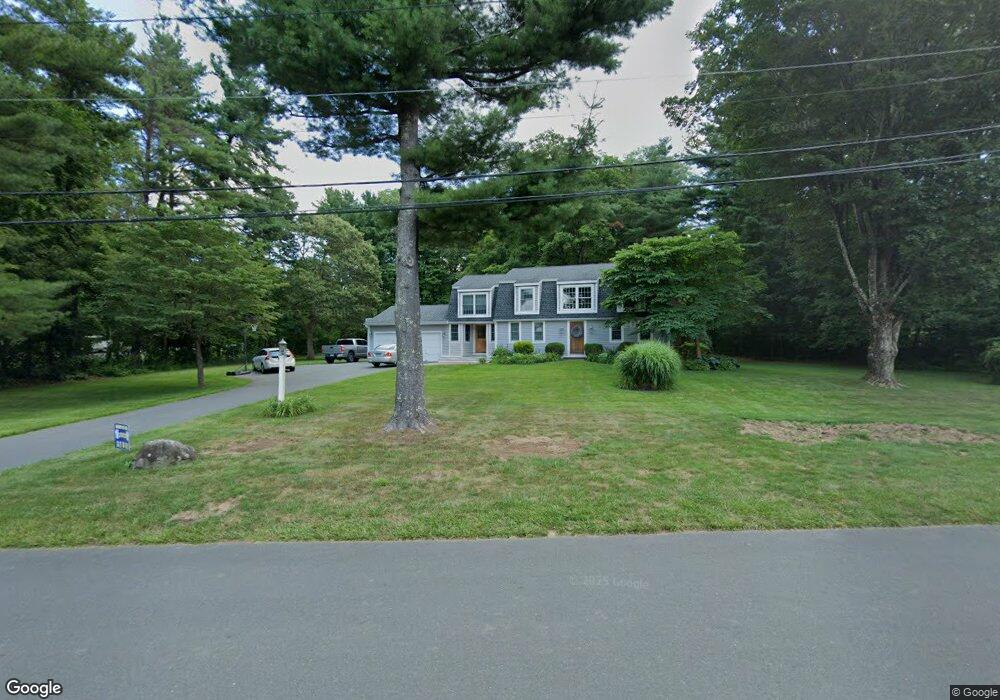
2 Hildurcrest Dr Simsbury, CT 06070
Estimated Value: $557,000 - $595,000
4
Beds
3
Baths
2,208
Sq Ft
$264/Sq Ft
Est. Value
About This Home
This home is located at 2 Hildurcrest Dr, Simsbury, CT 06070 and is currently estimated at $583,437, approximately $264 per square foot. 2 Hildurcrest Dr is a home located in Hartford County with nearby schools including Latimer Lane School, Henry James Memorial School, and Simsbury High School.
Ownership History
Date
Name
Owned For
Owner Type
Purchase Details
Closed on
Sep 26, 2001
Sold by
Slattery John C and Slattery Bernadette M
Bought by
Butler Steven J and Butler Elizabeth A
Current Estimated Value
Home Financials for this Owner
Home Financials are based on the most recent Mortgage that was taken out on this home.
Original Mortgage
$206,680
Interest Rate
6.91%
Purchase Details
Closed on
Jun 24, 1992
Sold by
Powell Walter Thomas
Bought by
Slattery John and Slattery Bernadette
Purchase Details
Closed on
Sep 12, 1989
Sold by
Leiby Grace
Bought by
Powell Walter
Create a Home Valuation Report for This Property
The Home Valuation Report is an in-depth analysis detailing your home's value as well as a comparison with similar homes in the area
Home Values in the Area
Average Home Value in this Area
Purchase History
| Date | Buyer | Sale Price | Title Company |
|---|---|---|---|
| Butler Steven J | $229,900 | -- | |
| Slattery John | $166,000 | -- | |
| Powell Walter | $216,000 | -- |
Source: Public Records
Mortgage History
| Date | Status | Borrower | Loan Amount |
|---|---|---|---|
| Open | Powell Walter | $320,000 | |
| Closed | Powell Walter | $206,680 | |
| Previous Owner | Powell Walter | $110,000 |
Source: Public Records
Tax History Compared to Growth
Tax History
| Year | Tax Paid | Tax Assessment Tax Assessment Total Assessment is a certain percentage of the fair market value that is determined by local assessors to be the total taxable value of land and additions on the property. | Land | Improvement |
|---|---|---|---|---|
| 2025 | $10,218 | $299,110 | $104,370 | $194,740 |
| 2024 | $9,963 | $299,110 | $104,370 | $194,740 |
| 2023 | $9,518 | $299,110 | $104,370 | $194,740 |
| 2022 | $9,102 | $235,630 | $106,220 | $129,410 |
| 2021 | $9,102 | $235,630 | $106,220 | $129,410 |
| 2020 | $8,740 | $235,630 | $106,220 | $129,410 |
| 2019 | $8,794 | $235,630 | $106,220 | $129,410 |
| 2018 | $8,857 | $235,630 | $106,220 | $129,410 |
| 2017 | $7,450 | $192,220 | $78,290 | $113,930 |
| 2016 | $7,135 | $192,220 | $78,290 | $113,930 |
| 2015 | $7,135 | $192,220 | $78,290 | $113,930 |
| 2014 | $7,139 | $192,220 | $78,290 | $113,930 |
Source: Public Records
Map
Nearby Homes
- 301 Bushy Hill Rd
- 302 Bushy Hill Rd
- 395 Bushy Hill Rd
- 51 Pine Glen Rd
- 8 Crane Place
- 24 Drumlin Rd
- 3 Minister Brook Dr
- 19 Glenbrook Dr
- 26 Red Stone Dr
- 1 Alcima Dr
- 4 Adams Rd
- 14 Nod Brook Dr
- 370A W Mountain Rd
- 10 Sachems Trail
- 36 Blue Ridge Dr
- 25 Tall Wood Hollow
- 120 Climax Rd
- 121 Gracey Rd
- 15 Sand Hill Rd
- 17 Cherry Tree Ln
- 9 Hildurcrest Dr
- 1 Hildurcrest Dr
- 5 Hildurcrest Dr
- 2 Canton Rd
- 5 Oakhurst Rd
- 19 Hildurcrest Dr
- 348 Bushy Hill Rd
- 23 Hildurcrest Dr
- 71 Hildurcrest Dr
- 72 Hildurcrest Dr
- 354 Bushy Hill Rd
- 9 Oakhurst Rd
- 332 Bushy Hill Rd
- 4 Canton Rd
- 3 Woodhaven Dr
- 27 Hildurcrest Dr
- 4 Oakhurst Rd
- 6 Canton Rd
- 1 Canton Rd
- 67 Hildurcrest Dr