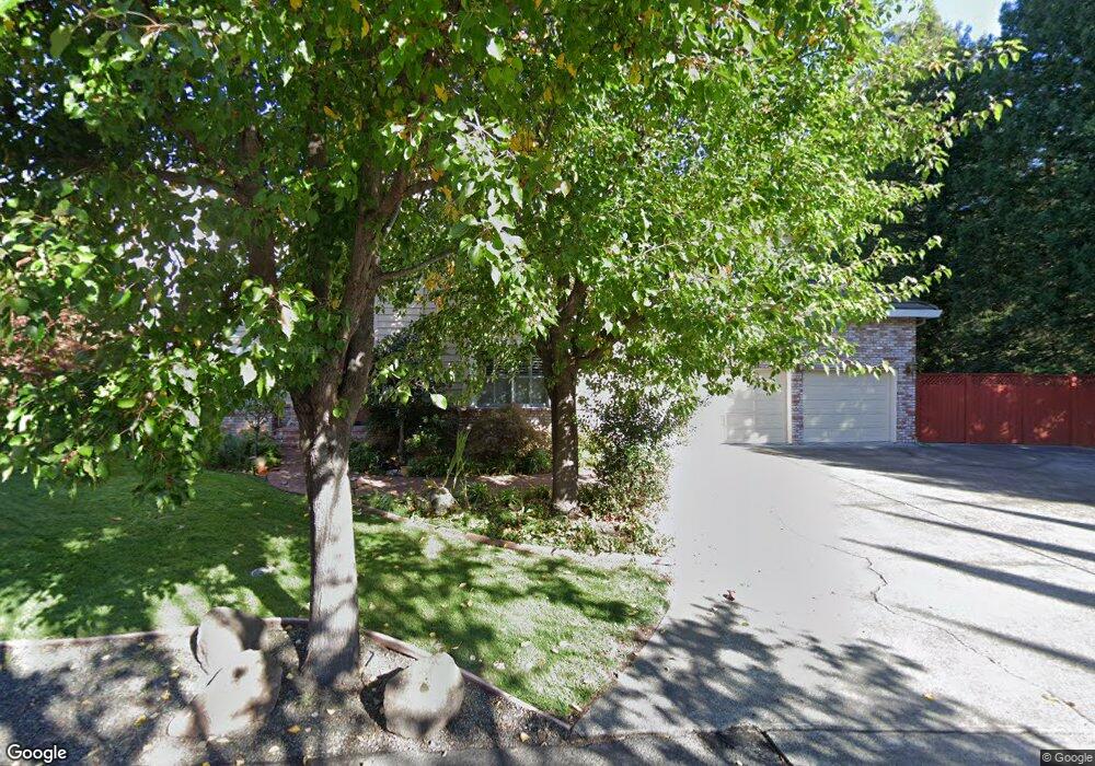
2 Huntington Ct Napa, CA 94558
Browns Valley NeighborhoodEstimated Value: $1,317,000 - $1,916,000
4
Beds
4
Baths
3,609
Sq Ft
$458/Sq Ft
Est. Value
About This Home
This home is located at 2 Huntington Ct, Napa, CA 94558 and is currently estimated at $1,651,831, approximately $457 per square foot. 2 Huntington Ct is a home located in Napa County with nearby schools including Browns Valley Elementary School, Harvest Middle School, and Napa High School.
Ownership History
Date
Name
Owned For
Owner Type
Purchase Details
Closed on
Feb 21, 2025
Sold by
Mirda Daniel P and Mirda Marcela I
Bought by
Daniel Paul Mirda And Marcela Isabel Mirda Re and Mirda
Current Estimated Value
Purchase Details
Closed on
May 15, 1997
Sold by
Cowley Percy E A and Cowley Joyce E
Bought by
Mirda Daniel P and Mirda Marcela I
Home Financials for this Owner
Home Financials are based on the most recent Mortgage that was taken out on this home.
Original Mortgage
$504,000
Interest Rate
8.15%
Mortgage Type
Seller Take Back
Create a Home Valuation Report for This Property
The Home Valuation Report is an in-depth analysis detailing your home's value as well as a comparison with similar homes in the area
Home Values in the Area
Average Home Value in this Area
Purchase History
| Date | Buyer | Sale Price | Title Company |
|---|---|---|---|
| Daniel Paul Mirda And Marcela Isabel Mirda Re | -- | None Listed On Document | |
| Mirda Daniel P | $560,000 | First American Title |
Source: Public Records
Mortgage History
| Date | Status | Borrower | Loan Amount |
|---|---|---|---|
| Previous Owner | Mirda Daniel P | $504,000 |
Source: Public Records
Tax History Compared to Growth
Tax History
| Year | Tax Paid | Tax Assessment Tax Assessment Total Assessment is a certain percentage of the fair market value that is determined by local assessors to be the total taxable value of land and additions on the property. | Land | Improvement |
|---|---|---|---|---|
| 2025 | $10,634 | $912,058 | $301,290 | $610,768 |
| 2024 | $10,634 | $894,176 | $295,383 | $598,793 |
| 2023 | $10,634 | $876,644 | $289,592 | $587,052 |
| 2022 | $10,308 | $859,456 | $283,914 | $575,542 |
| 2021 | $10,162 | $842,605 | $278,348 | $564,257 |
| 2020 | $10,087 | $833,966 | $275,494 | $558,472 |
| 2019 | $9,884 | $817,615 | $270,093 | $547,522 |
| 2018 | $9,760 | $801,585 | $264,798 | $536,787 |
| 2017 | $9,575 | $785,868 | $259,606 | $526,262 |
| 2016 | $9,419 | $770,460 | $254,516 | $515,944 |
| 2015 | $8,831 | $758,888 | $250,693 | $508,195 |
| 2014 | $8,701 | $744,024 | $245,783 | $498,241 |
Source: Public Records
Map
Nearby Homes
- 3177 Kingston Ave
- 100 Waterstone Ct
- 1135 Pinewood Dr
- 1038 Johnston St
- 3337 Kensington Cir
- 1016 Mccormick Ln
- 3181 Tiffanie Ln
- 2300 W Park Ave
- 2470 W Pueblo Ave
- 2984 1st St
- 2141 W Lincoln Ave
- 1019 Westview Dr
- 1010 Easum Dr
- 2108 W Lincoln Ave
- 2389 Chad Ct
- 1091 Century Dr
- 1565 Baywood Ln
- 1125 Westview Dr
- 15 Lemon Ct
- 1145 W Pueblo Place
- 6 Huntington Ct
- 1 Huntington Ct
- 5 Huntington Ct
- 3168 Browns Valley Rd
- 3146 Browns Valley Rd
- 10 Huntington Ct
- 14 Huntington Ct
- 9 Huntington Ct
- 3136 Browns Valley Rd
- 3180 Browns Valley Rd
- 15 Huntington Ct
- 19 Huntington Ct
- 3134 Browns Valley Rd
- 100 Thompson Ave
- 1001 Thompson Ave
- 1020 Larkin Way
- 1028 Larkin Way
- 1014 Larkin Way
- 1034 Larkin Way
- 3120 Browns Valley Rd