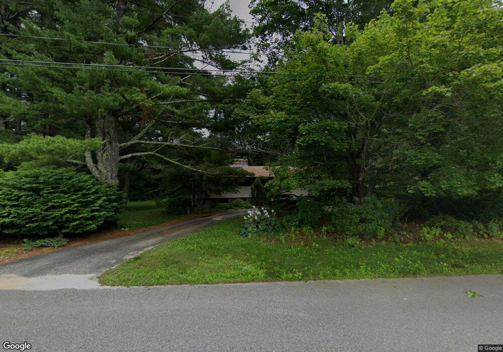
2 Karen Rd Windham, NH 03087
Estimated Value: $652,196 - $742,000
4
Beds
2
Baths
1,384
Sq Ft
$499/Sq Ft
Est. Value
About This Home
This home is located at 2 Karen Rd, Windham, NH 03087 and is currently estimated at $690,799, approximately $499 per square foot. 2 Karen Rd is a home located in Rockingham County with nearby schools including Golden Brook Elementary School, Windham Middle School, and Windham High School.
Ownership History
Date
Name
Owned For
Owner Type
Purchase Details
Closed on
Nov 8, 2021
Sold by
Tully Siobhan
Bought by
Tully Brian
Current Estimated Value
Home Financials for this Owner
Home Financials are based on the most recent Mortgage that was taken out on this home.
Original Mortgage
$375,000
Outstanding Balance
$343,094
Interest Rate
2.88%
Mortgage Type
Purchase Money Mortgage
Estimated Equity
$347,705
Purchase Details
Closed on
Feb 12, 2003
Sold by
Kalil Rita A
Bought by
Tully Siobhan
Purchase Details
Closed on
May 2, 1996
Sold by
Newman John and Newman Judith C
Bought by
Kalil Rita A
Home Financials for this Owner
Home Financials are based on the most recent Mortgage that was taken out on this home.
Original Mortgage
$100,000
Interest Rate
7.82%
Create a Home Valuation Report for This Property
The Home Valuation Report is an in-depth analysis detailing your home's value as well as a comparison with similar homes in the area
Home Values in the Area
Average Home Value in this Area
Purchase History
| Date | Buyer | Sale Price | Title Company |
|---|---|---|---|
| Tully Brian | $575,000 | None Available | |
| Tully Siobhan | $300,000 | -- | |
| Kalil Rita A | $180,000 | -- |
Source: Public Records
Mortgage History
| Date | Status | Borrower | Loan Amount |
|---|---|---|---|
| Open | Tully Brian | $375,000 | |
| Previous Owner | Kalil Rita A | $100,000 | |
| Previous Owner | Kalil Rita A | $75,260 | |
| Previous Owner | Kalil Rita A | $100,000 |
Source: Public Records
Tax History Compared to Growth
Tax History
| Year | Tax Paid | Tax Assessment Tax Assessment Total Assessment is a certain percentage of the fair market value that is determined by local assessors to be the total taxable value of land and additions on the property. | Land | Improvement |
|---|---|---|---|---|
| 2024 | $8,415 | $371,700 | $165,300 | $206,400 |
| 2023 | $7,954 | $371,700 | $165,300 | $206,400 |
| 2022 | $7,345 | $371,700 | $165,300 | $206,400 |
| 2021 | $6,921 | $371,700 | $165,300 | $206,400 |
| 2020 | $7,111 | $371,700 | $165,300 | $206,400 |
| 2019 | $6,578 | $291,700 | $151,600 | $140,100 |
| 2018 | $5,674 | $292,600 | $151,600 | $141,000 |
| 2017 | $5,911 | $292,600 | $151,600 | $141,000 |
| 2016 | $6,385 | $292,600 | $151,600 | $141,000 |
| 2015 | $6,355 | $292,600 | $151,600 | $141,000 |
| 2014 | $6,482 | $270,100 | $160,000 | $110,100 |
| 2013 | $6,129 | $259,700 | $160,000 | $99,700 |
Source: Public Records
Map
Nearby Homes
- 138 Castle Hill Rd
- 6 Lancaster Rd
- 63 Mammoth Rd
- 24 Del Ray Dr Unit 25
- 24 Del Ray Dr
- 7 Cypress Ln Unit 5
- 4 Cypress Ln Unit 10
- 2 Cypress Ln
- 23 Ryan Farm Rd
- 6 Lund Dr
- 11 Teloian Dr
- 2 2nd St
- 7 Buckhide Rd
- 11 Venus Way
- 7 Venus Way Unit 22
- 1119 Mammoth Rd
- 4 Elijah Hill Ln
- 21 Griffin Rd
- 37 Dugout Rd Unit B
- 33 Griffin Rd