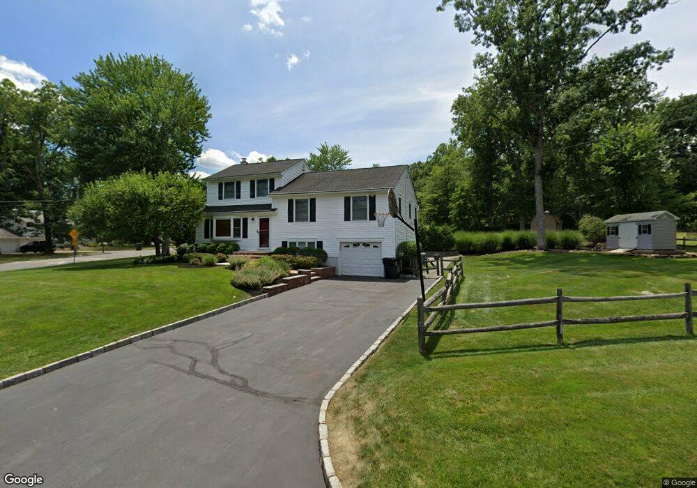
2 Locust Dr Morris Plains, NJ 07950
Estimated Value: $746,448 - $858,000
--
Bed
--
Bath
2,209
Sq Ft
$368/Sq Ft
Est. Value
About This Home
This home is located at 2 Locust Dr, Morris Plains, NJ 07950 and is currently estimated at $812,862, approximately $367 per square foot. 2 Locust Dr is a home located in Morris County with nearby schools including Whippany Park High School, Unity Charter School, and Allegro School.
Ownership History
Date
Name
Owned For
Owner Type
Purchase Details
Closed on
May 11, 1998
Sold by
Boulas Scott James and Boulas Mari Martha
Bought by
Depiro David G and Depiro Kathleen N
Current Estimated Value
Home Financials for this Owner
Home Financials are based on the most recent Mortgage that was taken out on this home.
Original Mortgage
$150,000
Outstanding Balance
$29,284
Interest Rate
7.09%
Estimated Equity
$783,578
Purchase Details
Closed on
Apr 11, 1996
Sold by
Fitzgerald Joseph Kevin and Fitzgerald Rosemary E
Bought by
Boulas Scott James and Boulas Mari Martha
Create a Home Valuation Report for This Property
The Home Valuation Report is an in-depth analysis detailing your home's value as well as a comparison with similar homes in the area
Home Values in the Area
Average Home Value in this Area
Purchase History
| Date | Buyer | Sale Price | Title Company |
|---|---|---|---|
| Depiro David G | $272,000 | Old Republic Title | |
| Boulas Scott James | $256,000 | -- |
Source: Public Records
Mortgage History
| Date | Status | Borrower | Loan Amount |
|---|---|---|---|
| Open | Depiro David G | $150,000 |
Source: Public Records
Tax History Compared to Growth
Tax History
| Year | Tax Paid | Tax Assessment Tax Assessment Total Assessment is a certain percentage of the fair market value that is determined by local assessors to be the total taxable value of land and additions on the property. | Land | Improvement |
|---|---|---|---|---|
| 2025 | $9,667 | $451,500 | $232,600 | $218,900 |
| 2024 | $9,545 | $451,500 | $232,600 | $218,900 |
| 2023 | $9,545 | $451,500 | $232,600 | $218,900 |
| 2022 | $8,732 | $451,500 | $232,600 | $218,900 |
| 2021 | $8,732 | $451,500 | $232,600 | $218,900 |
| 2020 | $8,213 | $451,500 | $232,600 | $218,900 |
| 2019 | $8,633 | $451,500 | $232,600 | $218,900 |
| 2018 | $8,497 | $451,500 | $232,600 | $218,900 |
| 2017 | $8,303 | $451,500 | $232,600 | $218,900 |
| 2016 | $8,177 | $451,500 | $232,600 | $218,900 |
| 2015 | $7,861 | $451,500 | $232,600 | $218,900 |
| 2014 | $7,698 | $451,500 | $232,600 | $218,900 |
Source: Public Records
Map
Nearby Homes
- 13 Mountview Rd
- 54 Locust Dr
- 83 Mountain Ave
- Route 10 E E Route 10 Unit 48 1B
- 15 Beech Dr
- 16 Slope Dr
- 9 Evergreen Ln
- 104 Ridgedale Ave
- 10 Veterans Way Unit 233
- 11 Veterans Way Unit 132
- 17 Veterans Way
- 10 Veterans Way Unit 241
- 15 Horsehill Rd
- 17 Horsehill Rd
- 241 Vista Dr
- 143 Vista Dr
- 22 Glenbrook Rd
- 112 Vista Dr Unit B12
- 44 Glenbrook Rd
- 12 Sunrise Dr
- 11 Countrywood Dr
- 5 Countrywood Dr
- 4 Locust Dr
- 13 Countrywood Dr
- 3 Locust Dr
- 10 Countrywood Dr
- 8 Countrywood Dr
- 12 Countrywood Dr
- 3 Countrywood Dr
- 6 Locust Dr
- 5 Locust Dr
- 6 Countrywood Dr
- 14 Countrywood Dr
- 15 Countrywood Dr
- 3 Cherry St
- 295 Malapardis Rd
- 7 Locust Dr
- 8 Locust Dr
- 4 Countrywood Dr
- 5 Cherry St