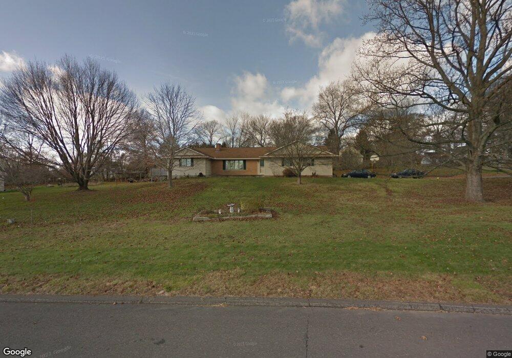
2 Mac Connie Ct Seymour, CT 06483
Estimated Value: $558,433 - $665,000
4
Beds
3
Baths
2,252
Sq Ft
$281/Sq Ft
Est. Value
About This Home
This home is located at 2 Mac Connie Ct, Seymour, CT 06483 and is currently estimated at $631,858, approximately $280 per square foot. 2 Mac Connie Ct is a home located in New Haven County with nearby schools including Bungay Elementary School, Seymour Middle School, and Seymour High School.
Ownership History
Date
Name
Owned For
Owner Type
Purchase Details
Closed on
Jul 26, 2007
Sold by
Edward H Macconnie T
Bought by
Valverde Wilmar and Valverde Margarita
Current Estimated Value
Home Financials for this Owner
Home Financials are based on the most recent Mortgage that was taken out on this home.
Original Mortgage
$337,500
Interest Rate
6.78%
Create a Home Valuation Report for This Property
The Home Valuation Report is an in-depth analysis detailing your home's value as well as a comparison with similar homes in the area
Home Values in the Area
Average Home Value in this Area
Purchase History
We collect this data history from publicly available records. To have your information removed, we recommend requesting removal directly through your county’s website.
| Date | Buyer | Sale Price | Title Company |
|---|---|---|---|
| Valverde Wilmar | $450,000 | -- |
Source: Public Records
Mortgage History
We collect this data history from publicly available records. To have your information removed, we recommend requesting removal directly through your county’s website.
| Date | Status | Borrower | Loan Amount |
|---|---|---|---|
| Open | Valverde Wilmar | $366,065 | |
| Closed | Valverde Wilmar | $337,500 | |
| Closed | Valverde Wilmar | $112,500 |
Source: Public Records
Tax History
| Year | Tax Paid | Tax Assessment Tax Assessment Total Assessment is a certain percentage of the fair market value that is determined by local assessors to be the total taxable value of land and additions on the property. | Land | Improvement |
|---|---|---|---|---|
| 2025 | $10,232 | $369,110 | $84,280 | $284,830 |
| 2024 | $8,868 | $240,730 | $70,350 | $170,380 |
| 2023 | $8,661 | $240,730 | $70,350 | $170,380 |
| 2022 | $8,568 | $240,730 | $70,350 | $170,380 |
| 2021 | $8,356 | $240,730 | $70,350 | $170,380 |
| 2020 | $8,943 | $248,430 | $82,530 | $165,900 |
| 2019 | $8,943 | $248,430 | $82,530 | $165,900 |
| 2018 | $8,943 | $248,430 | $82,530 | $165,900 |
| 2017 | $8,943 | $248,430 | $82,530 | $165,900 |
| 2016 | $8,943 | $248,430 | $82,530 | $165,900 |
| 2015 | $9,460 | $273,490 | $96,810 | $176,680 |
| 2014 | $9,310 | $273,490 | $96,810 | $176,680 |
Source: Public Records
Map
Nearby Homes
- 154 S Benham Rd
- 27 Partridge Dr
- 85 Buckingham Rd
- 28 Osprey Dr
- 148 Roosevelt Dr
- 109 Davis Rd
- 3 Roosevelt Dr
- 33 Steep Hill Rd
- 120 Hull St
- 22 Brookfield Rd
- 53 Webb Terrace
- 51 Brookfield Rd
- 85 Dwight St
- 60 Wabuda Place
- 8 Reichelt Terrace
- 290 Wakelee Ave
- 5 Old Town Rd
- 230 Westfield Ave
- 180 Franklin St
- 39 Golden Hill Ln
- 21 Tomlinson Rd
- 1 Mac Connie Ct
- 16 Tomlinson Rd
- 1 Mac Connie Ct
- 20 Tomlinson Rd
- 3 MacConnie Ct
- 3 Mac Connie Ct
- 22 Tomlinson Rd
- 23 Tomlinson Rd
- 12 Tomlinson Rd
- 9 Spindle Rd
- 7 Tomlinson Rd
- 27 Tomlinson Rd
- 8 Tomlinson Rd
- 8 Mac Connie Ct
- 7 MacConnie Ct
- 31 Tomlinson Rd
- 6 Spindle Rd
- 10 Mac Connie Ct
- 3 Tomlinson Rd
Your Personal Tour Guide
Ask me questions while you tour the home.