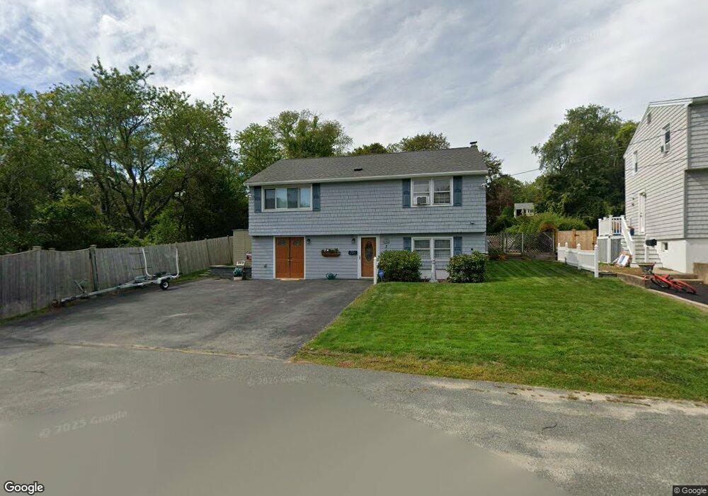
2 Macomber Rd Gloucester, MA 01930
Estimated Value: $591,064 - $661,000
2
Beds
1
Bath
900
Sq Ft
$681/Sq Ft
Est. Value
About This Home
This home is located at 2 Macomber Rd, Gloucester, MA 01930 and is currently estimated at $613,266, approximately $681 per square foot. 2 Macomber Rd is a home located in Essex County with nearby schools including Beeman Memorial, Ralph B O'maley Middle School, and Gloucester High School.
Ownership History
Date
Name
Owned For
Owner Type
Purchase Details
Closed on
Apr 11, 2022
Sold by
Psalidas Sharon L
Bought by
Alves Nicole and Reardon Ronald M
Current Estimated Value
Purchase Details
Closed on
May 19, 2003
Sold by
Psalidas Tr Charles N and Psalidas Jason C
Bought by
Psalidas Sharon L
Home Financials for this Owner
Home Financials are based on the most recent Mortgage that was taken out on this home.
Original Mortgage
$70,000
Interest Rate
5.84%
Purchase Details
Closed on
Sep 1, 1978
Bought by
Psalildas Sharon L
Create a Home Valuation Report for This Property
The Home Valuation Report is an in-depth analysis detailing your home's value as well as a comparison with similar homes in the area
Purchase History
| Date | Buyer | Sale Price | Title Company |
|---|---|---|---|
| Alves Nicole | -- | None Available | |
| Psalidas Sharon L | -- | -- | |
| Psalildas Sharon L | -- | -- |
Source: Public Records
Mortgage History
| Date | Status | Borrower | Loan Amount |
|---|---|---|---|
| Previous Owner | Psalildas Sharon L | $75,000 | |
| Previous Owner | Psalildas Sharon L | $20,000 | |
| Previous Owner | Psalildas Sharon L | $70,000 |
Source: Public Records
Tax History
| Year | Tax Paid | Tax Assessment Tax Assessment Total Assessment is a certain percentage of the fair market value that is determined by local assessors to be the total taxable value of land and additions on the property. | Land | Improvement |
|---|---|---|---|---|
| 2025 | $4,870 | $501,000 | $193,600 | $307,400 |
| 2024 | $4,972 | $511,000 | $184,300 | $326,700 |
| 2023 | $4,699 | $443,700 | $164,600 | $279,100 |
| 2022 | $4,396 | $374,800 | $143,200 | $231,600 |
| 2021 | $4,399 | $353,600 | $130,100 | $223,500 |
| 2020 | $4,129 | $334,900 | $130,100 | $204,800 |
| 2019 | $4,137 | $326,000 | $130,100 | $195,900 |
| 2018 | $3,905 | $302,000 | $130,100 | $171,900 |
| 2017 | $3,693 | $280,000 | $123,900 | $156,100 |
| 2016 | $3,673 | $269,900 | $129,300 | $140,600 |
| 2015 | $3,553 | $260,300 | $129,300 | $131,000 |
Source: Public Records
Map
Nearby Homes
- 3 Deacon Farm Ln
- 31 Echo Ave
- 13 Honeysuckle Rd
- 2 Breezy Point Rd
- 672 Washington St
- 13 Mystic Ave
- 8 Mystic Ave
- 98 Maplewood Ave
- 6 Monroe Ct
- 12 Arthur St
- 9 Cleveland Place
- 40 Sargent St
- 19 Trask St Unit 2
- 50 Warner St
- 113 Pleasant St
- 33 Maplewood Ave Unit 310
- 15 Mount Vernon St
- 15 Harvard St
- 167 Atlantic St
- 178 Atlantic St
Your Personal Tour Guide
Ask me questions while you tour the home.