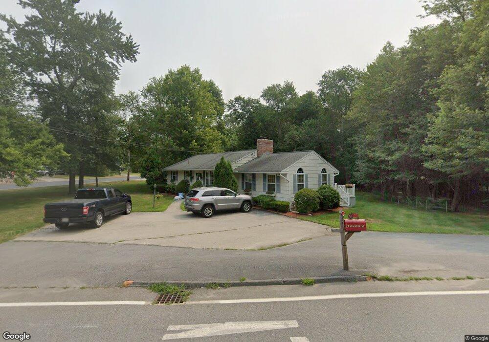
2 Marlboro St Hudson, MA 01749
Estimated Value: $538,000 - $648,000
3
Beds
2
Baths
1,320
Sq Ft
$451/Sq Ft
Est. Value
About This Home
This home is located at 2 Marlboro St, Hudson, MA 01749 and is currently estimated at $594,785, approximately $450 per square foot. 2 Marlboro St is a home located in Middlesex County with nearby schools including David J. Quinn Middle School, Hudson High School, and First Steps Children's Center.
Ownership History
Date
Name
Owned For
Owner Type
Purchase Details
Closed on
Jun 30, 1983
Bought by
Lowe Michael J
Current Estimated Value
Create a Home Valuation Report for This Property
The Home Valuation Report is an in-depth analysis detailing your home's value as well as a comparison with similar homes in the area
Home Values in the Area
Average Home Value in this Area
Purchase History
| Date | Buyer | Sale Price | Title Company |
|---|---|---|---|
| Lowe Michael J | -- | -- |
Source: Public Records
Mortgage History
| Date | Status | Borrower | Loan Amount |
|---|---|---|---|
| Open | Lowe Michael J | $170,000 | |
| Closed | Lowe Michael J | $129,000 | |
| Closed | Lowe Michael J | $10,000 | |
| Closed | Lowe Michael J | $110,000 |
Source: Public Records
Tax History Compared to Growth
Tax History
| Year | Tax Paid | Tax Assessment Tax Assessment Total Assessment is a certain percentage of the fair market value that is determined by local assessors to be the total taxable value of land and additions on the property. | Land | Improvement |
|---|---|---|---|---|
| 2025 | $7,458 | $537,300 | $228,100 | $309,200 |
| 2024 | $7,283 | $520,200 | $207,400 | $312,800 |
| 2023 | $6,694 | $458,500 | $199,500 | $259,000 |
| 2022 | $6,407 | $404,000 | $181,300 | $222,700 |
| 2021 | $6,241 | $376,200 | $172,700 | $203,500 |
| 2020 | $5,902 | $355,300 | $169,500 | $185,800 |
| 2019 | $5,909 | $347,000 | $169,500 | $177,500 |
| 2018 | $5,736 | $326,400 | $161,200 | $165,200 |
| 2017 | $5,362 | $306,400 | $153,400 | $153,000 |
| 2016 | $5,014 | $290,000 | $153,400 | $136,600 |
| 2015 | $4,680 | $271,000 | $153,400 | $117,600 |
| 2014 | $4,580 | $262,900 | $134,800 | $128,100 |
Source: Public Records
Map
Nearby Homes
- 7 Old North Rd
- 56 Forest Ave
- 425 Main St Unit 11B
- 34 Forest Ave
- 7e Strawberry Ln Unit E
- 11 Barracks Rd Unit 11
- 9 Barracks Rd Unit 9
- 3 Barracks Rd Unit 3
- 7 Barracks Rd Unit 7
- 5 Barracks Rd Unit 5
- 18 Collins Dr
- 26 Marychris Dr
- 304 Cox St
- 248 Main St Unit 207
- 248 Main St Unit 216
- 16 Houghton St
- 28 Pierce St
- 16 Abigail Dr
- 24 Seneca Dr
- 9 & 9A Abigail
- 117 Forest Ave
- 118 Forest Ave Unit 204
- 118 Forest Ave Unit 206
- 118 Forest Ave Unit 203
- 118 Forest Ave Unit 205
- 118 Forest Ave Unit 102
- 118 Forest Ave Unit 202
- 118 Forest Ave Unit 203 and 204
- 118 Forest Ave
- 122 Forest Ave
- 6 Marlboro St
- 121 Forest Ave
- 116 Forest Ave
- 53 Woodrow St
- 119 Forest Ave
- 6 Birchwood Rd
- 8 Birchwood Rd
- 4 Birchwood Rd
- 2 Causeway St
- 114 Forest Ave