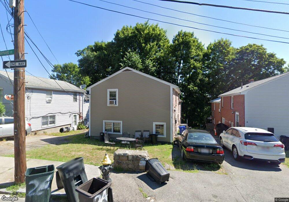
2 Maynard St Unit 2A Roslindale, MA 02131
Roslindale NeighborhoodEstimated Value: $846,000 - $1,076,433
3
Beds
2
Baths
1,200
Sq Ft
$776/Sq Ft
Est. Value
About This Home
Come tour this 3 Bed 1.5 Bath apartment for rent in the heart of Roslindale. This apartment features FREE laundry in unit along with one off street parking spot. No worries, there is plenty of parking on the street as well! Right around the corner is Hyde Park Ave, which has a plethora of public transportation locations, restaurants, convenient stores and a whole lot more! CURRENTLY VACANT and EASY to show. Reach out today because this opportunity will not last! Good credit and income required.
Ownership History
Date
Name
Owned For
Owner Type
Purchase Details
Closed on
Jan 17, 2024
Sold by
Spoony Marketing Lc Llc
Bought by
Rutledge Patrick and Rutledge Murphy
Current Estimated Value
Purchase Details
Closed on
Jul 2, 2021
Sold by
Lamar Arthur
Bought by
Spoony Marketing Llc
Purchase Details
Closed on
Jul 7, 2020
Sold by
Arthur Alicia
Bought by
Arthur Lamar
Home Financials for this Owner
Home Financials are based on the most recent Mortgage that was taken out on this home.
Original Mortgage
$200,000
Interest Rate
3.2%
Mortgage Type
New Conventional
Purchase Details
Closed on
Mar 31, 1994
Sold by
Fnma
Bought by
Arthur Lamar and Parham Terry E
Home Financials for this Owner
Home Financials are based on the most recent Mortgage that was taken out on this home.
Original Mortgage
$105,750
Interest Rate
7.07%
Mortgage Type
Purchase Money Mortgage
Purchase Details
Closed on
Aug 6, 1993
Sold by
Omalley Sean P and Source One Mg Svcs
Bought by
Source One Mtg Svcs
Create a Home Valuation Report for This Property
The Home Valuation Report is an in-depth analysis detailing your home's value as well as a comparison with similar homes in the area
Home Values in the Area
Average Home Value in this Area
Purchase History
| Date | Buyer | Sale Price | Title Company |
|---|---|---|---|
| Rutledge Patrick | $755,000 | None Available | |
| Spoony Marketing Llc | -- | None Available | |
| Arthur Lamar | -- | None Available | |
| Arthur Lamar | $117,500 | -- | |
| Source One Mtg Svcs | $143,945 | -- |
Source: Public Records
Mortgage History
| Date | Status | Borrower | Loan Amount |
|---|---|---|---|
| Previous Owner | Arthur Lamar | $200,000 | |
| Previous Owner | Source One Mtg Svcs | $180,000 | |
| Previous Owner | Source One Mtg Svcs | $102,000 | |
| Previous Owner | Source One Mtg Svcs | $105,750 | |
| Previous Owner | Source One Mtg Svcs | $130,000 |
Source: Public Records
Property History
| Date | Event | Price | List to Sale | Price per Sq Ft |
|---|---|---|---|---|
| 09/17/2025 09/17/25 | Off Market | $3,000 | -- | -- |
| 08/14/2025 08/14/25 | For Rent | $3,000 | -- | -- |
Tax History
| Year | Tax Paid | Tax Assessment Tax Assessment Total Assessment is a certain percentage of the fair market value that is determined by local assessors to be the total taxable value of land and additions on the property. | Land | Improvement |
|---|---|---|---|---|
| 2025 | $7,537 | $650,900 | $225,800 | $425,100 |
| 2024 | $7,265 | $666,500 | $226,600 | $439,900 |
| 2023 | $6,883 | $640,900 | $217,900 | $423,000 |
| 2022 | $6,339 | $582,600 | $198,100 | $384,500 |
| 2021 | $6,095 | $571,200 | $194,200 | $377,000 |
| 2020 | $5,203 | $492,700 | $174,700 | $318,000 |
| 2019 | $4,899 | $464,800 | $141,200 | $323,600 |
| 2018 | $4,595 | $438,500 | $141,200 | $297,300 |
| 2017 | $4,552 | $429,800 | $141,200 | $288,600 |
| 2016 | $4,377 | $397,900 | $141,200 | $256,700 |
| 2015 | $3,759 | $310,400 | $129,300 | $181,100 |
| 2014 | $3,486 | $277,100 | $129,300 | $147,800 |
Source: Public Records
Map
Nearby Homes
- 419 Poplar St
- 103 Whitford St
- 15 Highfield Rd
- 49 Dale St
- 16 Hilburn Place
- 76 Dale St
- 6 Ramsdell Ave Unit 4
- 142 Metropolitan Ave Unit 2
- 142 Metropolitan Ave Unit 1
- 142 Metropolitan Ave
- 766 Hyde Park Ave
- 8 Hillview Ave
- 4 Rowe Ct
- 624 Hyde Park Ave Unit D4
- 624 Hyde Park Ave Unit C3
- 86 Cornell St Unit 2
- 800 Hyde Park Ave Unit 3
- 89 Glendower Rd
- 498 Beech St
- 175 Clare Ave Unit B3
- 2A Maynard St
- 22 Maynard St Unit 24
- 4 Maynard St Unit 4A
- 4 Maynard St Unit A
- 402 Poplar St
- 6A Maynard St Unit A
- 66A Maynard St
- 6 Maynard St Unit 6A
- 6 Maynard St Unit 1
- 400 Poplar St Unit 400A
- 88 Maynard St
- 8 Maynard St Unit 8A
- 8 Maynard St Unit 1
- 398A Poplar St Unit A
- 408 Poplar St
- 398 Poplar St Unit 398A
- 398 Poplar St
- 398 Poplar St Unit 1
- 10 Maynard St Unit 12
- 396 Poplar St Unit 396A
Your Personal Tour Guide
Ask me questions while you tour the home.