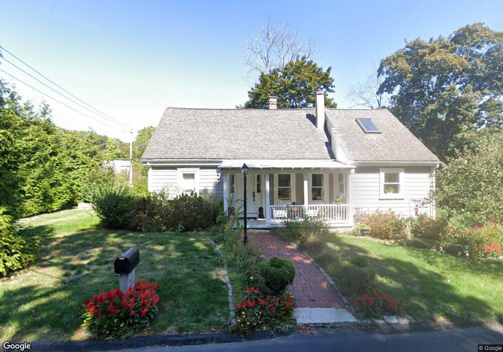
2 Mill Ln Unit 2 Cohasset, MA 02025
Estimated Value: $712,000 - $831,000
3
Beds
2
Baths
2,150
Sq Ft
$346/Sq Ft
Est. Value
About This Home
This home is located at 2 Mill Ln Unit 2, Cohasset, MA 02025 and is currently estimated at $743,822, approximately $345 per square foot. 2 Mill Ln Unit 2 is a home located in Norfolk County with nearby schools including Joseph Osgood School, Deer Hill School, and Cohasset Middle School.
Ownership History
Date
Name
Owned For
Owner Type
Purchase Details
Closed on
Jan 13, 2015
Sold by
Germaine Samuel L and Germaine Patricia E
Bought by
Alexander David D and Alexander Cynthia A
Current Estimated Value
Purchase Details
Closed on
Oct 9, 2002
Sold by
Ford Bonnie L
Bought by
Germaine Samuel L and Germaine Patricia E
Create a Home Valuation Report for This Property
The Home Valuation Report is an in-depth analysis detailing your home's value as well as a comparison with similar homes in the area
Home Values in the Area
Average Home Value in this Area
Purchase History
| Date | Buyer | Sale Price | Title Company |
|---|---|---|---|
| Alexander David D | $385,600 | -- | |
| Germaine Samuel L | $225,000 | -- |
Source: Public Records
Tax History
| Year | Tax Paid | Tax Assessment Tax Assessment Total Assessment is a certain percentage of the fair market value that is determined by local assessors to be the total taxable value of land and additions on the property. | Land | Improvement |
|---|---|---|---|---|
| 2025 | $5,371 | $463,800 | $139,200 | $324,600 |
| 2024 | $5,457 | $448,400 | $116,100 | $332,300 |
| 2023 | $5,290 | $448,300 | $116,000 | $332,300 |
| 2022 | $5,091 | $405,300 | $112,300 | $293,000 |
| 2021 | $5,396 | $413,800 | $112,300 | $301,500 |
| 2020 | $5,367 | $413,800 | $112,300 | $301,500 |
| 2019 | $5,338 | $413,800 | $112,300 | $301,500 |
| 2018 | $5,293 | $413,800 | $112,300 | $301,500 |
| 2017 | $5,327 | $407,900 | $102,100 | $305,800 |
| 2016 | $6,127 | $475,700 | $204,200 | $271,500 |
| 2015 | $6,046 | $475,700 | $204,200 | $271,500 |
| 2014 | $5,905 | $470,900 | $204,200 | $266,700 |
Source: Public Records
Map
Nearby Homes
- 27 Ox Pasture Ln
- 45 Hemlock Way
- 71 Ledgewood Dr
- 34 Flintlock Ridge Rd
- 0 Bates Ln (Lot E Kevin's Way) Unit 73419598
- 28 Bayberry Ln
- 46 Pond St
- 165 R Summer St
- 453 Clapp Rd
- 449 Clapp Rd
- 451 Clapp Rd
- 453 - 455 Clapp Rd
- 817 Country Way
- 40 Pond St
- 31 Chittenden Ln Unit 31
- 11 Forest Ln
- 9 Forest Ln Unit 9
- 212 S Main St
- 171 S Main St
- 26 Mordecai Lincoln Rd
- 2 Mill Ln
- 358 Beechwood St
- 368 Beechwood St
- 339 Beechwood St
- 365 Beechwood St
- 15 Mill Ln Unit SF
- 15 Mill Ln
- 15 Mill Ln Unit Summer
- 15 Mill Ln Unit 1
- LOT 2 Ox Pasture Ln
- LOT 4 Carbone Ln
- 364 Beechwood St
- 380 Beechwood St
- 375 Beechwood St
- 2 Bound Brook Ln
- 384 Beechwood St
- 31 Mill Ln
- 31A Mill Ln
- 389 Beechwood St
- 36 Mill Ln
Your Personal Tour Guide
Ask me questions while you tour the home.