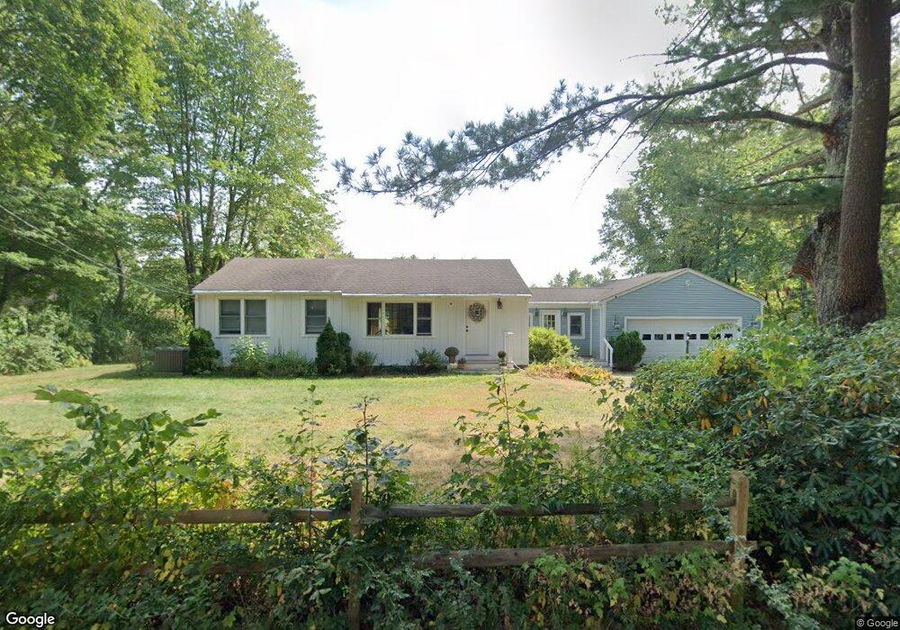
2 Mill Ln Hampton Falls, NH 03844
Estimated Value: $553,000 - $590,000
2
Beds
1
Bath
1,476
Sq Ft
$391/Sq Ft
Est. Value
About This Home
This home is located at 2 Mill Ln, Hampton Falls, NH 03844 and is currently estimated at $576,914, approximately $390 per square foot. 2 Mill Ln is a home with nearby schools including Lincoln Akerman School, Winnacunnet High School, and Sacred Heart School.
Ownership History
Date
Name
Owned For
Owner Type
Purchase Details
Closed on
Sep 30, 2002
Sold by
Chevalier Jason M and Chevalier Jill M
Bought by
Wile James L and Wile Betsy G
Current Estimated Value
Purchase Details
Closed on
Nov 26, 1996
Sold by
Mark Gertrude
Bought by
Chevalier Jason M and Chevalier Jill M
Home Financials for this Owner
Home Financials are based on the most recent Mortgage that was taken out on this home.
Original Mortgage
$118,750
Interest Rate
7.81%
Create a Home Valuation Report for This Property
The Home Valuation Report is an in-depth analysis detailing your home's value as well as a comparison with similar homes in the area
Home Values in the Area
Average Home Value in this Area
Purchase History
| Date | Buyer | Sale Price | Title Company |
|---|---|---|---|
| Wile James L | $259,000 | -- | |
| Chevalier Jason M | $125,000 | -- |
Source: Public Records
Mortgage History
| Date | Status | Borrower | Loan Amount |
|---|---|---|---|
| Previous Owner | Chevalier Jason M | $118,750 |
Source: Public Records
Tax History
| Year | Tax Paid | Tax Assessment Tax Assessment Total Assessment is a certain percentage of the fair market value that is determined by local assessors to be the total taxable value of land and additions on the property. | Land | Improvement |
|---|---|---|---|---|
| 2025 | $7,169 | $484,400 | $263,000 | $221,400 |
| 2024 | $6,934 | $484,200 | $263,000 | $221,200 |
| 2023 | $6,270 | $484,200 | $263,000 | $221,200 |
| 2022 | $5,596 | $266,600 | $175,000 | $91,600 |
| 2021 | $5,502 | $260,500 | $175,000 | $85,500 |
| 2020 | $8,105 | $260,500 | $175,000 | $85,500 |
| 2019 | $5,760 | $260,500 | $175,000 | $85,500 |
| 2018 | $7,974 | $261,500 | $174,900 | $86,600 |
| 2017 | $6,276 | $226,900 | $147,700 | $79,200 |
| 2016 | $4,878 | $226,900 | $147,700 | $79,200 |
| 2015 | $5,042 | $226,900 | $147,700 | $79,200 |
| 2014 | $4,683 | $226,900 | $147,700 | $79,200 |
Source: Public Records
Map
Nearby Homes
- 127 Kensington Rd
- 35 New Zealand Rd
- 100 Drinkwater Rd
- 47 Scott Ave
- 96 Lafayette Rd
- 39 Coach Ln
- 24 Adder Ln
- 269 South Rd
- 253 Amesbury Rd
- 9 Towle Farm Rd
- 51 Locust St
- 6 Forest Dr
- 157 Timber Swamp Rd
- 9 Elmwood St
- 3 Alison Cir
- 191 Towle Farm Rd
- 60 Hampton Meadows
- 29 Hampton Meadows
- 151 Walton Rd
- 241 & 245 Lafayette Rd
- 118 Kensington Rd
- 116 Kensington Rd
- 6 Mill Ln
- 0 Mill Ln
- 5 Mill Ln
- 117 Kensington Rd
- 114 Kensington Rd
- 113 Kensington Rd
- 34 Goodwin Rd
- 37 Goodwin Rd
- 124 Kensington Rd
- 111 Kensington Rd
- 110 Kensington Rd
- 8 Mill Ln
- 7 Mill Ln
- 109 Kensington Rd
- 108 Kensington Rd
- 107 Kensington Rd
- 10 Mill Ln
- 130 Kensington Rd
Your Personal Tour Guide
Ask me questions while you tour the home.