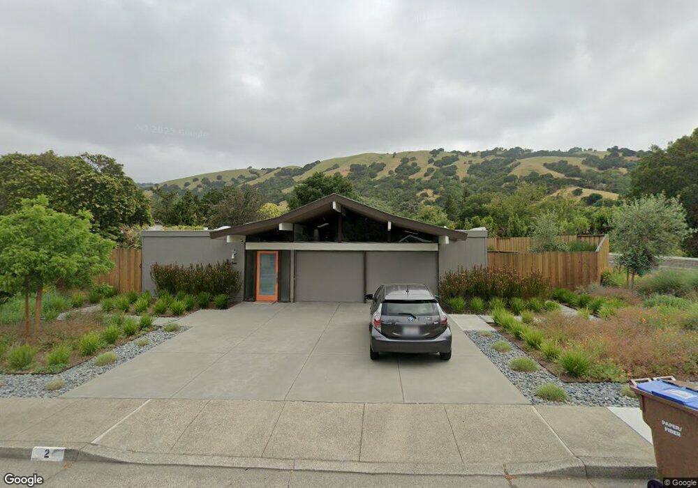
2 Mount Darwin Ct San Rafael, CA 94903
Lucas Valley NeighborhoodEstimated Value: $1,816,000 - $1,908,000
3
Beds
2
Baths
1,634
Sq Ft
$1,129/Sq Ft
Est. Value
About This Home
This home is located at 2 Mount Darwin Ct, San Rafael, CA 94903 and is currently estimated at $1,845,539, approximately $1,129 per square foot. 2 Mount Darwin Ct is a home located in Marin County with nearby schools including Lucas Valley Elementary School, Miller Creek Middle School, and Terra Linda High School.
Ownership History
Date
Name
Owned For
Owner Type
Purchase Details
Closed on
Mar 9, 2016
Sold by
Brydges Brian and Moyer Brett
Bought by
Morgan Susan E
Current Estimated Value
Purchase Details
Closed on
Dec 13, 2013
Sold by
Munson Catherine H
Bought by
Brydges Brian and Moyer Brett
Home Financials for this Owner
Home Financials are based on the most recent Mortgage that was taken out on this home.
Original Mortgage
$92,500
Interest Rate
4.32%
Mortgage Type
Unknown
Purchase Details
Closed on
May 20, 2013
Sold by
Ward Rory
Bought by
Munson Catherine H
Purchase Details
Closed on
Jan 9, 1995
Sold by
Munson Catherine H
Bought by
Ward Rory
Home Financials for this Owner
Home Financials are based on the most recent Mortgage that was taken out on this home.
Original Mortgage
$261,400
Interest Rate
8.62%
Purchase Details
Closed on
Jun 20, 1994
Sold by
Munson Catherine H
Bought by
Munson Catherine H
Create a Home Valuation Report for This Property
The Home Valuation Report is an in-depth analysis detailing your home's value as well as a comparison with similar homes in the area
Home Values in the Area
Average Home Value in this Area
Purchase History
| Date | Buyer | Sale Price | Title Company |
|---|---|---|---|
| Morgan Susan E | $1,500,000 | Fidelity National Title Comp | |
| Brydges Brian | $925,000 | First American Title Company | |
| Munson Catherine H | $600,000 | Stewart Title Of Ca Inc | |
| Ward Rory | $327,000 | Cal Land Title | |
| Munson Catherine H | -- | First American Title Company |
Source: Public Records
Mortgage History
| Date | Status | Borrower | Loan Amount |
|---|---|---|---|
| Previous Owner | Brydges Brian | $92,500 | |
| Previous Owner | Brydges Brian | $740,000 | |
| Previous Owner | Ward Rory | $261,400 |
Source: Public Records
Tax History
| Year | Tax Paid | Tax Assessment Tax Assessment Total Assessment is a certain percentage of the fair market value that is determined by local assessors to be the total taxable value of land and additions on the property. | Land | Improvement |
|---|---|---|---|---|
| 2025 | $23,075 | $1,773,287 | $713,813 | $1,059,474 |
| 2024 | $22,449 | $1,738,518 | $699,817 | $1,038,701 |
| 2023 | $22,470 | $1,704,438 | $686,099 | $1,018,339 |
| 2022 | $21,599 | $1,671,018 | $672,646 | $998,372 |
| 2021 | $20,626 | $1,638,256 | $659,458 | $978,798 |
| 2020 | $20,678 | $1,621,464 | $652,699 | $968,765 |
| 2019 | $20,099 | $1,589,677 | $639,903 | $949,774 |
| 2018 | $19,876 | $1,558,519 | $627,361 | $931,158 |
| 2017 | $18,788 | $1,527,960 | $615,060 | $912,900 |
| 2016 | $12,345 | $952,687 | $465,988 | $486,699 |
| 2015 | $12,041 | $938,381 | $458,991 | $479,390 |
| 2014 | $11,273 | $920,000 | $450,000 | $470,000 |
Source: Public Records
Map
Nearby Homes
- 892 Greenberry Ln
- 1200 Idylberry Rd
- 2151 Danberry Ln
- 5 Maoli Dr
- 829 Del Ganado Rd
- 11 Oak Tree Ct
- 841 Montecillo Rd
- 750 Montecillo Rd
- 659 Las Colindas Rd
- 876 Las Ovejas Ave
- 38 Twelveoak Hill Dr
- 1881 Las Gallinas Ave
- 506 Cedar Hill Dr
- 5 Creekside Dr
- 19 Surrey Ln
- 81 Forest Ln
- 89 Forest Ln
- 952 Lea Dr Unit 30
- 94 Forest Ln
- 587 Tanbark Terrace
- 6 Mount Darwin Ct
- 17 Mount Lassen Dr
- 10 Mount Darwin Ct
- 3 Mount Darwin Ct
- 1 Mount Darwin Ct
- 5 Mount Darwin Ct
- 14 Mount Darwin Ct
- 7 Mount Darwin Ct
- 21 Mount Lassen Dr
- 9 Mount Darwin Ct
- 1111 Idylberry Rd
- 1115 Idylberry Rd
- 23 Mount Lassen Dr
- 1117 Idylberry Rd
- 11 Mount Darwin Ct
- 17 Mount Darwin Ct
- 1121 Idylberry Rd
- 87 Mount Muir Ct
- 15 Mount Darwin Ct
- 7 Mount Lassen Dr
Your Personal Tour Guide
Ask me questions while you tour the home.