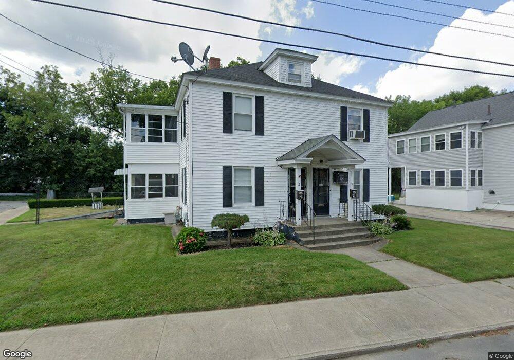
2 Mulvanity St Nashua, NH 03060
Downtown Nashua NeighborhoodEstimated Value: $540,089 - $614,000
4
Beds
2
Baths
2,160
Sq Ft
$270/Sq Ft
Est. Value
About This Home
This home is located at 2 Mulvanity St, Nashua, NH 03060 and is currently estimated at $582,522, approximately $269 per square foot. 2 Mulvanity St is a home located in Hillsborough County with nearby schools including Dr. Norman W. Crisp Elementary School, Elm Street Middle School, and Nashua High School North.
Create a Home Valuation Report for This Property
The Home Valuation Report is an in-depth analysis detailing your home's value as well as a comparison with similar homes in the area
Home Values in the Area
Average Home Value in this Area
Tax History Compared to Growth
Tax History
| Year | Tax Paid | Tax Assessment Tax Assessment Total Assessment is a certain percentage of the fair market value that is determined by local assessors to be the total taxable value of land and additions on the property. | Land | Improvement |
|---|---|---|---|---|
| 2024 | $8,209 | $516,300 | $147,700 | $368,600 |
| 2023 | $7,671 | $420,800 | $118,100 | $302,700 |
| 2022 | $7,604 | $420,800 | $118,100 | $302,700 |
| 2021 | $6,183 | $266,300 | $70,900 | $195,400 |
| 2020 | $6,012 | $265,900 | $70,900 | $195,000 |
| 2019 | $5,786 | $265,900 | $70,900 | $195,000 |
| 2018 | $5,640 | $265,900 | $70,900 | $195,000 |
| 2017 | $4,947 | $174,600 | $68,800 | $105,800 |
| 2016 | $4,377 | $174,600 | $68,800 | $105,800 |
| 2015 | $4,283 | $174,600 | $68,800 | $105,800 |
| 2014 | $4,199 | $174,600 | $68,800 | $105,800 |
Source: Public Records
Map
Nearby Homes
- 13 Mulvanity St
- 18 Harbor Ave Unit 208
- 65 Allds St
- 2 Lyons St
- 24 E Otterson St
- 4 Chase St
- 5 Mulberry St
- 76 Gillis St
- 1 Circle Ave
- 8 Buck St Unit 10
- 15 Lovell St Unit 3
- 15 Lovell St Unit 7
- 15 Lovell St Unit 10
- 13 Sapphire Ln
- 27 Fifield St Unit 13
- 46 Perham St Unit 214
- 38 Central St
- 15 Atherton Ave
- 19 Atherton Ave
- 22 Wilder St
- 6 Mulvanity St
- 21 Proctor St
- 68 Mulvanity St
- 14 Proctor St Unit 16
- 14-16 Proctor St Unit 16
- 16 Proctor St
- 14-16 Proctor St Unit 2
- 14-16 Proctor St
- 14 Proctor St Unit 1
- 8 Proctor St Unit 10
- 18 Proctor St
- 11 Proctor St
- 9 Proctor St Unit 9
- 3 Proctor St
- 2 Proctor St
- 10 Mulvanity St Unit 12
- 9 New St
- 5 Proctor St
- 35 Proctor St
- 11 New St