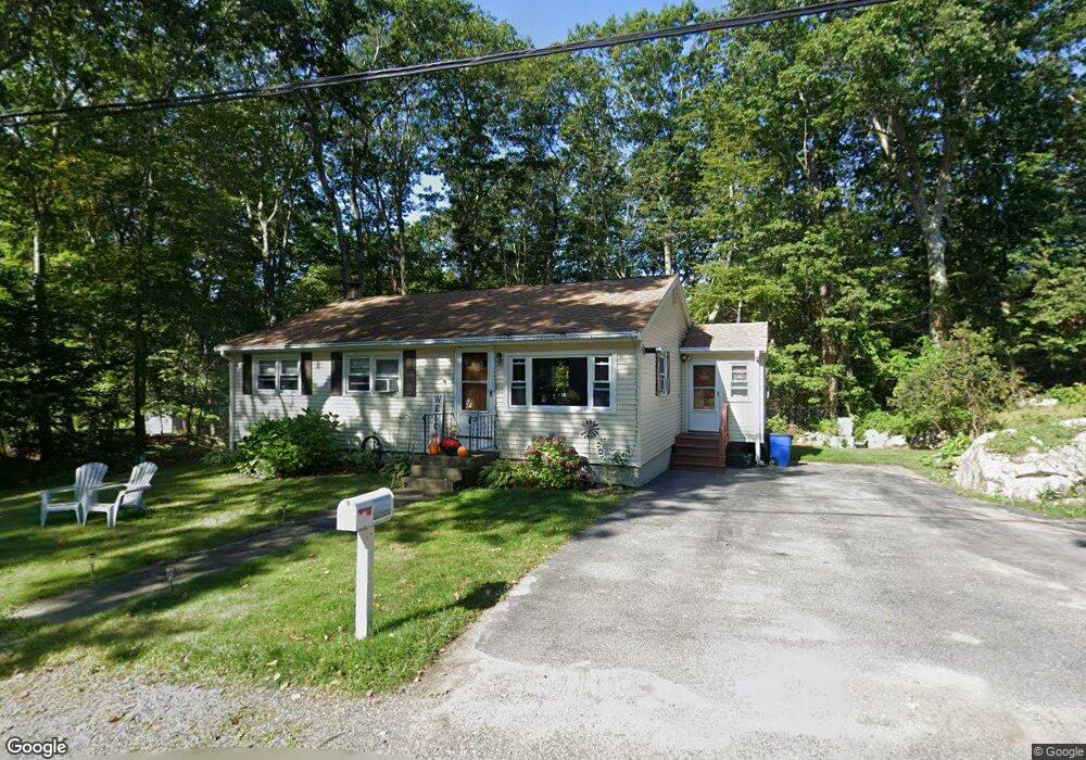
2 Newton Rd Gloucester, MA 01930
Magnolia NeighborhoodEstimated Value: $627,000 - $737,857
3
Beds
2
Baths
1,319
Sq Ft
$516/Sq Ft
Est. Value
About This Home
This home is located at 2 Newton Rd, Gloucester, MA 01930 and is currently estimated at $681,214, approximately $516 per square foot. 2 Newton Rd is a home located in Essex County with nearby schools including West Parish, Ralph B O'maley Middle School, and Gloucester High School.
Ownership History
Date
Name
Owned For
Owner Type
Purchase Details
Closed on
Jan 12, 2021
Sold by
Spoon Sandra M Est and Spoon
Bought by
Morse Stephen
Current Estimated Value
Home Financials for this Owner
Home Financials are based on the most recent Mortgage that was taken out on this home.
Original Mortgage
$387,600
Outstanding Balance
$342,687
Interest Rate
2.7%
Mortgage Type
Purchase Money Mortgage
Estimated Equity
$338,527
Purchase Details
Closed on
Aug 19, 2019
Sold by
Spoon Sandra M and Morse Theresa
Bought by
Spoon Sandra M
Purchase Details
Closed on
Nov 23, 2016
Sold by
Spoon Doreen C and Spoon Sandra M
Bought by
Williams Jeanne D and Morse Theresa
Purchase Details
Closed on
Sep 3, 2009
Sold by
Spoon Geneva E and Spoon Doreen C
Bought by
Spoon Doreen C
Create a Home Valuation Report for This Property
The Home Valuation Report is an in-depth analysis detailing your home's value as well as a comparison with similar homes in the area
Home Values in the Area
Average Home Value in this Area
Purchase History
| Date | Buyer | Sale Price | Title Company |
|---|---|---|---|
| Morse Stephen | $408,000 | None Available | |
| Morse Stephen | $408,000 | None Available | |
| Spoon Sandra M | -- | -- | |
| Williams Jeanne D | -- | -- | |
| Spoon Doreen C | -- | -- |
Source: Public Records
Mortgage History
| Date | Status | Borrower | Loan Amount |
|---|---|---|---|
| Open | Morse Stephen | $387,600 | |
| Closed | Morse Stephen | $387,600 | |
| Previous Owner | Spoon Doreen C | $82,800 | |
| Previous Owner | Spoon Doreen C | $48,000 | |
| Previous Owner | Spoon Doreen C | $196,000 |
Source: Public Records
Tax History
| Year | Tax Paid | Tax Assessment Tax Assessment Total Assessment is a certain percentage of the fair market value that is determined by local assessors to be the total taxable value of land and additions on the property. | Land | Improvement |
|---|---|---|---|---|
| 2025 | $6,028 | $620,200 | $250,700 | $369,500 |
| 2024 | $5,861 | $602,400 | $238,700 | $363,700 |
| 2023 | $5,876 | $554,900 | $213,100 | $341,800 |
| 2022 | $5,460 | $465,500 | $181,200 | $284,300 |
| 2021 | $5,479 | $440,400 | $164,700 | $275,700 |
| 2020 | $5,250 | $425,800 | $164,700 | $261,100 |
| 2019 | $5,228 | $412,000 | $164,700 | $247,300 |
| 2018 | $5,182 | $400,800 | $164,700 | $236,100 |
| 2017 | $5,044 | $382,400 | $156,900 | $225,500 |
| 2016 | $4,789 | $351,900 | $157,400 | $194,500 |
| 2015 | $4,722 | $345,900 | $157,400 | $188,500 |
Source: Public Records
Map
Nearby Homes
- 24 Flume Rd
- 2 Ocean Ave Unit 2K
- 53 Raymond St
- 468 Summer St
- 450 Summer St
- 239 Summer St
- 100 Eastern Point Blvd
- 5 Marshfield St
- 8 Forest St
- 368 Essex Ave
- 5 Lepage Ln
- 24 Cobblestone Ln Unit 603
- 145 Essex Ave Unit 402
- 5 Samoset Rd Unit B
- 13 Leslie o Johnson Rd
- 15 Raven Ln Unit 15
- 4 Cobb Ave
- 15 Harvard St
- 20 Beacon St
- 20 Beacon St Unit 2
- 169 Hesperus Ave
- 4 Newton Rd
- 167 Hesperus Ave
- 171 Hesperus Ave
- 171 Hesperus Ave
- 171 Hesperus Ave Unit 171
- 3 Newton Rd
- 165 Hesperus Ave
- 6 Newton Rd
- 162 Hesperus Ave
- 164 Hesperus Ave
- 5 Newton Rd
- 163 Hesperus Ave
- 166 Hesperus Ave
- 156 Hesperus Ave
- 156 Hesperus Ave Unit 156
- 173 Hesperus Ave
- 4 Old Salem Path
- 161 Hesperus Ave
- 7 Newton Rd
Your Personal Tour Guide
Ask me questions while you tour the home.