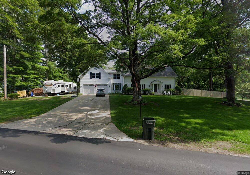
2 Peabody Row Londonderry, NH 03053
Estimated Value: $567,000 - $2,345,211
4
Beds
1
Bath
2,520
Sq Ft
$408/Sq Ft
Est. Value
About This Home
This home is located at 2 Peabody Row, Londonderry, NH 03053 and is currently estimated at $1,027,553, approximately $407 per square foot. 2 Peabody Row is a home with nearby schools including Matthew Thornton Elementary School, Londonderry Middle School, and Londonderry Senior High School.
Ownership History
Date
Name
Owned For
Owner Type
Purchase Details
Closed on
Jan 27, 2014
Sold by
Grammatic Phyllis
Bought by
580 Winnacunnet Rd Inc
Current Estimated Value
Purchase Details
Closed on
Jun 30, 1997
Sold by
Keenan Thomas F
Bought by
Wagner Derek T
Home Financials for this Owner
Home Financials are based on the most recent Mortgage that was taken out on this home.
Original Mortgage
$114,450
Interest Rate
7.81%
Create a Home Valuation Report for This Property
The Home Valuation Report is an in-depth analysis detailing your home's value as well as a comparison with similar homes in the area
Home Values in the Area
Average Home Value in this Area
Purchase History
| Date | Buyer | Sale Price | Title Company |
|---|---|---|---|
| 580 Winnacunnet Rd Inc | $1,150,000 | -- | |
| Wagner Derek T | $120,500 | -- |
Source: Public Records
Mortgage History
| Date | Status | Borrower | Loan Amount |
|---|---|---|---|
| Open | Wagner Lynne | $256,600 | |
| Closed | Wagner Derek T | $192,000 | |
| Previous Owner | Wagner Derek T | $180,000 | |
| Previous Owner | Wagner Derek T | $15,000 | |
| Previous Owner | Wagner Derek T | $114,450 |
Source: Public Records
Tax History Compared to Growth
Tax History
| Year | Tax Paid | Tax Assessment Tax Assessment Total Assessment is a certain percentage of the fair market value that is determined by local assessors to be the total taxable value of land and additions on the property. | Land | Improvement |
|---|---|---|---|---|
| 2024 | $7,513 | $465,500 | $179,900 | $285,600 |
| 2023 | $7,285 | $465,500 | $179,900 | $285,600 |
| 2022 | $7,318 | $396,000 | $134,900 | $261,100 |
| 2021 | $7,278 | $396,000 | $134,900 | $261,100 |
| 2020 | $6,795 | $337,900 | $112,400 | $225,500 |
| 2019 | $6,552 | $337,900 | $112,400 | $225,500 |
| 2018 | $6,139 | $281,600 | $93,700 | $187,900 |
| 2017 | $6,085 | $281,600 | $93,700 | $187,900 |
| 2016 | $6,054 | $281,600 | $93,700 | $187,900 |
| 2015 | $5,919 | $281,600 | $93,700 | $187,900 |
| 2014 | $5,939 | $281,600 | $93,700 | $187,900 |
| 2011 | -- | $286,800 | $93,700 | $193,100 |
Source: Public Records
Map
Nearby Homes
- 31 Midridge Cir
- 27 Midridge Cir
- 111 Winterwood Dr
- 214 Winding Pond Rd
- 47 Winding Pond Rd
- 14 Mohawk Dr
- 74 Boulder Dr Unit 74
- 267 Winding Pond Rd
- 1 Lily Ln
- 17 Lily Ln
- 19 Lily Ln
- 14 Reed St
- 5 Elise Ave Unit Lot 94
- 12 Morrison Dr
- 40 Elise Ave Unit Lot 20
- 36 Elise Ave Unit Lot 18
- 1 Elise Ave Unit Lot 96
- 7 Elise Ave Unit Lot 93
- 107a Gilcreast Rd Unit A
- 8 Elise Ave Unit Lot 4
- 4 Peabody Row
- 33 Midridge Cir
- 33 Midridge Cir Unit 33
- 6 Peabody Row
- 35 Midridge Cir Unit 35
- 36 Midridge Cir
- 38 Midridge Cir
- 39 Midridge Cir Unit 39
- 39 Midridge Cir
- 30 Midridge Cir Unit 30
- 30 Midridge Cir
- 9 Peabody Row
- 3 Adams Rd
- 24 Midridge Cir Unit 24
- 1 Midridge Cir Unit 1
- 213 Mammoth Rd
- 23 Midridge Cir
- 3 Midridge Cir
- 22 Midridge Cir Unit 22
- 5 Midridge Cir Unit 5