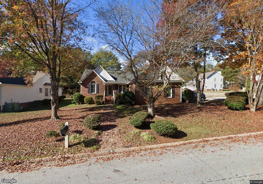
2 Planters Row Dr Mauldin, SC 29662
Estimated Value: $335,000 - $376,009
3
Beds
2
Baths
2,100
Sq Ft
$169/Sq Ft
Est. Value
About This Home
This home is located at 2 Planters Row Dr, Mauldin, SC 29662 and is currently estimated at $354,502, approximately $168 per square foot. 2 Planters Row Dr is a home located in Greenville County with nearby schools including Greenbrier Elementary School, Hillcrest Middle School, and Mauldin High School.
Ownership History
Date
Name
Owned For
Owner Type
Purchase Details
Closed on
Mar 14, 2014
Sold by
Tate Virginia Parker
Bought by
Webster Haley Brookey
Current Estimated Value
Home Financials for this Owner
Home Financials are based on the most recent Mortgage that was taken out on this home.
Original Mortgage
$155,650
Outstanding Balance
$116,122
Interest Rate
4.24%
Mortgage Type
New Conventional
Estimated Equity
$238,380
Create a Home Valuation Report for This Property
The Home Valuation Report is an in-depth analysis detailing your home's value as well as a comparison with similar homes in the area
Home Values in the Area
Average Home Value in this Area
Purchase History
| Date | Buyer | Sale Price | Title Company |
|---|---|---|---|
| Webster Haley Brookey | $168,500 | -- |
Source: Public Records
Mortgage History
| Date | Status | Borrower | Loan Amount |
|---|---|---|---|
| Open | Webster Haley Brookey | $155,650 |
Source: Public Records
Tax History
| Year | Tax Paid | Tax Assessment Tax Assessment Total Assessment is a certain percentage of the fair market value that is determined by local assessors to be the total taxable value of land and additions on the property. | Land | Improvement |
|---|---|---|---|---|
| 2025 | $1,614 | $9,770 | $2,180 | $7,590 |
| 2024 | $1,614 | $8,500 | $1,240 | $7,260 |
| 2023 | $1,548 | $8,500 | $1,240 | $7,260 |
| 2022 | $1,458 | $8,500 | $1,240 | $7,260 |
| 2021 | $1,459 | $8,500 | $1,240 | $7,260 |
| 2020 | $1,342 | $7,390 | $1,080 | $6,310 |
| 2019 | $1,343 | $7,390 | $1,080 | $6,310 |
| 2018 | $1,340 | $7,390 | $1,080 | $6,310 |
| 2017 | $1,340 | $7,390 | $1,080 | $6,310 |
| 2016 | $1,291 | $184,860 | $27,000 | $157,860 |
| 2015 | $1,291 | $184,860 | $27,000 | $157,860 |
| 2014 | $3,741 | $202,960 | $29,331 | $173,629 |
Source: Public Records
Map
Nearby Homes
- 4 Old Hastings Ct
- 111 Golden Crest Ct
- 2 Knollvine Cove
- 104 Fawn Ridge Way
- 9 Colombard Ct
- 207 Nantallah Trail
- 14 Croftstone Ct
- 8 Chelseabrook Ct
- 712 Brooks Rd
- 413 Twist Cir
- 515 Fagin Cir
- 248 Paperbark Dr
- 317 Scarlet Leaf Ln
- 407 Fielder Way
- 66 Sikes Cir
- 120 Cambie Place
- 416 Fielder Way
- 412 Fielder Way
- 310 Scarlet Leaf Ln
- 245 Paperbark Dr
- 6 Planters Row Dr
- 9 Natchez Dr
- 2 Cade Ct
- 5 Natchez Dr
- 1 Planters Row Dr
- 5 Planters Row Dr
- 100 Edmondston Ct
- 4 Cade Ct
- 2 Natchez Dr
- 105 Edmondston Ct
- 3 Natchez Dr
- 9 Planters Row Dr
- 102 Edmondston Ct
- 6 Cade Ct
- 109 Edmondston Ct
- 1 Natchez Dr
- 101 Planters Row Dr
- 104 Edmondston Ct
- 314 Hyde Park Ln
- 201 Edmondston Ct
Your Personal Tour Guide
Ask me questions while you tour the home.