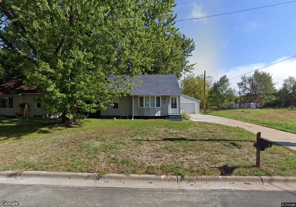
2 Pointcross Dr Circle Pines, MN 55014
Estimated Value: $264,000 - $287,598
3
Beds
2
Baths
1,305
Sq Ft
$213/Sq Ft
Est. Value
About This Home
This home is located at 2 Pointcross Dr, Circle Pines, MN 55014 and is currently estimated at $278,150, approximately $213 per square foot. 2 Pointcross Dr is a home located in Anoka County with nearby schools including Blue Heron Elementary School, Centennial Middle School, and Centennial High School.
Ownership History
Date
Name
Owned For
Owner Type
Purchase Details
Closed on
Feb 24, 2017
Sold by
Mcneil David David
Bought by
O'Neill Madeline and O'Neill Jacob
Current Estimated Value
Home Financials for this Owner
Home Financials are based on the most recent Mortgage that was taken out on this home.
Original Mortgage
$147,731
Outstanding Balance
$121,148
Interest Rate
4.12%
Estimated Equity
$157,002
Purchase Details
Closed on
Jan 26, 2017
Sold by
Mcneil David J and Mcneil Raquel
Bought by
Neill Madeline O and Neill Jacob O
Home Financials for this Owner
Home Financials are based on the most recent Mortgage that was taken out on this home.
Original Mortgage
$147,731
Outstanding Balance
$121,148
Interest Rate
4.12%
Estimated Equity
$157,002
Purchase Details
Closed on
Jul 8, 2016
Sold by
Mcneil Malcolm Malcolm
Bought by
Mcneil David David
Create a Home Valuation Report for This Property
The Home Valuation Report is an in-depth analysis detailing your home's value as well as a comparison with similar homes in the area
Home Values in the Area
Average Home Value in this Area
Purchase History
| Date | Buyer | Sale Price | Title Company |
|---|---|---|---|
| O'Neill Madeline | $152,300 | -- | |
| Neill Madeline O | $152,300 | Network Title Inc | |
| Mcneil David David | $100,000 | -- | |
| Hyland Kevin Kevin | $243,600 | -- |
Source: Public Records
Mortgage History
| Date | Status | Borrower | Loan Amount |
|---|---|---|---|
| Open | O'Neill Madeline | $147,731 | |
| Closed | Neill Madeline O | $147,731 | |
| Closed | Hyland Kevin Kevin | $236,292 |
Source: Public Records
Tax History
| Year | Tax Paid | Tax Assessment Tax Assessment Total Assessment is a certain percentage of the fair market value that is determined by local assessors to be the total taxable value of land and additions on the property. | Land | Improvement |
|---|---|---|---|---|
| 2025 | $3,017 | $268,600 | $110,000 | $158,600 |
| 2024 | $3,017 | $255,300 | $95,000 | $160,300 |
| 2023 | $3,035 | $266,500 | $98,200 | $168,300 |
| 2022 | $2,299 | $263,400 | $82,000 | $181,400 |
| 2021 | $2,247 | $181,100 | $64,400 | $116,700 |
| 2020 | $2,713 | $174,000 | $64,400 | $109,600 |
| 2019 | $2,504 | $171,200 | $61,300 | $109,900 |
| 2018 | $2,176 | $150,200 | $0 | $0 |
| 2017 | $2,262 | $142,200 | $0 | $0 |
| 2016 | $2,277 | $116,600 | $0 | $0 |
| 2015 | -- | $116,600 | $47,000 | $69,600 |
| 2014 | -- | $104,800 | $44,800 | $60,000 |
Source: Public Records
Map
Nearby Homes
- 8 Pointcross Dr
- 104 South Dr Unit B
- 4842 104th Ave NE
- 4831 104th Ln NE
- 4841 105th Ln NE
- 365 Sioux Lookout
- 7164 Sunset Ave
- 7095 Ivy Ridge Ln
- 10216 Erskin St NE
- 9991 Cord St NE
- 6422 Lakota Trail
- 7127 Ivy Ridge Ln
- 4145 Austin St NE
- 24 Elm St
- 343 Heritage Trail
- 306 Heritage Trail
- 330 Heritage Trail Unit 117
- 7163 Whippoorwill Ln
- 6473 Totem Trail
- 7298 Lea Ct N Unit 6
Your Personal Tour Guide
Ask me questions while you tour the home.