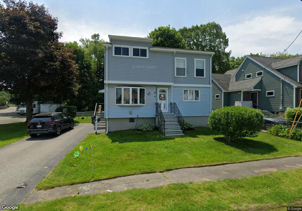
2 Raddin Rd Peabody, MA 01960
South Peabody NeighborhoodEstimated Value: $688,000 - $732,000
4
Beds
3
Baths
1,555
Sq Ft
$459/Sq Ft
Est. Value
About This Home
This home is located at 2 Raddin Rd, Peabody, MA 01960 and is currently estimated at $713,451, approximately $458 per square foot. 2 Raddin Rd is a home located in Essex County with nearby schools including Peabody Veterans Memorial High School and St John The Baptist School.
Ownership History
Date
Name
Owned For
Owner Type
Purchase Details
Closed on
Jun 10, 2016
Sold by
Bartkiewicz Mark F and Bartkiewicz M B
Bought by
Bartkiewicz Melanie C and Pierre Harry J
Current Estimated Value
Home Financials for this Owner
Home Financials are based on the most recent Mortgage that was taken out on this home.
Original Mortgage
$264,000
Outstanding Balance
$208,453
Interest Rate
3.66%
Mortgage Type
New Conventional
Estimated Equity
$504,998
Purchase Details
Closed on
May 1, 2015
Sold by
Munroe Teresa L
Bought by
Bartkiewicz Mark F and Bartkiewicz M B
Purchase Details
Closed on
Mar 18, 2010
Sold by
Bartkiewicz Evelyn T
Bought by
2 Raddin Road Peabody and Bartkiewicz
Create a Home Valuation Report for This Property
The Home Valuation Report is an in-depth analysis detailing your home's value as well as a comparison with similar homes in the area
Home Values in the Area
Average Home Value in this Area
Purchase History
| Date | Buyer | Sale Price | Title Company |
|---|---|---|---|
| Bartkiewicz Melanie C | $330,000 | -- | |
| Bartkiewicz Mark F | $135,000 | -- | |
| Bartkiewcz Mark F | -- | -- | |
| 2 Raddin Road Peabody | -- | -- |
Source: Public Records
Mortgage History
| Date | Status | Borrower | Loan Amount |
|---|---|---|---|
| Open | Bartkiewicz Melanie C | $264,000 | |
| Previous Owner | 2 Raddin Road Peabody | $50,000 |
Source: Public Records
Tax History
| Year | Tax Paid | Tax Assessment Tax Assessment Total Assessment is a certain percentage of the fair market value that is determined by local assessors to be the total taxable value of land and additions on the property. | Land | Improvement |
|---|---|---|---|---|
| 2025 | $5,935 | $640,900 | $227,600 | $413,300 |
| 2024 | $5,355 | $587,200 | $227,600 | $359,600 |
| 2023 | $5,447 | $572,200 | $203,200 | $369,000 |
| 2022 | $4,760 | $471,300 | $181,500 | $289,800 |
| 2021 | $4,697 | $447,800 | $165,000 | $282,800 |
| 2020 | $4,921 | $458,200 | $165,000 | $293,200 |
| 2019 | $4,419 | $401,400 | $165,000 | $236,400 |
| 2018 | $4,438 | $387,300 | $150,000 | $237,300 |
| 2017 | $3,354 | $285,200 | $150,000 | $135,200 |
| 2016 | $3,259 | $273,400 | $150,000 | $123,400 |
| 2015 | $3,376 | $274,500 | $146,200 | $128,300 |
Source: Public Records
Map
Nearby Homes
- 6 Allen Rd
- 12 Tara Rd
- 26 Bartholomew Terrace
- 4 Pulver Dr
- 11 Pulver Dr
- 233 Bartholomew St
- 325 Den Quarry Rd
- 217 Cedar Brook Rd
- 18 Kittredge St
- 21 Forest St
- 10 Fairview Rd
- 13 Ralph Rd
- 54 Harris Rd
- 55 Hawthorne Cir
- 23 Tamarack Ln Unit 23
- 15 Swampscott Ave
- 333 Lynnfield St
- 30 Longwood Rd
- 4R Forest St
- 38-1/2 Ellsworth Rd
Your Personal Tour Guide
Ask me questions while you tour the home.