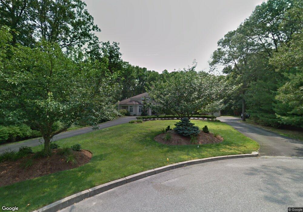
2 Sandy Brook Ct Warwick, RI 02886
Cowesett NeighborhoodEstimated Value: $1,342,047 - $1,701,000
4
Beds
5
Baths
7,548
Sq Ft
$194/Sq Ft
Est. Value
About This Home
This home is located at 2 Sandy Brook Ct, Warwick, RI 02886 and is currently estimated at $1,465,349, approximately $194 per square foot. 2 Sandy Brook Ct is a home located in Kent County with nearby schools including Our Lady of Mercy School.
Ownership History
Date
Name
Owned For
Owner Type
Purchase Details
Closed on
Feb 18, 2020
Sold by
Jackman Michael A
Bought by
Michael A Jackman Ret
Current Estimated Value
Purchase Details
Closed on
Apr 30, 2009
Sold by
American Home Mtg Svcs
Bought by
Jackman Michael
Purchase Details
Closed on
Mar 3, 2005
Sold by
Buontempo John and Buontempo Susan R
Bought by
Kirinsky Sarah
Home Financials for this Owner
Home Financials are based on the most recent Mortgage that was taken out on this home.
Original Mortgage
$980,000
Interest Rate
5.66%
Mortgage Type
Purchase Money Mortgage
Create a Home Valuation Report for This Property
The Home Valuation Report is an in-depth analysis detailing your home's value as well as a comparison with similar homes in the area
Home Values in the Area
Average Home Value in this Area
Purchase History
| Date | Buyer | Sale Price | Title Company |
|---|---|---|---|
| Michael A Jackman Ret | -- | None Available | |
| Jackman Michael | $639,000 | -- | |
| Kirinsky Sarah | $1,225,000 | -- |
Source: Public Records
Mortgage History
| Date | Status | Borrower | Loan Amount |
|---|---|---|---|
| Previous Owner | Kirinsky Sarah | $200,000 | |
| Previous Owner | Kirinsky Sarah | $150,000 | |
| Previous Owner | Kirinsky Sarah | $1,125,000 | |
| Previous Owner | Kirinsky Sarah | $980,000 |
Source: Public Records
Tax History
| Year | Tax Paid | Tax Assessment Tax Assessment Total Assessment is a certain percentage of the fair market value that is determined by local assessors to be the total taxable value of land and additions on the property. | Land | Improvement |
|---|---|---|---|---|
| 2025 | $17,548 | $1,381,700 | $104,500 | $1,277,200 |
| 2024 | $18,611 | $1,286,200 | $94,100 | $1,192,100 |
| 2023 | $18,251 | $1,286,200 | $94,100 | $1,192,100 |
| 2022 | $20,088 | $1,072,500 | $100,700 | $971,800 |
| 2021 | $20,088 | $1,072,500 | $100,700 | $971,800 |
| 2020 | $20,088 | $1,072,500 | $100,700 | $971,800 |
| 2019 | $20,088 | $1,072,500 | $100,700 | $971,800 |
| 2018 | $15,931 | $765,900 | $100,700 | $665,200 |
| 2017 | $15,502 | $765,900 | $100,700 | $665,200 |
| 2016 | $22,683 | $1,120,700 | $100,700 | $1,020,000 |
| 2015 | $21,590 | $1,040,500 | $134,000 | $906,500 |
| 2014 | $20,872 | $1,040,500 | $134,000 | $906,500 |
| 2013 | $20,591 | $1,040,500 | $134,000 | $906,500 |
Source: Public Records
Map
Nearby Homes
- 442 Sleepy Hollow Farm Rd
- 181 Heritage Dr
- 486 Greenbush Rd
- 510 Greenbush Rd
- 520 Greenbush Rd
- 146 Edmond Dr
- 33 Eagle Run
- 10 Arrowhead Way
- 37 Eagle Run Unit 37B
- 39 Ledge Rd
- 0 Spencer Ave
- 0 Cedar St
- 28 Hill Top Dr
- 24 Hyland Ave
- 52 Bruce Ln
- 51 Hesper Dr
- 2 Eagle Run
- 155 Birkshire Dr
- 88 Greene St
- 4430 Post Rd Unit 62E
- 177 Gilbert Stuart Dr
- 1 Sandy Brook Ct
- 138 Shadow Brook Dr
- 161 Gilbert Stuart Dr
- 205 Castle Rocks Rd
- 217 Castle Rocks Rd
- 126 Shadow Brook Dr
- 154 Shadow Brook Dr
- 197 Castle Rocks Rd
- 229 Castle Rocks Rd
- 221 Gilbert Stuart Dr
- 237 Castle Rocks Rd
- 123 Shadow Brook Dr
- 110 Shadow Brook Dr
- 400 Varnum Dr
- 187 Castle Rocks Rd
- 208 Castle Rocks Rd
- 172 Gilbert Stuart Dr
- 159 Shadow Brook Dr
- 133 Gilbert Stuart Dr
Your Personal Tour Guide
Ask me questions while you tour the home.