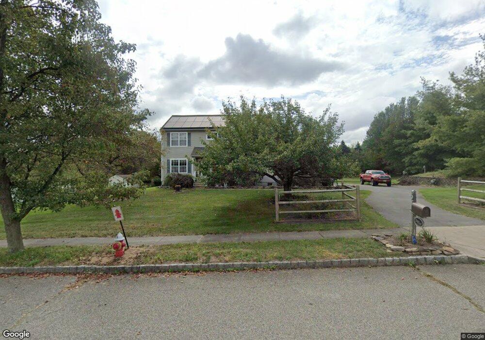
2 Saxton Ln Hackettstown, NJ 07840
Estimated Value: $580,352 - $681,000
Studio
--
Bath
2,124
Sq Ft
$295/Sq Ft
Est. Value
About This Home
This home is located at 2 Saxton Ln, Hackettstown, NJ 07840 and is currently estimated at $627,588, approximately $295 per square foot. 2 Saxton Ln is a home located in Warren County with nearby schools including Mansfield Twp Elementary School, Warren Hills Regional Middle School, and Warren Hills Reg High School.
Ownership History
Date
Name
Owned For
Owner Type
Purchase Details
Closed on
Aug 19, 1998
Sold by
Watts Donald G and Watts Maxine H
Bought by
Donlan Daniel and Donlan Joann
Current Estimated Value
Home Financials for this Owner
Home Financials are based on the most recent Mortgage that was taken out on this home.
Original Mortgage
$168,000
Outstanding Balance
$31,223
Interest Rate
6.86%
Estimated Equity
$596,365
Purchase Details
Closed on
Nov 29, 1994
Sold by
Farinella Ltd Partnership
Bought by
Watts Donald G and Watts Maxine H
Create a Home Valuation Report for This Property
The Home Valuation Report is an in-depth analysis detailing your home's value as well as a comparison with similar homes in the area
Home Values in the Area
Average Home Value in this Area
Purchase History
| Date | Buyer | Sale Price | Title Company |
|---|---|---|---|
| Donlan Daniel | $224,000 | -- | |
| Watts Donald G | $198,900 | -- |
Source: Public Records
Mortgage History
| Date | Status | Borrower | Loan Amount |
|---|---|---|---|
| Open | Donlan Daniel | $168,000 |
Source: Public Records
Tax History
| Year | Tax Paid | Tax Assessment Tax Assessment Total Assessment is a certain percentage of the fair market value that is determined by local assessors to be the total taxable value of land and additions on the property. | Land | Improvement |
|---|---|---|---|---|
| 2025 | $11,216 | $317,100 | $108,000 | $209,100 |
| 2024 | $11,263 | $317,100 | $108,000 | $209,100 |
| 2023 | $11,064 | $317,100 | $108,000 | $209,100 |
| 2022 | $11,064 | $317,100 | $108,000 | $209,100 |
| 2021 | $11,140 | $317,100 | $108,000 | $209,100 |
| 2020 | $11,029 | $317,100 | $108,000 | $209,100 |
| 2019 | $10,670 | $317,100 | $108,000 | $209,100 |
| 2018 | $10,445 | $317,100 | $108,000 | $209,100 |
| 2017 | $10,445 | $317,100 | $108,000 | $209,100 |
| 2016 | $10,207 | $317,100 | $108,000 | $209,100 |
| 2015 | $9,992 | $317,100 | $108,000 | $209,100 |
| 2014 | $9,675 | $317,100 | $108,000 | $209,100 |
Source: Public Records
Map
Nearby Homes
- 48 Brantwood Terrace
- 34 Brookside Ave
- 39 Canterbury Ln
- 21 Slope Dr
- 6 Brookside Ave
- 9 Hillside Rd
- 1 Heather Ct
- 108 Hillside Terrace E
- 108 Marilyn Dr
- 130 Kings Hwy
- 125 Riva Dr Unit 3A08A
- 105 Kings Hwy
- 6 Herbert Ln
- 40 Bennington Square
- 95 Wimbledon Square
- 45 Knob Hill Rd
- 0 Sliker Ln
- 133 Deerfield Dr
- 128 College View Dr
- 117 Deerfield Dr
Your Personal Tour Guide
Ask me questions while you tour the home.