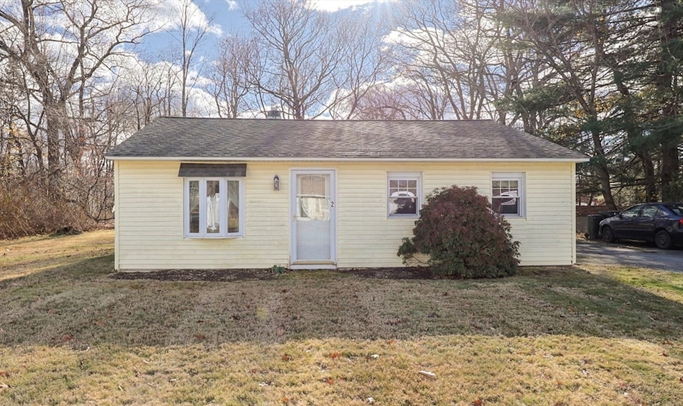
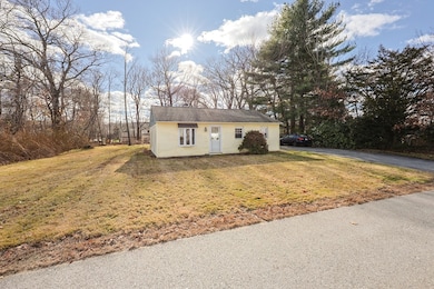
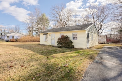
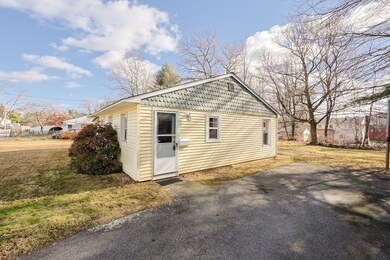

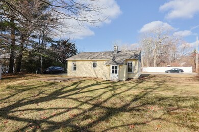
2 Sherman Ave Auburn, MA 01501
West Auburn NeighborhoodEstimated payment $1,948/month
Highlights
- Property is near public transit
- No HOA
- Outdoor Storage
- Ranch Style House
- Shops
- Forced Air Heating System
About This Home
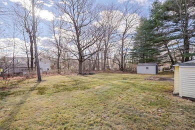
Welcome to 2 Sherman Ave in Auburn. This 2 bed, 1 bath ranch offers great potential for new owners looking for their starter home or investors looking to fix and flip. This home sits on a beautiful large level lot with lots of potential. Paved driveway for ample off street parking and shed in yard for extra storage. Roof done in 2017. New oil furnace earlier this year. Home is situated on a quiet side street yet offers the luxury of convenience as its close to shopping centers, restaurants, services, and major routes such as 90/290/395 and route 20. Bring your ideas and vision. Schedule your showing today.

Home Details
Home Type
- Single Family
Est. Annual Taxes
- $4,367
Year Built
- Built in 1949
Lot Details
- 0.38 Acre Lot
- Level Lot
- Cleared Lot
- Property is zoned 101
Home Design
- 858 Sq Ft Home
- Manufactured Home on a slab
- Ranch Style House
- Frame Construction
- Shingle Roof
- Stone
Kitchen
- Range
- Dishwasher
Flooring
- Carpet
- Laminate
Bedrooms and Bathrooms
- 2 Bedrooms
- 1 Full Bathroom
Parking
- 6 Car Parking Spaces
- Driveway
- Paved Parking
- Open Parking
- Off-Street Parking
Utilities
- No Cooling
- Forced Air Heating System
- 1 Heating Zone
- Heating System Uses Oil
- Electric Water Heater
Additional Features
- Washer and Electric Dryer Hookup
- Outdoor Storage
- Property is near public transit
Community Details
- No Home Owners Association
- Shops
Listing and Financial Details
- Assessor Parcel Number M:0054 L:0003,1457968
Map
Home Values in the Area
Average Home Value in this Area
Tax History
| Year | Tax Paid | Tax Assessment Tax Assessment Total Assessment is a certain percentage of the fair market value that is determined by local assessors to be the total taxable value of land and additions on the property. | Land | Improvement |
|---|---|---|---|---|
| 2025 | $44 | $305,600 | $116,200 | $189,400 |
| 2024 | $4,392 | $294,200 | $111,300 | $182,900 |
| 2023 | $4,230 | $266,400 | $101,200 | $165,200 |
| 2022 | $3,991 | $237,300 | $101,200 | $136,100 |
| 2021 | $4,680 | $201,700 | $89,400 | $112,300 |
| 2020 | $0 | $201,700 | $89,400 | $112,300 |
| 2019 | $3,367 | $182,800 | $88,500 | $94,300 |
| 2018 | $3,079 | $167,000 | $82,800 | $84,200 |
| 2017 | $2,922 | $159,300 | $75,100 | $84,200 |
| 2016 | $2,737 | $151,300 | $78,000 | $73,300 |
| 2015 | $2,620 | $151,800 | $78,000 | $73,800 |
| 2014 | $2,441 | $141,200 | $74,200 | $67,000 |
Property History
| Date | Event | Price | List to Sale | Price per Sq Ft |
|---|---|---|---|---|
| 11/26/2025 11/26/25 | For Sale | $299,999 | -- | $350 / Sq Ft |
Purchase History
| Date | Type | Sale Price | Title Company |
|---|---|---|---|
| Quit Claim Deed | -- | -- |
Mortgage History
| Date | Status | Loan Amount | Loan Type |
|---|---|---|---|
| Open | $234,000 | Adjustable Rate Mortgage/ARM |
Source: MLS Property Information Network (MLS PIN)
MLS Number: 73457835
APN: AUBU-000054-000000-000003
Disclaimer: Certain information contained herein is derived from information provided by parties other than Homes.com. All information provided is deemed reliable, but is not guaranteed to be accurate and should be independently verified.
![]() The property listing data and information, or the Images, set forth herein were provided to MLS Property Information Network, Inc. from third party sources, including sellers, lessors and public records, and were compiled by MLS Property Information Network, Inc. The property listing data and information, and the Images, are for the personal, non-commercial use of consumers having a good faith interest in purchasing or leasing listed properties of the type displayed to them and may not be used for any purpose other than to identify prospective properties which such consumers may have a good faith interest in purchasing or leasing. MLS Property Information Network, Inc. and its subscribers disclaim any and all representations and warranties as to the accuracy of the property listing data and information, or as to the accuracy of any of the Images, set forth herein.
The property listing data and information, or the Images, set forth herein were provided to MLS Property Information Network, Inc. from third party sources, including sellers, lessors and public records, and were compiled by MLS Property Information Network, Inc. The property listing data and information, and the Images, are for the personal, non-commercial use of consumers having a good faith interest in purchasing or leasing listed properties of the type displayed to them and may not be used for any purpose other than to identify prospective properties which such consumers may have a good faith interest in purchasing or leasing. MLS Property Information Network, Inc. and its subscribers disclaim any and all representations and warranties as to the accuracy of the property listing data and information, or as to the accuracy of any of the Images, set forth herein.
- 0 Athens St
- 48 Appleton Rd
- 21 Linda Ave
- 4 Linden Ln
- 217 Prospect St
- 503 Heritage Ln
- 3 Lancaster St
- 19 Garden St
- 12 Lancaster St
- 381 Oxford St N
- 12 Coachman Ln
- Lot 2 Leicester St
- 8 Garden St
- 3 Old Cart Rd
- 6 Paul St
- 11 Inwood Rd
- 88 Vine St
- 23 Thayer Pond Dr Unit 1
- 18 Thayer Pond Dr Unit 3
- 24 Thayer Pond Dr Unit 16
- 296 Central St Unit 1
- 1 Ridge Rd
- 404 Oxford St N
- 3 Bylund Dr
- 15 Thayer Pond Dr Unit 8
- 27 Leicester St Unit 2
- 27 Leicester St Unit 1
- 41 Watch St
- 60 Old Common Rd Unit 1
- 3 Vinal St
- 86 Pinehurst Ave Unit 1
- 175 James St
- 17 Abington St Unit 2
- 3 Jacobson Dr Unit 2
- 30 Apricot St Unit 1
- 328 Greenwood St
- 5 Brookline St Unit 3
- 278 Greenwood St Unit 1
- 17 Montague St Unit B
- 15 Catalpa Cir Unit 1