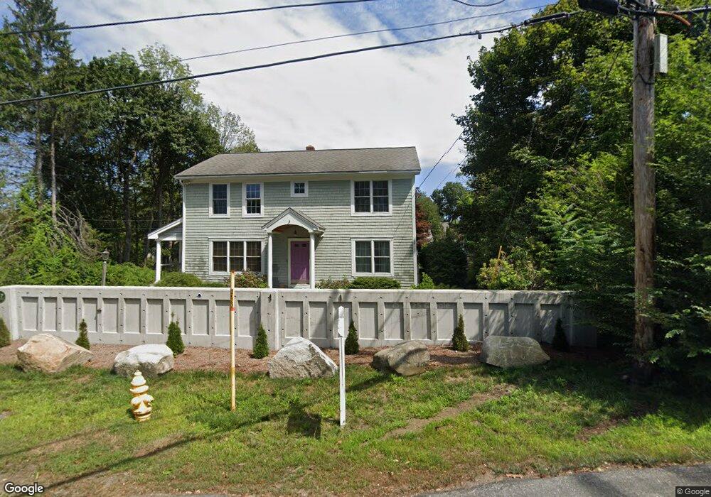
2 Sparhawk Ln Kittery Point, ME 03905
Kittery Point NeighborhoodEstimated Value: $363,000 - $1,296,000
2
Beds
1
Bath
936
Sq Ft
$738/Sq Ft
Est. Value
About This Home
This home is located at 2 Sparhawk Ln, Kittery Point, ME 03905 and is currently estimated at $691,173, approximately $738 per square foot. 2 Sparhawk Ln is a home with nearby schools including Horace Mitchell Primary School, Shapleigh School, and Robert W Traip Academy.
Ownership History
Date
Name
Owned For
Owner Type
Purchase Details
Closed on
May 12, 2025
Sold by
Brown Dale E
Bought by
Shoop Zehra N
Current Estimated Value
Home Financials for this Owner
Home Financials are based on the most recent Mortgage that was taken out on this home.
Original Mortgage
$350,000
Outstanding Balance
$348,127
Interest Rate
6.64%
Mortgage Type
Purchase Money Mortgage
Estimated Equity
$343,046
Create a Home Valuation Report for This Property
The Home Valuation Report is an in-depth analysis detailing your home's value as well as a comparison with similar homes in the area
Home Values in the Area
Average Home Value in this Area
Purchase History
| Date | Buyer | Sale Price | Title Company |
|---|---|---|---|
| Shoop Zehra N | $350,000 | None Available | |
| Shoop Zehra N | $350,000 | None Available | |
| Shoop Zehra N | $350,000 | None Available |
Source: Public Records
Mortgage History
| Date | Status | Borrower | Loan Amount |
|---|---|---|---|
| Open | Shoop Zehra N | $350,000 | |
| Closed | Shoop Zehra N | $350,000 |
Source: Public Records
Tax History
| Year | Tax Paid | Tax Assessment Tax Assessment Total Assessment is a certain percentage of the fair market value that is determined by local assessors to be the total taxable value of land and additions on the property. | Land | Improvement |
|---|---|---|---|---|
| 2024 | $3,911 | $275,400 | $165,600 | $109,800 |
| 2023 | $3,748 | $275,400 | $165,600 | $109,800 |
| 2022 | $3,712 | $275,400 | $165,600 | $109,800 |
| 2021 | $3,580 | $275,400 | $165,600 | $109,800 |
| 2020 | $3,553 | $275,400 | $165,600 | $109,800 |
| 2019 | $2,895 | $166,400 | $65,100 | $101,300 |
| 2018 | $3,169 | $166,400 | $65,100 | $101,300 |
| 2017 | $3,941 | $166,400 | $65,100 | $101,300 |
| 2016 | $2,671 | $166,400 | $65,100 | $101,300 |
| 2015 | $2,607 | $166,400 | $65,100 | $101,300 |
| 2014 | $2,583 | $166,400 | $65,100 | $101,300 |
| 2013 | $2,533 | $166,400 | $65,100 | $101,300 |
Source: Public Records
Map
Nearby Homes
- 12 Gillis Dr Unit 3
- 24 Seabreeze Ln
- 4 Trefethen Ave
- 18 Mainmast Cir
- 8 Spruce Point Rd
- 75 Marina Heights Rd
- 100 Shepard's Cove Rd Unit H305
- 100 Shepard's Cove Rd Unit G107
- 100 Shepards Cove Rd Unit F204
- 100 Shepards Cove Rd Unit H301
- 25 S Mill St
- 36 State St
- 66 State St Unit 202
- 80 State St Unit 302
- 35 Badgers Island W Unit 203
- 35 Badgers Island W Unit 301
- 35 Badgers Island W Unit 302
- 35 Badgers Island W Unit 103
- 8 Grover Ave
- 8 Grover Ln
- 17 Pepperrell Rd
- 4 Sparhawk Ln
- 19 Pepperrell Rd
- 15 Pepperrell Rd
- 8 Sparhawk Ln
- 7 Sparhawk Ln
- 10 Sparhawk Ln
- 16 Pepperrell Rd
- 14 Pepperrell Rd
- 5 Sparhawk Ln
- 7 Pepperrell Rd
- 5 Pepperrell Rd
- 18 Pepperrell Rd
- 12 Pepperrell Rd
- 9 Sparhawk Ln
- 11 Sparhawk Ln
- 8 Pepperrell Rd
- 31 Pepperrell Rd
- 24 Pepperrell Rd
- 24 Pepperrell Rd
Your Personal Tour Guide
Ask me questions while you tour the home.