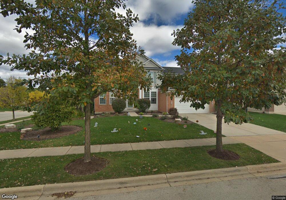
2 Springbrook Ct Streamwood, IL 60107
Estimated Value: $510,000 - $617,000
4
Beds
3
Baths
2,697
Sq Ft
$209/Sq Ft
Est. Value
About This Home
This home is located at 2 Springbrook Ct, Streamwood, IL 60107 and is currently estimated at $563,735, approximately $209 per square foot. 2 Springbrook Ct is a home located in Cook County with nearby schools including Hilltop Elementary School, Canton Middle School, and Streamwood High School.
Ownership History
Date
Name
Owned For
Owner Type
Purchase Details
Closed on
Mar 27, 2006
Sold by
Pulte Homes
Bought by
Bodhanwala Ashish and Bodhanwala Rashmi
Current Estimated Value
Home Financials for this Owner
Home Financials are based on the most recent Mortgage that was taken out on this home.
Original Mortgage
$368,000
Outstanding Balance
$206,876
Interest Rate
6.37%
Mortgage Type
Fannie Mae Freddie Mac
Estimated Equity
$356,859
Create a Home Valuation Report for This Property
The Home Valuation Report is an in-depth analysis detailing your home's value as well as a comparison with similar homes in the area
Home Values in the Area
Average Home Value in this Area
Purchase History
| Date | Buyer | Sale Price | Title Company |
|---|---|---|---|
| Bodhanwala Ashish | $460,000 | Cti |
Source: Public Records
Mortgage History
| Date | Status | Borrower | Loan Amount |
|---|---|---|---|
| Open | Bodhanwala Ashish | $368,000 |
Source: Public Records
Tax History Compared to Growth
Tax History
| Year | Tax Paid | Tax Assessment Tax Assessment Total Assessment is a certain percentage of the fair market value that is determined by local assessors to be the total taxable value of land and additions on the property. | Land | Improvement |
|---|---|---|---|---|
| 2025 | $11,215 | $50,000 | $9,166 | $40,834 |
| 2024 | $11,215 | $39,521 | $8,020 | $31,501 |
| 2023 | $10,904 | $39,521 | $8,020 | $31,501 |
| 2022 | $10,904 | $39,521 | $8,020 | $31,501 |
| 2021 | $9,815 | $29,974 | $6,874 | $23,100 |
| 2020 | $9,734 | $29,974 | $6,874 | $23,100 |
| 2019 | $9,603 | $33,305 | $6,874 | $26,431 |
| 2018 | $10,736 | $33,847 | $6,014 | $27,833 |
| 2017 | $10,616 | $33,847 | $6,014 | $27,833 |
| 2016 | $10,193 | $33,847 | $6,014 | $27,833 |
| 2015 | $10,473 | $32,007 | $5,442 | $26,565 |
| 2014 | $10,341 | $32,007 | $5,442 | $26,565 |
| 2013 | $9,977 | $32,007 | $5,442 | $26,565 |
Source: Public Records
Map
Nearby Homes
- 1463 Yellowstone Dr
- 33 Foxglove Ct
- 1291 Foxglove Dr
- 1287 Foxglove Dr
- 1289 Foxglove Dr
- 1293 Foxglove Dr
- 1281 Foxglove Dr
- 1279 Foxglove Dr
- 1295 Foxglove Dr
- 934 Tuscany Dr
- 56 Veneto Ct
- 982 Tuscany Dr
- 1325 Laurel Oaks Dr
- 1265 Tamarack Dr Unit 72
- 1504 Laurel Oaks Dr
- 1150 Nottingham Ln
- 71 Monarch Dr Unit 40126L
- 1103 Nottingham Ln
- 629 Dogleg Ln
- 650 Littleton Trail Unit 224
- 4 Springbrook Ct
- 2 Acadia Ct
- 912 Blue Ridge Dr
- 6 Springbrook Ct
- 919 Blue Ridge Dr
- 930 Blue Ridge Dr
- 5 Springbrook Ct
- 4 Acadia Ct
- 931 Blue Ridge Dr
- 910 Blue Ridge Dr
- 917 Blue Ridge Dr
- 932 Blue Ridge Dr
- 933 Blue Ridge Dr
- 6 Acadia Ct
- 908 Blue Ridge Dr
- 915 Blue Ridge Dr
- 7 Springbrook Ct
- 3 Acadia Ct
- 934 Blue Ridge Dr
- 9 Springbrook Ct