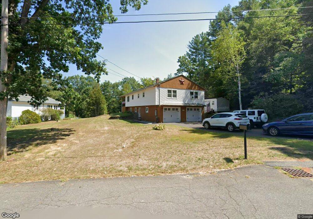
2 Stone Valley Rd Orange, MA 01364
Estimated Value: $372,229 - $425,000
3
Beds
2
Baths
1,400
Sq Ft
$286/Sq Ft
Est. Value
About This Home
This home is located at 2 Stone Valley Rd, Orange, MA 01364 and is currently estimated at $400,057, approximately $285 per square foot. 2 Stone Valley Rd is a home located in Franklin County with nearby schools including Fisher Hill and Ralph C Mahar Regional School.
Ownership History
Date
Name
Owned For
Owner Type
Purchase Details
Closed on
Jul 30, 2004
Sold by
Gonzalez Carlo A and Gonzalez Cheryl P
Bought by
Ward Catherine A
Current Estimated Value
Home Financials for this Owner
Home Financials are based on the most recent Mortgage that was taken out on this home.
Original Mortgage
$188,100
Interest Rate
6.33%
Mortgage Type
Purchase Money Mortgage
Purchase Details
Closed on
Jun 10, 1994
Sold by
Stone Ronald M
Bought by
Ramsdell Cheryl P
Create a Home Valuation Report for This Property
The Home Valuation Report is an in-depth analysis detailing your home's value as well as a comparison with similar homes in the area
Home Values in the Area
Average Home Value in this Area
Purchase History
| Date | Buyer | Sale Price | Title Company |
|---|---|---|---|
| Ward Catherine A | $209,000 | -- | |
| Ramsdell Cheryl P | $89,900 | -- |
Source: Public Records
Mortgage History
| Date | Status | Borrower | Loan Amount |
|---|---|---|---|
| Open | Ramsdell Cheryl P | $200,000 | |
| Closed | Ramsdell Cheryl P | $188,100 | |
| Previous Owner | Ramsdell Cheryl P | $93,000 |
Source: Public Records
Tax History
| Year | Tax Paid | Tax Assessment Tax Assessment Total Assessment is a certain percentage of the fair market value that is determined by local assessors to be the total taxable value of land and additions on the property. | Land | Improvement |
|---|---|---|---|---|
| 2025 | $62 | $376,900 | $31,800 | $345,100 |
| 2024 | $5,508 | $315,800 | $31,800 | $284,000 |
| 2023 | $5,449 | $303,400 | $31,800 | $271,600 |
| 2022 | $5,141 | $268,900 | $31,800 | $237,100 |
| 2021 | $4,445 | $221,700 | $53,800 | $167,900 |
| 2020 | $4,363 | $214,600 | $53,400 | $161,200 |
| 2019 | $3,984 | $176,900 | $47,900 | $129,000 |
| 2018 | $3,791 | $172,800 | $47,100 | $125,700 |
| 2017 | $3,669 | $172,800 | $47,100 | $125,700 |
| 2016 | $3,696 | $170,300 | $47,100 | $123,200 |
| 2015 | $3,614 | $174,000 | $47,100 | $126,900 |
| 2014 | $3,524 | $178,500 | $47,100 | $131,400 |
Source: Public Records
Map
Nearby Homes
- 216 Holtshire Rd
- 222 W River St
- 39 Terrace St
- 166-168 W Main St
- 313-315 Walnut Hill Rd
- 56 Shelter St
- 30 Cottage St
- 35 Ball St
- 246 Holtshire Rd Unit Lot 3
- 83 W Main St
- 36 Summit St Unit A
- 36 Summit St Unit B
- 12-14 E Main St
- 270 S Main St
- 50 E Main St
- 58 E Main St
- 490 S Main St
- 23 E Howe St
- 00 S Main St
- 000 S Main St
- 8 Stone Valley Rd
- 29 Stone Valley Rd Unit 4
- 29 Stone Valley Rd Unit 8
- 5 Stone Valley Rd
- 14 Stone Valley Rd
- 7 Stone Valley Rd
- 20 Stone Valley Rd
- 23 Stone Valley Rd
- 30 Stone Valley Rd
- 175 Holtshire Rd
- 41 Stone Valley Rd E
- 41 Stone Valley Rd
- 38 Stone Valley Rd
- 155 Holtshire Rd
- 179 Holtshire Rd
- 40 Stone Valley Rd
- 49 Stone Valley Rd
- 44 Stone Valley Rd
- 57 Stone Valley Rd
- 50 Stone Valley Rd
Your Personal Tour Guide
Ask me questions while you tour the home.