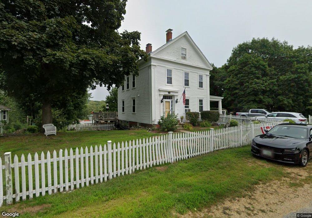
2 Tide Mill Rd Greenland, NH 03840
Estimated Value: $384,000 - $501,663
2
Beds
1
Bath
1,466
Sq Ft
$314/Sq Ft
Est. Value
About This Home
This home is located at 2 Tide Mill Rd, Greenland, NH 03840 and is currently estimated at $460,916, approximately $314 per square foot. 2 Tide Mill Rd is a home located in Rockingham County with nearby schools including Greenland Central School, The Cornerstone School, and Rye Country Day School.
Ownership History
Date
Name
Owned For
Owner Type
Purchase Details
Closed on
Nov 20, 2020
Sold by
Ahlgren John L
Bought by
Palmisciano Bessie J
Current Estimated Value
Purchase Details
Closed on
Apr 28, 2015
Sold by
Sammel Evelin U
Bought by
Blue Bonnet Realty Llc
Create a Home Valuation Report for This Property
The Home Valuation Report is an in-depth analysis detailing your home's value as well as a comparison with similar homes in the area
Home Values in the Area
Average Home Value in this Area
Purchase History
| Date | Buyer | Sale Price | Title Company |
|---|---|---|---|
| Palmisciano Bessie J | -- | None Available | |
| Blue Bonnet Realty Llc | $160,000 | -- |
Source: Public Records
Mortgage History
| Date | Status | Borrower | Loan Amount |
|---|---|---|---|
| Previous Owner | Blue Bonnet Realty Llc | $345,000 |
Source: Public Records
Tax History Compared to Growth
Tax History
| Year | Tax Paid | Tax Assessment Tax Assessment Total Assessment is a certain percentage of the fair market value that is determined by local assessors to be the total taxable value of land and additions on the property. | Land | Improvement |
|---|---|---|---|---|
| 2024 | $4,766 | $366,900 | $234,300 | $132,600 |
| 2023 | $4,502 | $366,900 | $234,300 | $132,600 |
| 2022 | $4,667 | $258,000 | $155,200 | $102,800 |
| 2021 | $4,830 | $258,000 | $155,200 | $102,800 |
| 2020 | $4,278 | $258,000 | $155,200 | $102,800 |
| 2019 | $4,231 | $258,000 | $155,200 | $102,800 |
| 2018 | $4,074 | $258,000 | $155,200 | $102,800 |
| 2017 | $3,441 | $206,800 | $122,400 | $84,400 |
| 2016 | $3,423 | $205,600 | $122,400 | $83,200 |
| 2015 | $3,477 | $205,600 | $122,400 | $83,200 |
| 2014 | $3,273 | $205,600 | $122,400 | $83,200 |
| 2013 | $3,187 | $205,600 | $122,400 | $83,200 |
Source: Public Records
Map
Nearby Homes
- 64 Boxwood Path Unit 64
- 36 Downs Ave
- 12 Founders Square Unit A
- 60 Ocean Rd
- Unit 25 Summerwind Place Unit 25
- Unit 1 Summerwind Place Unit 1
- Unit 3 Summerwind Place Unit 3
- Unit 29 Summerwind Place Unit 29
- Unit 31 Summerwind Place Unit 31
- Unit 15 Summerwind Place Unit 15
- 16 Summerwind Place Unit 16
- Unit 13 Summerwind Place Unit 13
- 41 Newington Rd
- 540 Ocean Rd
- 14 Balmoral Dr
- 13 Dearborn Rd
- 445 Ocean Rd Unit 4
- 638 Post Rd
- 380 Ocean Rd Unit 9
- 26 Mariette Dr
- 4 Tide Mill Rd
- 542 Portsmouth Ave
- 11 Fish And Game Rd
- 10 Tide Mill Rd
- 529 Portsmouth Ave
- 521 Portsmouth Ave
- 512 Portsmouth Ave
- 18 Tide Mill Rd
- 578 Portsmouth Ave
- 517 Portsmouth Ave
- 511 Portsmouth Ave
- 510 Portsmouth Ave
- 507 Portsmouth Ave
- 502 Portsmouth Ave
- 589 Portsmouth Ave
- 29 Cemetery Ln
- 496 Portsmouth Ave
- 499 Portsmouth Ave
- 69 Tide Mill Rd
- Lot A Seavey Unit Lot A