Estimated Value: $239,688 - $268,000
Studio
--
Bath
1,727
Sq Ft
$147/Sq Ft
Est. Value
About This Home
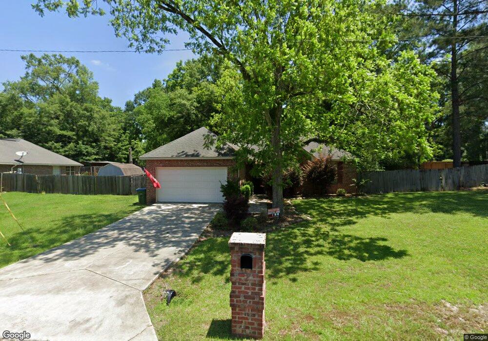
This home is located at 2 Tryston Rd, Petal, MS 39465 and is currently estimated at $253,422, approximately $146 per square foot. 2 Tryston Rd is a home located in Forrest County with nearby schools including Petal Primary School, Petal Elementary School, and Petal Upper Elementary School.
Ownership History
Date
Name
Owned For
Owner Type
Purchase Details
Closed on
Apr 15, 2016
Sold by
Simmons Patrick and Simmons Carol D
Bought by
Green Richard
Current Estimated Value
Home Financials for this Owner
Home Financials are based on the most recent Mortgage that was taken out on this home.
Original Mortgage
$165,483
Outstanding Balance
$131,681
Interest Rate
3.73%
Estimated Equity
$121,741
Purchase Details
Closed on
Feb 24, 2014
Bought by
Patrick Patrick G and Patrick Carol D
Home Financials for this Owner
Home Financials are based on the most recent Mortgage that was taken out on this home.
Original Mortgage
$60,000
Interest Rate
4.43%
Mortgage Type
New Conventional
Purchase Details
Closed on
Aug 21, 2009
Sold by
Lee Anthony Todd and Lee Wendy Rae
Bought by
Downey Ragan and Downey Sally L
Home Financials for this Owner
Home Financials are based on the most recent Mortgage that was taken out on this home.
Original Mortgage
$129,222
Interest Rate
5.14%
Create a Home Valuation Report for This Property
The Home Valuation Report is an in-depth analysis detailing your home's value as well as a comparison with similar homes in the area
Home Values in the Area
Average Home Value in this Area
Purchase History
| Date | Buyer | Sale Price | Title Company |
|---|---|---|---|
| Green Richard | -- | -- | |
| Patrick Patrick G | -- | -- | |
| Simmons Patrick G | -- | -- | |
| Downey Ragan | -- | -- |
Source: Public Records
Mortgage History
| Date | Status | Borrower | Loan Amount |
|---|---|---|---|
| Open | Green Richard | $165,483 | |
| Previous Owner | Simmons Patrick G | $60,000 | |
| Previous Owner | Downey Ragan | $129,222 |
Source: Public Records
Tax History
| Year | Tax Paid | Tax Assessment Tax Assessment Total Assessment is a certain percentage of the fair market value that is determined by local assessors to be the total taxable value of land and additions on the property. | Land | Improvement |
|---|---|---|---|---|
| 2024 | $2,461 | $14,242 | $0 | $0 |
| 2023 | $2,213 | $142,420 | $0 | $0 |
| 2022 | $2,141 | $14,242 | $0 | $0 |
| 2021 | $2,152 | $14,242 | $0 | $0 |
| 2020 | $2,093 | $13,817 | $0 | $0 |
| 2019 | $2,089 | $13,817 | $0 | $0 |
| 2018 | $2,093 | $13,817 | $0 | $0 |
| 2017 | $2,118 | $13,817 | $0 | $0 |
| 2016 | $1,845 | $12,369 | $0 | $0 |
| 2015 | $1,813 | $123,694 | $0 | $0 |
| 2014 | -- | $12,369 | $0 | $0 |
Source: Public Records
Map
Nearby Homes
- Lot 29 Clinton Dr
- 304 Margaret Ave
- 135 Meadowood St
- 144 Corinth Rd
- 113 Sun Cir
- 34 Country Park Cir
- 000 Dawson Cut Off
- 207 E 8th Ave
- 902 S Main St
- 1101 S Main St
- 201 Smith St
- 303 Petal Dr
- Lot 254 Petal Dr
- 211 Waller St
- 115 Smith St
- 1408 Carterville Rd
- 102 Smith St
- 118 van Slyke Ln
- 54 Pinewood Dr
- 15 Chateau Dr
Your Personal Tour Guide
Ask me questions while you tour the home.