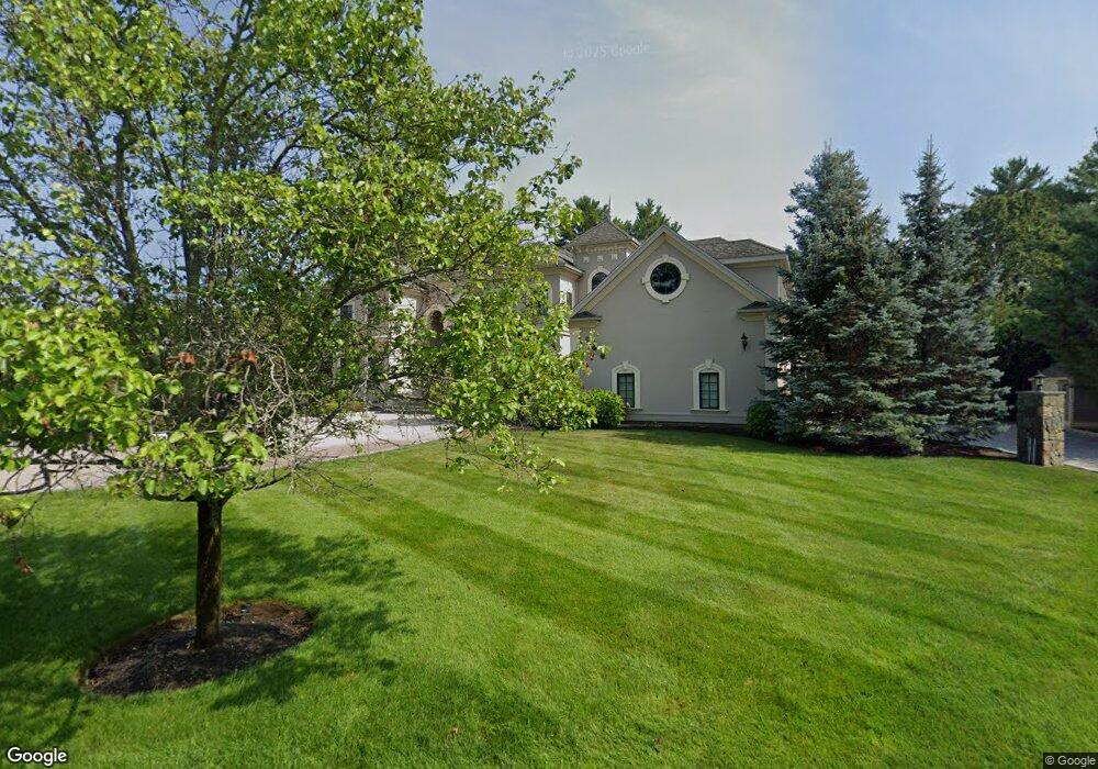
2 Warren Dr Unit 2 Middleton, MA 01949
Estimated Value: $2,084,000 - $2,932,000
5
Beds
7
Baths
8,600
Sq Ft
$288/Sq Ft
Est. Value
About This Home
This home is located at 2 Warren Dr Unit 2, Middleton, MA 01949 and is currently estimated at $2,474,318, approximately $287 per square foot. 2 Warren Dr Unit 2 is a home located in Essex County with nearby schools including Howe-Manning Elementary School, Fuller Meadow Elementary School, and Masconomet Regional Middle School.
Ownership History
Date
Name
Owned For
Owner Type
Purchase Details
Closed on
Dec 19, 2019
Sold by
Lightbody Charles
Bought by
Lightbody Charles and Westmoreland Gail
Current Estimated Value
Purchase Details
Closed on
Jul 11, 2019
Sold by
Bandar Daniel E and Bandar Leslie R
Bought by
Lightbody Charles
Purchase Details
Closed on
Jun 7, 2005
Sold by
Smith Farm Ests Dev Co
Bought by
Bandar Daniel E
Create a Home Valuation Report for This Property
The Home Valuation Report is an in-depth analysis detailing your home's value as well as a comparison with similar homes in the area
Home Values in the Area
Average Home Value in this Area
Purchase History
| Date | Buyer | Sale Price | Title Company |
|---|---|---|---|
| Lightbody Charles | -- | None Available | |
| Lightbody Charles | $1,229,000 | -- | |
| Bandar Daniel E | -- | -- |
Source: Public Records
Mortgage History
| Date | Status | Borrower | Loan Amount |
|---|---|---|---|
| Previous Owner | Bandar Daniel E | $250,000 | |
| Previous Owner | Bandar Daniel E | $1,500,000 | |
| Previous Owner | Bandar Daniel E | $873,000 | |
| Previous Owner | Bandar Daniel E | $505,000 |
Source: Public Records
Tax History Compared to Growth
Tax History
| Year | Tax Paid | Tax Assessment Tax Assessment Total Assessment is a certain percentage of the fair market value that is determined by local assessors to be the total taxable value of land and additions on the property. | Land | Improvement |
|---|---|---|---|---|
| 2025 | $28,398 | $2,388,400 | $650,100 | $1,738,300 |
| 2024 | $26,953 | $2,286,100 | $553,700 | $1,732,400 |
| 2023 | $23,054 | $1,791,300 | $621,500 | $1,169,800 |
| 2022 | $21,036 | $1,587,600 | $450,300 | $1,137,300 |
| 2021 | $20,920 | $1,524,800 | $470,900 | $1,053,900 |
| 2020 | $21,014 | $1,542,900 | $470,900 | $1,072,000 |
| 2019 | $23,300 | $1,702,000 | $479,700 | $1,222,300 |
| 2018 | $23,270 | $1,666,900 | $529,700 | $1,137,200 |
| 2017 | $22,944 | $1,644,700 | $500,300 | $1,144,400 |
| 2016 | $22,080 | $1,589,600 | $500,300 | $1,089,300 |
| 2015 | $18,224 | $1,322,500 | $506,000 | $816,500 |
Source: Public Records
Map
Nearby Homes
- 3 Warren Dr
- 78 Mill St
- 112 Mill St
- 70 Mill St
- 121 Liberty St
- 37 Moonpenny Dr
- 20-B Wildmeadow Rd
- 34 Wildmeadow Rd
- 4 Wildmeadow Rd
- 2 New Meadow Ln
- 10 Callaway Dr Unit 10
- 34 Kenney Rd
- 22 Locust St
- 77 Essex St
- 8 Lebeau Dr
- 35 Central St
- 53 N Main St Unit 53
- 196-200 B1 N Main St
- 49 Maple St Unit B
- 38 N Main St