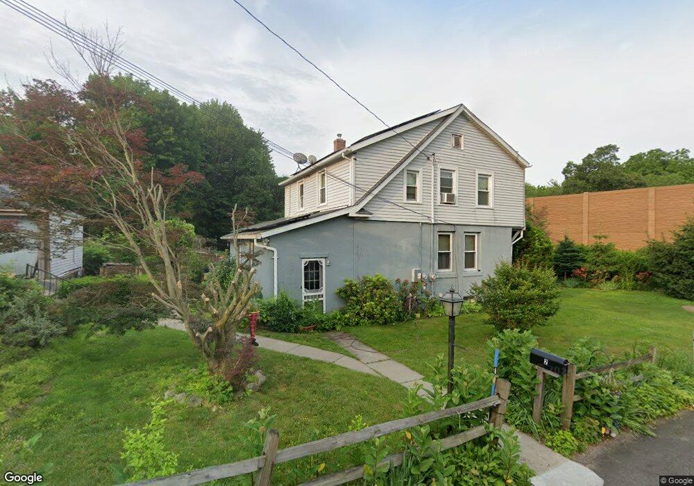
2 Westbrook St Ansonia, CT 06401
Estimated Value: $336,000 - $399,000
3
Beds
2
Baths
1,566
Sq Ft
$234/Sq Ft
Est. Value
About This Home
This home is located at 2 Westbrook St, Ansonia, CT 06401 and is currently estimated at $366,504, approximately $234 per square foot. 2 Westbrook St is a home located in New Haven County with nearby schools including Mead School, Prendergast School, and Ansonia Middle School.
Ownership History
Date
Name
Owned For
Owner Type
Purchase Details
Closed on
Mar 27, 2015
Sold by
Sherwood Everett
Bought by
Sherwood Carrie and Sherwood Everett
Current Estimated Value
Purchase Details
Closed on
Apr 13, 1988
Sold by
Dorothy-Fosdick
Bought by
Grabowski Sylvester
Create a Home Valuation Report for This Property
The Home Valuation Report is an in-depth analysis detailing your home's value as well as a comparison with similar homes in the area
Home Values in the Area
Average Home Value in this Area
Purchase History
| Date | Buyer | Sale Price | Title Company |
|---|---|---|---|
| Sherwood Carrie | -- | -- | |
| Grabowski Sylvester | $182,000 | -- |
Source: Public Records
Mortgage History
| Date | Status | Borrower | Loan Amount |
|---|---|---|---|
| Previous Owner | Grabowski Sylvester | $170,000 | |
| Previous Owner | Grabowski Sylvester | $110,000 |
Source: Public Records
Tax History Compared to Growth
Tax History
| Year | Tax Paid | Tax Assessment Tax Assessment Total Assessment is a certain percentage of the fair market value that is determined by local assessors to be the total taxable value of land and additions on the property. | Land | Improvement |
|---|---|---|---|---|
| 2025 | $4,742 | $166,110 | $37,940 | $128,170 |
| 2024 | $4,400 | $166,110 | $37,940 | $128,170 |
| 2023 | $4,359 | $166,110 | $37,940 | $128,170 |
| 2022 | $4,687 | $124,000 | $49,900 | $74,100 |
| 2021 | $4,687 | $124,000 | $49,900 | $74,100 |
| 2020 | $4,687 | $124,000 | $49,900 | $74,100 |
| 2019 | $9,691 | $124,000 | $49,900 | $74,100 |
| 2018 | $4,628 | $124,000 | $49,900 | $74,100 |
| 2017 | $9,296 | $114,300 | $43,200 | $71,100 |
| 2016 | $4,266 | $114,300 | $43,200 | $71,100 |
| 2015 | $4,289 | $114,300 | $43,200 | $71,100 |
| 2014 | $4,413 | $114,300 | $43,200 | $71,100 |
| 2013 | $4,497 | $114,300 | $43,200 | $71,100 |
Source: Public Records
Map
Nearby Homes
- 185 Wakelee Ave
- 193 Wakelee Ave
- 16 Holbrook Ct
- 15 Holbrook St
- 17 Holbrook St
- 222 Wakelee Ave
- 42 Meadow St
- 23 Day St
- 56 Franklin St
- 6 Grove St
- 132 Howard Ave
- 10 Clarkson St Unit 12
- 107A Howard Ave
- 6 Clarkson St
- 6 Crescent St
- 162 Emmett Ave
- 13 Tomlinson St
- 0 7 Liberty Pines St Unit 7 24119006
- 7 Howard Ave Unit 3
- 114 Emmett Ave
- 103 Westfield Ave
- 107 Westfield Ave
- 99 Westfield Ave
- 101 Westfield Ave 2nd Flr
- 1 Westbrook St
- 101 Westfield Ave Unit 2ND F
- 95 Westfield Ave
- 117 Westfield Ave
- 106 Westfield Ave Unit 2
- 106 Westfield Ave
- 127 Westfield Ave
- 127 Westfield Ave
- 89 Westfield Ave
- 104 Westfield Ave
- 104 Westfield Ave Unit 6401
- 102 Westfield Ave
- 108 Westfield Ave
- 112 Westfield Ave
- 83 Westfield Ave
- 120 Westfield Ave