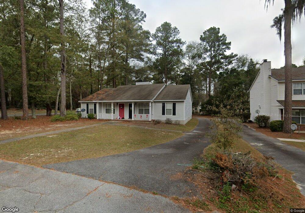
2 Wooddale Dr Unit A Valdosta, GA 31602
Estimated Value: $123,510 - $228,000
--
Bed
2
Baths
1,078
Sq Ft
$161/Sq Ft
Est. Value
About This Home
This home is located at 2 Wooddale Dr Unit A, Valdosta, GA 31602 and is currently estimated at $173,878, approximately $161 per square foot. 2 Wooddale Dr Unit A is a home located in Lowndes County with nearby schools including S.L. Mason Elementary School, Valdosta Middle School, and Valdosta High School.
Ownership History
Date
Name
Owned For
Owner Type
Purchase Details
Closed on
Aug 15, 2023
Sold by
Minor Randy J
Bought by
Minor Lynn C and Minor Randy J
Current Estimated Value
Purchase Details
Closed on
Mar 28, 1989
Bought by
Minor Randy J
Purchase Details
Closed on
Mar 31, 1987
Bought by
Jackson B Renee
Purchase Details
Closed on
May 29, 1984
Bought by
Minor Randy J
Purchase Details
Closed on
May 21, 1984
Bought by
Tillman I Hamilton
Purchase Details
Closed on
Jan 3, 1984
Bought by
Devcon Corp
Purchase Details
Closed on
Jun 6, 1983
Bought by
Rolling Hills Dev Co
Create a Home Valuation Report for This Property
The Home Valuation Report is an in-depth analysis detailing your home's value as well as a comparison with similar homes in the area
Home Values in the Area
Average Home Value in this Area
Purchase History
| Date | Buyer | Sale Price | Title Company |
|---|---|---|---|
| Minor Lynn C | -- | -- | |
| Minor Randy J | $15,600 | -- | |
| Jackson B Renee | $45,000 | -- | |
| Minor Randy J | $39,300 | -- | |
| Tillman I Hamilton | -- | -- | |
| Devcon Corp | $48,000 | -- | |
| Rolling Hills Dev Co | -- | -- |
Source: Public Records
Tax History Compared to Growth
Tax History
| Year | Tax Paid | Tax Assessment Tax Assessment Total Assessment is a certain percentage of the fair market value that is determined by local assessors to be the total taxable value of land and additions on the property. | Land | Improvement |
|---|---|---|---|---|
| 2024 | $1,006 | $36,026 | $8,000 | $28,026 |
| 2023 | $1,006 | $36,026 | $8,000 | $28,026 |
| 2022 | $986 | $29,176 | $8,000 | $21,176 |
| 2021 | $1,014 | $29,176 | $8,000 | $21,176 |
| 2020 | $909 | $25,593 | $8,000 | $17,593 |
| 2019 | $909 | $25,593 | $8,000 | $17,593 |
| 2018 | $920 | $25,593 | $8,000 | $17,593 |
| 2017 | $927 | $25,593 | $8,000 | $17,593 |
| 2016 | $925 | $25,593 | $8,000 | $17,593 |
| 2015 | $849 | $25,593 | $8,000 | $17,593 |
| 2014 | $917 | $27,181 | $8,000 | $19,181 |
Source: Public Records
Map
Nearby Homes
- 2121 Northwood Cir
- 2092 S Sherwood Dr Unit L100
- 2092 S Sherwood Dr Unit N118
- 2092 S Sherwood Dr Unit E38
- 2092 S Sherwood Dr Unit P130
- 2092 S Sherwood Dr
- 2092 S Sherwood Dr Unit P130
- 2092 S Sherwood Dr Unit G52
- 2110 Park Ln
- 2102 Park Ln
- 2207 S Sherwood Dr
- 2243 Oakgrove Cir
- 2214 Park Ln
- 2215 Park Ln
- 2115 Pinecliff Dr
- 1921 Gornto Rd Unit 19
- 1921 Gornto Rd Unit 5
- 2208 Dogwood Dr
- 2115 Westfield Dr
- 2206 Gornto Rd
- 2 Wooddale Dr Unit B
- 4 Wooddale Dr Unit A
- 4 Wooddale Dr
- 4 Wooddale Dr
- 48 Wooddale Dr
- 6 Wooddale Dr Unit B
- 1 Westbrook Cir Unit B
- 1 Westbrook Cir Unit A
- 3 Westbrook Cir Unit B
- 3 Westbrook Cir
- 1 Wooddale Dr Unit A/B
- 1 Wooddale Dr
- 3 Wooddale Dr Unit B
- 3 Wooddale Dr Unit A
- 3 Wooddale Dr
- 3 Wooddale Dr
- 5 Westbrook Cir Unit B
- 2094 S Sherwood Dr
- 5 Wooddale Dr
- 8 Wooddale Dr