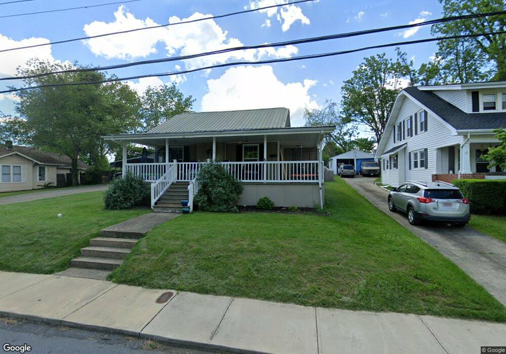
20 22nd St Bristol, TN 37620
Estimated Value: $147,000 - $212,000
--
Bed
1
Bath
1,458
Sq Ft
$124/Sq Ft
Est. Value
About This Home
This home is located at 20 22nd St, Bristol, TN 37620 and is currently estimated at $181,032, approximately $124 per square foot. 20 22nd St is a home located in Sullivan County with nearby schools including Anderson Elementary School, Vance Middle School, and Tennessee High School.
Ownership History
Date
Name
Owned For
Owner Type
Purchase Details
Closed on
Feb 25, 2022
Sold by
Ray Green Ethan
Bought by
Green Ethan Ray
Current Estimated Value
Purchase Details
Closed on
Oct 3, 2018
Sold by
Eades Matthew and Eades Julie Anne
Bought by
Green Ethan Ray and Green Thea M
Home Financials for this Owner
Home Financials are based on the most recent Mortgage that was taken out on this home.
Original Mortgage
$60,000
Interest Rate
4.5%
Mortgage Type
New Conventional
Purchase Details
Closed on
Feb 19, 2009
Sold by
Regency Finance Co
Bought by
Eades Matthew
Home Financials for this Owner
Home Financials are based on the most recent Mortgage that was taken out on this home.
Original Mortgage
$77,895
Interest Rate
5.15%
Purchase Details
Closed on
Jun 13, 2008
Purchase Details
Closed on
Dec 29, 1994
Sold by
Dorothy Dulaney
Bought by
Jones A D
Create a Home Valuation Report for This Property
The Home Valuation Report is an in-depth analysis detailing your home's value as well as a comparison with similar homes in the area
Home Values in the Area
Average Home Value in this Area
Purchase History
| Date | Buyer | Sale Price | Title Company |
|---|---|---|---|
| Green Ethan Ray | -- | None Listed On Document | |
| Green Ethan Ray | $75,000 | Ecu Title & Escrow | |
| Eades Matthew | $74,000 | -- | |
| -- | $78,000 | -- | |
| Jones A D | $3,333 | -- |
Source: Public Records
Mortgage History
| Date | Status | Borrower | Loan Amount |
|---|---|---|---|
| Previous Owner | Green Ethan Ray | $60,000 | |
| Previous Owner | Jones A D | $77,895 |
Source: Public Records
Tax History Compared to Growth
Tax History
| Year | Tax Paid | Tax Assessment Tax Assessment Total Assessment is a certain percentage of the fair market value that is determined by local assessors to be the total taxable value of land and additions on the property. | Land | Improvement |
|---|---|---|---|---|
| 2024 | -- | $28,650 | $3,350 | $25,300 |
| 2023 | $1,258 | $28,650 | $3,350 | $25,300 |
| 2022 | $1,258 | $28,650 | $3,350 | $25,300 |
| 2021 | $1,258 | $28,650 | $3,350 | $25,300 |
| 2020 | $714 | $28,650 | $3,350 | $25,300 |
| 2019 | $1,315 | $27,800 | $3,350 | $24,450 |
| 2018 | $1,310 | $27,800 | $3,350 | $24,450 |
| 2017 | $1,310 | $27,800 | $3,350 | $24,450 |
| 2016 | $1,298 | $26,900 | $3,350 | $23,550 |
| 2014 | -- | $26,891 | $0 | $0 |
Source: Public Records
Map
Nearby Homes
- 2228 Bay St
- 2000 Euclid Ave
- 000 Hemlock Dr
- 2177 Randolph St
- 1614 Broad St
- 2412,14,16 Bradley St
- 1057 Moorland Ave
- 2400 Bradley St
- 2241 Bradley St
- 2121 2123 Randolph St
- 1443 Windsor Ave
- 60 Peters St
- 2461 Bradley St
- 460 Vance St
- 2413 Catherine St
- 548 Floyd St
- 1724 & 1728 Euclid Ave
- 728 Randolph St
- 401 Crockett St
- 420 Douglas St