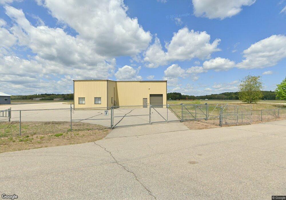
20 Airport Rd Gilford, NH 03249
Estimated Value: $429,529
--
Bed
--
Bath
--
Sq Ft
1
Acres
About This Home
This home is located at 20 Airport Rd, Gilford, NH 03249 and is currently estimated at $429,529. 20 Airport Rd is a home located in Belknap County with nearby schools including Gilford Elementary School, Gilford Middle School, and Gilford High School.
Ownership History
Date
Name
Owned For
Owner Type
Purchase Details
Closed on
Jan 16, 2025
Sold by
Labrie James R and Labrie Eugene R
Bought by
Labrie James R and Labrie Kathleen A
Current Estimated Value
Purchase Details
Closed on
Sep 20, 2013
Sold by
American Aviation Corp
Bought by
Labrie James R and Labrie Eugene R
Purchase Details
Closed on
Oct 28, 2004
Sold by
Desmarais Arthur G
Bought by
American Aviation Corp
Create a Home Valuation Report for This Property
The Home Valuation Report is an in-depth analysis detailing your home's value as well as a comparison with similar homes in the area
Home Values in the Area
Average Home Value in this Area
Purchase History
| Date | Buyer | Sale Price | Title Company |
|---|---|---|---|
| Labrie James R | -- | None Available | |
| Labrie James R | $210,000 | -- | |
| Labrie James R | $210,000 | -- | |
| American Aviation Corp | $225,000 | -- | |
| American Aviation Corp | $225,000 | -- |
Source: Public Records
Tax History Compared to Growth
Tax History
| Year | Tax Paid | Tax Assessment Tax Assessment Total Assessment is a certain percentage of the fair market value that is determined by local assessors to be the total taxable value of land and additions on the property. | Land | Improvement |
|---|---|---|---|---|
| 2024 | $4,538 | $403,400 | $151,700 | $251,700 |
| 2023 | $4,155 | $403,400 | $151,700 | $251,700 |
| 2022 | $2,998 | $244,700 | $94,500 | $150,200 |
| 2021 | $2,905 | $236,600 | $94,500 | $142,100 |
| 2020 | $3,499 | $232,800 | $94,500 | $138,300 |
| 2019 | $3,714 | $234,200 | $94,500 | $139,700 |
| 2018 | $3,795 | $222,700 | $85,500 | $137,200 |
| 2017 | $3,844 | $222,700 | $85,500 | $137,200 |
| 2016 | $4,008 | $223,300 | $85,500 | $137,800 |
| 2015 | $4,013 | $223,300 | $85,500 | $137,800 |
| 2011 | $4,255 | $229,400 | $85,500 | $143,900 |
Source: Public Records
Map
Nearby Homes
- 9 Lily Pond Rd
- 44 Gilford Dr E
- 84 Old Lake Shore Rd
- 8 Mulberry Hill Rd Unit B
- 71 Annis Dr Unit 1
- 320 Old Lake Shore Rd Unit 3
- 23 Liscomb Cir Unit 58
- 9 Sargents Place Unit 35
- 9 Sargents Place Unit 84
- 9 Sargents Place Unit 23
- 9 Sargents Place Unit 72
- 9 Sargents Place Unit 113
- 118 Weirs Rd Unit G05
- 343 Old Lake Shore Rd Unit 32
- 30 Beacon Hill Rd
- 115 Weirs Rd Unit 109B
- 60 Weirs Rd Unit D2
- 73 Weirs Slip I-22
- 61 White Oaks Rd
- 31 Henderson Rd Unit 17
- 28 Airport Rd
- 15 Airport Rd
- 42 Airport Rd
- 4 Gilford Dr E
- 57 Gilford East Dr
- 50 Airport Rd
- 19 Gilford Yacht Club Unit 19
- 12 Gilford Dr E
- 20 Gilford Yacht Club Unit 20
- 29 Gilford East Dr
- 29 Gilford East Dr
- 60 Airport Rd
- 46 Gilford Yacht Club Unit 46
- Lot 43 Gilford Dr E
- 43 Gilford E
- 43 Gilford E Unit A
- 43 Gilford East Dr
- 43 Gilford East Dr
- 43 Gilford East Dr
- 23 Lake Shore Park Rd