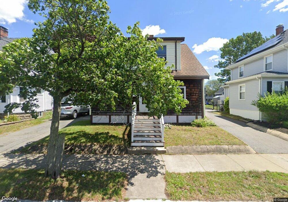
20 Allerton St Lynn, MA 01904
Lower Broadway NeighborhoodEstimated Value: $565,551 - $600,000
3
Beds
2
Baths
1,472
Sq Ft
$396/Sq Ft
Est. Value
About This Home
This home is located at 20 Allerton St, Lynn, MA 01904 and is currently estimated at $582,388, approximately $395 per square foot. 20 Allerton St is a home located in Essex County with nearby schools including Edward A. Sisson Elementary School, William R. Fallon School, and Pickering Middle School.
Ownership History
Date
Name
Owned For
Owner Type
Purchase Details
Closed on
Aug 27, 2021
Sold by
Martin Kathleen
Bought by
Martin Katie M
Current Estimated Value
Purchase Details
Closed on
Jan 1, 1983
Bought by
Martin Joseph M and Martin Kathleen G
Create a Home Valuation Report for This Property
The Home Valuation Report is an in-depth analysis detailing your home's value as well as a comparison with similar homes in the area
Home Values in the Area
Average Home Value in this Area
Purchase History
| Date | Buyer | Sale Price | Title Company |
|---|---|---|---|
| Martin Katie M | -- | None Available | |
| Martin Katie M | -- | None Available | |
| Martin Katie M | -- | None Available | |
| Martin Joseph M | $9,200 | -- |
Source: Public Records
Mortgage History
| Date | Status | Borrower | Loan Amount |
|---|---|---|---|
| Previous Owner | Martin Joseph M | $120,000 | |
| Previous Owner | Martin Joseph M | $25,000 | |
| Previous Owner | Martin Joseph M | $80,000 |
Source: Public Records
Tax History
| Year | Tax Paid | Tax Assessment Tax Assessment Total Assessment is a certain percentage of the fair market value that is determined by local assessors to be the total taxable value of land and additions on the property. | Land | Improvement |
|---|---|---|---|---|
| 2025 | $5,052 | $487,600 | $191,900 | $295,700 |
| 2024 | $5,016 | $476,400 | $187,500 | $288,900 |
| 2023 | $4,697 | $421,300 | $176,300 | $245,000 |
| 2022 | $4,641 | $373,400 | $138,600 | $234,800 |
| 2021 | $4,450 | $341,500 | $140,300 | $201,200 |
| 2020 | $4,189 | $312,600 | $126,500 | $186,100 |
| 2019 | $4,231 | $295,900 | $119,100 | $176,800 |
| 2018 | $4,063 | $268,200 | $110,900 | $157,300 |
| 2017 | $4,062 | $260,400 | $97,900 | $162,500 |
| 2016 | $3,859 | $238,500 | $90,500 | $148,000 |
| 2015 | $3,873 | $231,200 | $96,200 | $135,000 |
Source: Public Records
Map
Nearby Homes
- 2 Chestnut Terrace
- 10 Pond St
- 325 Western Ave
- 198 Locust St Unit 303
- 200 Locust St Unit 706
- 1 Clough St
- 70 Grant St
- 135 Allen Ave
- 15 Nichols Ave
- 199 Allen Ave
- 100 Magnolia Ave Unit 5
- 102 Henry Ave
- 6-8 Beede Ave
- 67 Beacon Hill Ave
- 49 Eade St
- 6A Goodridge St
- 51 Laighton St Unit 7
- 105 Lawton Ave
- 354 Broadway Unit 3
- 1 Hillcrest Ave
- 16 Allerton St
- 24 Allerton St
- 12 Allerton St
- 28 Allerton St
- 19 Locust St
- 15 Locust St
- 21 Locust St
- 11 Locust St
- 32 Allerton St
- 25 Locust St
- 10 Allerton St
- 19 Allerton St
- 628 Chestnut St Unit 3
- 628 Chestnut St Unit 5
- 628 Chestnut St Unit 2
- 628 Chestnut St Unit 8
- 628 Chestnut St
- 7 Locust St
- 624 Chestnut St
- 34 Allerton St
Your Personal Tour Guide
Ask me questions while you tour the home.