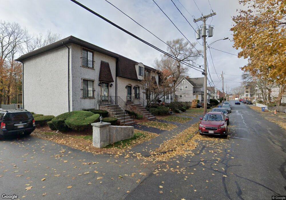
20 Bennett St Unit F Wakefield, MA 01880
East Side NeighborhoodEstimated Value: $592,000 - $680,000
2
Beds
2
Baths
1,500
Sq Ft
$429/Sq Ft
Est. Value
About This Home
This home is located at 20 Bennett St Unit F, Wakefield, MA 01880 and is currently estimated at $643,368, approximately $428 per square foot. 20 Bennett St Unit F is a home located in Middlesex County with nearby schools including Wakefield Memorial High School, St Joseph School, and Odyssey Day School.
Ownership History
Date
Name
Owned For
Owner Type
Purchase Details
Closed on
Jun 30, 2009
Sold by
Walczewski Gary and Walczewski Nicole
Bought by
Wu Melody M
Current Estimated Value
Home Financials for this Owner
Home Financials are based on the most recent Mortgage that was taken out on this home.
Original Mortgage
$204,700
Interest Rate
4.92%
Mortgage Type
Purchase Money Mortgage
Purchase Details
Closed on
Jul 22, 1997
Sold by
Romano Sharyn and Romano Donna L
Bought by
Pagliuso Frank L and Destefano Josephine F
Create a Home Valuation Report for This Property
The Home Valuation Report is an in-depth analysis detailing your home's value as well as a comparison with similar homes in the area
Home Values in the Area
Average Home Value in this Area
Purchase History
| Date | Buyer | Sale Price | Title Company |
|---|---|---|---|
| Wu Melody M | $273,000 | -- | |
| Pagliuso Frank L | $117,500 | -- |
Source: Public Records
Mortgage History
| Date | Status | Borrower | Loan Amount |
|---|---|---|---|
| Open | Pagliuso Frank L | $199,750 | |
| Closed | Wu Melody M | $204,700 |
Source: Public Records
Tax History Compared to Growth
Tax History
| Year | Tax Paid | Tax Assessment Tax Assessment Total Assessment is a certain percentage of the fair market value that is determined by local assessors to be the total taxable value of land and additions on the property. | Land | Improvement |
|---|---|---|---|---|
| 2025 | $6,264 | $551,900 | $0 | $551,900 |
| 2024 | $5,857 | $520,600 | $0 | $520,600 |
| 2023 | $5,497 | $468,600 | $0 | $468,600 |
| 2022 | $4,811 | $390,500 | $0 | $390,500 |
| 2021 | $4,737 | $372,100 | $0 | $372,100 |
| 2020 | $4,255 | $333,200 | $0 | $333,200 |
| 2019 | $4,108 | $320,200 | $0 | $320,200 |
| 2018 | $3,978 | $307,200 | $0 | $307,200 |
| 2017 | $3,383 | $259,600 | $0 | $259,600 |
| 2016 | $3,421 | $253,600 | $0 | $253,600 |
| 2015 | $3,305 | $245,200 | $0 | $245,200 |
| 2014 | $3,072 | $240,400 | $0 | $240,400 |
Source: Public Records
Map
Nearby Homes
- 38 Bennett St Unit 3D
- 22 Jefferson Rd
- 134 Nahant St Unit B
- 5 Bateman Ct Unit 5
- 51 Crescent St
- 50 Albion St
- 62 Foundry St Unit 310
- 62 Foundry St Unit 312
- 62 Foundry St Unit 506
- 62 Foundry St Unit 202
- 62 Foundry St Unit 208
- 62 Foundry St Unit 414
- 62 Foundry St Unit 406
- 62 Foundry St Unit 313
- Unit 208 Plan at Wrenly
- Unit 310 Plan at Wrenly
- 69 Foundry St Unit 416
- 69 Foundry St Unit 310
- 16 Pleasant St
- 9 Avon St Unit 2
- 20 Bennett St Unit 20A
- 20 Bennett St Unit H
- 20 Bennett St Unit G
- 20 Bennett St Unit E
- 20 Bennett St Unit D
- 20 Bennett St Unit C
- 20 Bennett St Unit B
- 20 Bennett St Unit A
- 20D Bennett St
- 20B Bennett St Unit 20B
- 22D Bennett St Unit 22D
- 22 Bennett St Unit D
- 22 Bennett St Unit C
- 22 Bennett St Unit B
- 22 Bennett St Unit A
- 22C Bennett St Unit 22C
- 22B Bennett St Unit 22B
- 22B Bennett St Unit 22 B
- 22 Bennett St Unit 20-G
- 19 Bennett St Unit 2