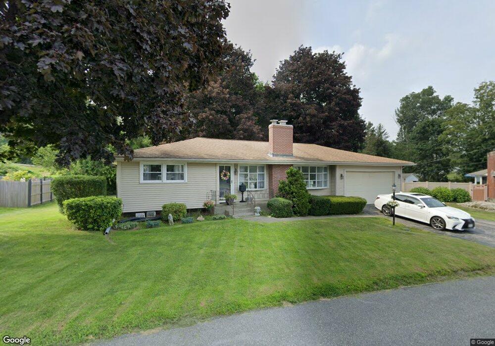
20 Blueridge Rd West Boylston, MA 01583
Estimated Value: $460,000 - $518,000
3
Beds
1
Bath
1,350
Sq Ft
$366/Sq Ft
Est. Value
About This Home
This home is located at 20 Blueridge Rd, West Boylston, MA 01583 and is currently estimated at $494,538, approximately $366 per square foot. 20 Blueridge Rd is a home located in Worcester County with nearby schools including Major Edwards Elementary School, West Boylston Junior/Senior High School, and Abby Kelley Foster Charter Public School.
Ownership History
Date
Name
Owned For
Owner Type
Purchase Details
Closed on
Aug 27, 2019
Sold by
Obrien Colleen A
Bought by
Fallon Colleen A and Fallon Daniel R
Current Estimated Value
Home Financials for this Owner
Home Financials are based on the most recent Mortgage that was taken out on this home.
Original Mortgage
$240,000
Outstanding Balance
$209,739
Interest Rate
3.7%
Mortgage Type
New Conventional
Estimated Equity
$284,799
Purchase Details
Closed on
Aug 16, 1996
Sold by
Goyette L Paul L and Goyette Mary
Bought by
Obrien Colleen A
Home Financials for this Owner
Home Financials are based on the most recent Mortgage that was taken out on this home.
Original Mortgage
$105,000
Interest Rate
8.08%
Mortgage Type
Purchase Money Mortgage
Create a Home Valuation Report for This Property
The Home Valuation Report is an in-depth analysis detailing your home's value as well as a comparison with similar homes in the area
Home Values in the Area
Average Home Value in this Area
Purchase History
| Date | Buyer | Sale Price | Title Company |
|---|---|---|---|
| Fallon Colleen A | -- | -- | |
| Obrien Colleen A | $135,000 | -- |
Source: Public Records
Mortgage History
| Date | Status | Borrower | Loan Amount |
|---|---|---|---|
| Open | Fallon Colleen A | $240,000 | |
| Previous Owner | Obrien Colleen A | $106,000 | |
| Previous Owner | Obrien Colleen A | $105,000 | |
| Previous Owner | Obrien Colleen A | $30,000 |
Source: Public Records
Tax History Compared to Growth
Tax History
| Year | Tax Paid | Tax Assessment Tax Assessment Total Assessment is a certain percentage of the fair market value that is determined by local assessors to be the total taxable value of land and additions on the property. | Land | Improvement |
|---|---|---|---|---|
| 2025 | $60 | $429,500 | $88,700 | $340,800 |
| 2024 | $5,801 | $392,500 | $88,700 | $303,800 |
| 2023 | $5,663 | $363,500 | $88,200 | $275,300 |
| 2022 | $5,292 | $299,300 | $88,200 | $211,100 |
| 2021 | $5,108 | $276,700 | $83,700 | $193,000 |
| 2020 | $4,994 | $268,800 | $83,700 | $185,100 |
| 2019 | $3,110 | $247,300 | $83,700 | $163,600 |
| 2018 | $4,442 | $237,300 | $83,700 | $153,600 |
| 2017 | $3,924 | $208,700 | $83,700 | $125,000 |
| 2016 | $3,852 | $208,800 | $77,800 | $131,000 |
| 2015 | $3,681 | $200,700 | $77,000 | $123,700 |
Source: Public Records
Map
Nearby Homes
- 39 Meola Ave
- 33 Meola Ave
- 1 Highland Ave
- 33 Isleboro St
- 12 Birchbrush Ln
- 29 Isleboro St
- 44 Dixfield St
- 39 Davidson Rd
- 1110 W Boylston St Unit A
- 1097 W Boylston St
- 740 Burncoat St Unit B
- 22 Danielles Way
- 26 Danielles Way
- 31 Danielles Way
- 9 Idalla Ave
- 12 Dixfield Rd
- 156 Hillside Village Dr
- 59 Santoro Rd
- 83 Hillside Village Dr
- 93 Winfield Rd
- 24 Blueridge Rd
- 18 Blueridge Rd
- 4 Hawthorne Dr
- 14 Blueridge Rd
- 28 Blueridge Rd
- 9 Blueridge Rd
- 3 Shanandoah Hill Dr
- 109 Woodland St
- 8 Hawthorne Dr
- 110 Woodland St
- 7 Rd
- 7 Shanandoah Hill Dr
- 4 Shanandoah Hill Dr
- 7 Hawthorne Dr
- 7 Blueridge Rd
- 8 Blueridge Rd
- 105 Woodland St
- 10 Hawthorne Dr
- 137 Woodland St
- 4 Danielian Dr