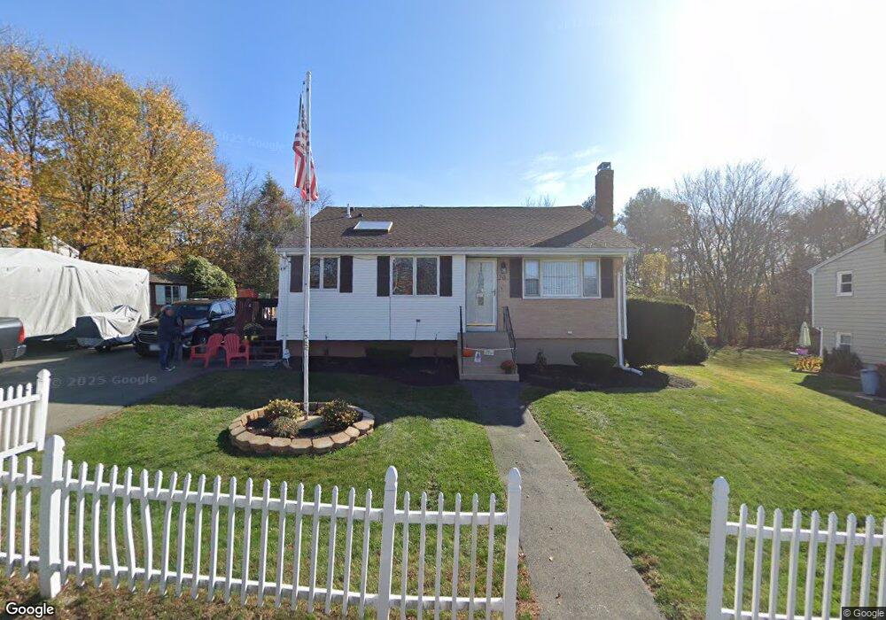
20 Boundary Ave Brockton, MA 02302
Montello NeighborhoodEstimated Value: $483,000 - $530,000
3
Beds
2
Baths
1,388
Sq Ft
$366/Sq Ft
Est. Value
About This Home
This home is located at 20 Boundary Ave, Brockton, MA 02302 and is currently estimated at $507,747, approximately $365 per square foot. 20 Boundary Ave is a home located in Plymouth County with nearby schools including Brookfield Elementary School, Downey Elementary School, and Ashfield Middle School.
Ownership History
Date
Name
Owned For
Owner Type
Purchase Details
Closed on
Jun 27, 2003
Sold by
Chaplin Frank B
Bought by
Chaplin Frank B and Chaplin Deborah M
Current Estimated Value
Purchase Details
Closed on
Feb 25, 2003
Sold by
Pizzuto Dominic and Savoy Stephanie
Bought by
Chaplin Frank B
Purchase Details
Closed on
Apr 19, 2001
Sold by
Pizzuto Dominic and Powers Irene
Bought by
Pizzuto Dominic
Create a Home Valuation Report for This Property
The Home Valuation Report is an in-depth analysis detailing your home's value as well as a comparison with similar homes in the area
Home Values in the Area
Average Home Value in this Area
Purchase History
| Date | Buyer | Sale Price | Title Company |
|---|---|---|---|
| Chaplin Frank B | $234,000 | -- | |
| Chaplin Frank B | $234,000 | -- | |
| Pizzuto Dominic | $130,000 | -- |
Source: Public Records
Mortgage History
| Date | Status | Borrower | Loan Amount |
|---|---|---|---|
| Open | Pizzuto Dominic | $291,150 | |
| Closed | Pizzuto Dominic | $260,100 |
Source: Public Records
Tax History Compared to Growth
Tax History
| Year | Tax Paid | Tax Assessment Tax Assessment Total Assessment is a certain percentage of the fair market value that is determined by local assessors to be the total taxable value of land and additions on the property. | Land | Improvement |
|---|---|---|---|---|
| 2025 | $4,948 | $408,600 | $157,700 | $250,900 |
| 2024 | $4,898 | $407,500 | $157,700 | $249,800 |
| 2023 | $4,661 | $359,100 | $107,900 | $251,200 |
| 2022 | $4,364 | $312,400 | $98,100 | $214,300 |
| 2021 | $4,224 | $291,300 | $90,300 | $201,000 |
| 2020 | $4,283 | $282,700 | $79,500 | $203,200 |
| 2019 | $4,312 | $277,500 | $75,600 | $201,900 |
| 2018 | $3,760 | $234,100 | $75,600 | $158,500 |
| 2017 | $3,597 | $223,400 | $75,600 | $147,800 |
| 2016 | $2,897 | $166,900 | $72,100 | $94,800 |
| 2015 | $3,122 | $172,000 | $72,100 | $99,900 |
| 2014 | $2,968 | $163,700 | $72,100 | $91,600 |
Source: Public Records
Map
Nearby Homes
- 5 Brookville Ave
- 261 Jon Dr
- 18 Brookfield Dr
- 38 Stephen Dr
- 690 N Quincy St
- 170 Elsie Rd
- 285 Hovendon Ave
- 719 S Franklin St Unit L Block 1
- 719 S Franklin St Unit D Block 1
- 719 S Franklin St Unit C Block 1
- 505 Hampton Way Unit 505
- 40 Christopher Rd
- 29 Belair Dr
- 12 Hamilton Way
- 53 Kent St
- 61 Kent St
- 60 Bonney St
- 175 Winter St
- 36 Dix Rd
- 421 Winter St
- 26 Boundary Ave
- 14 Boundary Ave
- 32 Boundary Ave
- 842 N Quincy St
- 7 Randolph Ave
- 4 Randolph Ave
- 38 Boundary Ave
- 10 Boundary Ave
- 15 Boundary Ave
- 836 N Quincy St
- 11 Boundary Ave
- 44 Boundary Ave
- 7 Gary Rd
- 14 Randolph Ave
- 828 N Quincy St
- 61 Boundary St
- 15 Randolph Ave
- 67 Boundary St
- 47 Boundary St
- 1 Boundary Ave