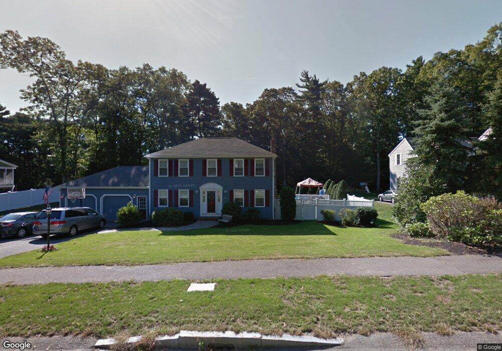
20 Caesar Chelor Dr Wrentham, MA 02093
Estimated Value: $718,960 - $885,000
3
Beds
2
Baths
1,768
Sq Ft
$452/Sq Ft
Est. Value
About This Home
This home is located at 20 Caesar Chelor Dr, Wrentham, MA 02093 and is currently estimated at $798,490, approximately $451 per square foot. 20 Caesar Chelor Dr is a home located in Norfolk County with nearby schools including Delaney Elementary School and Charles E Roderick.
Ownership History
Date
Name
Owned For
Owner Type
Purchase Details
Closed on
Jan 22, 1993
Sold by
Diplacido Dev Corp
Bought by
Crowley Christine A
Current Estimated Value
Home Financials for this Owner
Home Financials are based on the most recent Mortgage that was taken out on this home.
Original Mortgage
$149,100
Interest Rate
8.15%
Mortgage Type
Purchase Money Mortgage
Purchase Details
Closed on
Nov 12, 1992
Sold by
Diplacido Thomas W
Bought by
Diplacido Dev Corp
Create a Home Valuation Report for This Property
The Home Valuation Report is an in-depth analysis detailing your home's value as well as a comparison with similar homes in the area
Purchase History
| Date | Buyer | Sale Price | Title Company |
|---|---|---|---|
| Crowley Christine A | $186,400 | -- | |
| Diplacido Dev Corp | $60,000 | -- |
Source: Public Records
Mortgage History
| Date | Status | Borrower | Loan Amount |
|---|---|---|---|
| Open | Diplacido Dev Corp | $325,000 | |
| Closed | Diplacido Dev Corp | $148,000 | |
| Closed | Diplacido Dev Corp | $149,100 |
Source: Public Records
Tax History
| Year | Tax Paid | Tax Assessment Tax Assessment Total Assessment is a certain percentage of the fair market value that is determined by local assessors to be the total taxable value of land and additions on the property. | Land | Improvement |
|---|---|---|---|---|
| 2025 | $7,853 | $677,600 | $338,300 | $339,300 |
| 2024 | $7,692 | $641,000 | $338,300 | $302,700 |
| 2023 | $7,453 | $590,600 | $307,600 | $283,000 |
| 2022 | $7,087 | $518,400 | $279,500 | $238,900 |
| 2021 | $7,029 | $499,600 | $279,500 | $220,100 |
| 2020 | $6,588 | $462,300 | $229,800 | $232,500 |
| 2019 | $6,420 | $454,700 | $229,800 | $224,900 |
| 2018 | $6,419 | $450,800 | $229,900 | $220,900 |
| 2017 | $6,311 | $442,900 | $225,400 | $217,500 |
| 2016 | $6,173 | $432,300 | $218,900 | $213,400 |
| 2015 | $6,106 | $407,600 | $210,500 | $197,100 |
| 2014 | $5,562 | $363,300 | $173,500 | $189,800 |
Source: Public Records
Map
Nearby Homes
- 2 Earle Stewart Ln
- 12 Earle Stewart Ln
- 3 Earle Stewart Ln
- 10 Earle Stewart Ln Unit Lot 5
- 10 Nature View Dr
- 15 Nature View Dr
- 500 Franklin St
- 287 Park St
- 50 Reed Fulton Ave Unit Lot 61
- 246 Forest Grove Ave
- 45 Joshua Rd
- 576 Dedham St
- 11 Weber Farm Rd Unit 11
- 8 Weber Farm Rd Unit 8
- 440 Chestnut St
- 0 W Birch Rd
- 30 Weber Farm Rd Unit 30
- 75 Jordan Rd
- 8 Ridgefield Rd
- 483 Thurston St
- 0 Ceasar Chelor
- 10 Caesar Chelor Dr
- 30 Caesar Chelor Dr
- 45 Caesar Chelor Dr
- 35 Caesar Chelor Dr
- 25 Caesar Chelor Dr
- 40 Caesar Chelor Dr
- 55 Caesar Chelor Dr
- 50 Lakeside Ave
- 110 Lakeside Ave
- 42 Lakeside Ave
- 46 Lakeside Ave
- 130 Creek St
- 130 Creek St Unit 2
- 114 Lakeside Ave
- 8 Caesar Chelor Dr
- 15 Caesar Chelor Dr
- 50 Caesar Chelor Dr
- 65 Caesar Chelor Dr
- 40 Lakeside Ave
Your Personal Tour Guide
Ask me questions while you tour the home.