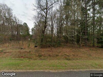
20 Cannon Rd Hawkinsville, GA 31036
Estimated Value: $58,267 - $119,000
3
Beds
2
Baths
1,064
Sq Ft
$89/Sq Ft
Est. Value
About This Home
This home is located at 20 Cannon Rd, Hawkinsville, GA 31036 and is currently estimated at $94,567, approximately $88 per square foot. 20 Cannon Rd is a home with nearby schools including Pulaski County Elementary School, Pulaski County Middle School, and Hawkinsville High School.
Ownership History
Date
Name
Owned For
Owner Type
Purchase Details
Closed on
Mar 7, 2008
Sold by
Allen Larry E
Bought by
Castaneda Marco Antonio Diaz
Current Estimated Value
Purchase Details
Closed on
Mar 5, 2008
Sold by
Fleeman Constance C
Bought by
Allen Larry E
Purchase Details
Closed on
Apr 11, 2000
Sold by
Fleeman Constance C
Bought by
Register Jonathan D
Create a Home Valuation Report for This Property
The Home Valuation Report is an in-depth analysis detailing your home's value as well as a comparison with similar homes in the area
Home Values in the Area
Average Home Value in this Area
Purchase History
| Date | Buyer | Sale Price | Title Company |
|---|---|---|---|
| Castaneda Marco Antonio Diaz | $37,500 | -- | |
| Allen Larry E | -- | -- | |
| Register Jonathan D | $10,000 | -- |
Source: Public Records
Mortgage History
| Date | Status | Borrower | Loan Amount |
|---|---|---|---|
| Open | Castaneda Marco Antonio Diaz | $16,431 |
Source: Public Records
Tax History Compared to Growth
Tax History
| Year | Tax Paid | Tax Assessment Tax Assessment Total Assessment is a certain percentage of the fair market value that is determined by local assessors to be the total taxable value of land and additions on the property. | Land | Improvement |
|---|---|---|---|---|
| 2024 | $119 | $4,178 | $2,828 | $1,350 |
| 2023 | $160 | $5,595 | $2,628 | $2,967 |
| 2022 | $318 | $11,104 | $2,628 | $8,476 |
| 2021 | $319 | $11,104 | $2,628 | $8,476 |
| 2020 | $320 | $11,104 | $2,628 | $8,476 |
| 2019 | $291 | $10,124 | $2,628 | $7,496 |
| 2018 | $291 | $10,124 | $2,628 | $7,496 |
| 2017 | $307 | $10,684 | $2,628 | $8,056 |
| 2016 | $307 | $10,684 | $2,628 | $8,056 |
| 2015 | -- | $10,237 | $2,628 | $7,609 |
| 2014 | -- | $10,237 | $2,628 | $7,609 |
| 2013 | -- | $10,237 | $2,628 | $7,609 |
Source: Public Records
Map
Nearby Homes
- 311 Riverside Dr
- 0 Industrial Blvd Unit 10367445
- 5 Poplar St
- 3 Joseph Rullo St
- 7 Highland Ave
- 0 Progress Ave Unit 252062
- 66 Progress Ave
- 86 North St
- 603 Castle Ct
- 602 Castle Ct
- 604 Castle Ct
- 601 Castle Ct
- 191 Commerce St
- 6.44 +/- acres Georgia 26
- 1301 Georgia 26
- V/L Sandy Dr
- 0 Sandy Dr Unit 10507984
- 20 Sandy Dr
- 35 Arbor Dr
- 41 Merritt St
- 20 Cannon Rd
- 42 Fire Road 110
- 0 Cannon Rd
- 0 Cannon Rd Unit 7314661
- 58 Cannon Rd
- 338 Upper River Rd
- 308 Upper River Rd
- 373 Upper River Rd
- LOT Honey Bee Rd
- 0 Honey Bee Rd
- 146 High Bluff Rd Unit 110
- 147 High Bluff Rd
- 130 High Bluff Rd
- Lot High Bluff Rd
- 136 High Bluff Rd
- 116 High Bluff Rd
- 84 High Bluff Rd
- 397 Upper River Rd
- 80 High Bluff Rd
- 6 High Bluff Rd
