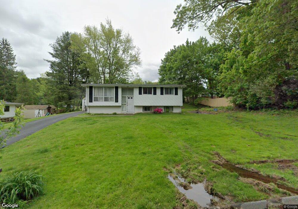
20 Cartridge Trail Ledyard, CT 06339
Estimated Value: $264,000 - $355,544
3
Beds
2
Baths
1,028
Sq Ft
$286/Sq Ft
Est. Value
About This Home
This home is located at 20 Cartridge Trail, Ledyard, CT 06339 and is currently estimated at $293,886, approximately $285 per square foot. 20 Cartridge Trail is a home located in New London County with nearby schools including Ledyard Middle School and Ledyard High School.
Ownership History
Date
Name
Owned For
Owner Type
Purchase Details
Closed on
May 30, 2025
Sold by
Homand Mark A
Bought by
Fox-Hetzer Samuel and Fox-Hetzer Eileen
Current Estimated Value
Home Financials for this Owner
Home Financials are based on the most recent Mortgage that was taken out on this home.
Original Mortgage
$266,750
Outstanding Balance
$266,065
Interest Rate
6.81%
Mortgage Type
Purchase Money Mortgage
Estimated Equity
$27,821
Purchase Details
Closed on
Nov 30, 2015
Sold by
Homand Francis A and Homand Ann E
Bought by
Homand Mark A
Purchase Details
Closed on
Oct 4, 1972
Bought by
Homand Mark A
Create a Home Valuation Report for This Property
The Home Valuation Report is an in-depth analysis detailing your home's value as well as a comparison with similar homes in the area
Home Values in the Area
Average Home Value in this Area
Purchase History
| Date | Buyer | Sale Price | Title Company |
|---|---|---|---|
| Fox-Hetzer Samuel | $275,000 | None Available | |
| Fox-Hetzer Samuel | $275,000 | None Available | |
| Homand Mark A | -- | -- | |
| Homand Mark A | -- | -- | |
| Homand Mark A | -- | -- |
Source: Public Records
Mortgage History
| Date | Status | Borrower | Loan Amount |
|---|---|---|---|
| Open | Fox-Hetzer Samuel | $266,750 | |
| Closed | Fox-Hetzer Samuel | $266,750 | |
| Previous Owner | Homand Mark A | $42,880 |
Source: Public Records
Tax History Compared to Growth
Tax History
| Year | Tax Paid | Tax Assessment Tax Assessment Total Assessment is a certain percentage of the fair market value that is determined by local assessors to be the total taxable value of land and additions on the property. | Land | Improvement |
|---|---|---|---|---|
| 2025 | $4,752 | $127,960 | $42,560 | $85,400 |
| 2024 | $4,621 | $131,250 | $42,560 | $88,690 |
| 2023 | $4,536 | $131,250 | $42,560 | $88,690 |
| 2022 | $4,439 | $131,250 | $42,560 | $88,690 |
| 2021 | $4,410 | $131,250 | $42,560 | $88,690 |
| 2020 | $4,007 | $114,590 | $34,090 | $80,500 |
| 2019 | $4,018 | $114,590 | $34,090 | $80,500 |
| 2018 | $3,929 | $114,590 | $34,090 | $80,500 |
| 2017 | $3,729 | $114,590 | $34,090 | $80,500 |
| 2016 | $3,655 | $114,590 | $34,090 | $80,500 |
| 2015 | $3,484 | $114,590 | $34,090 | $80,500 |
| 2014 | $3,489 | $116,690 | $34,090 | $82,600 |
Source: Public Records
Map
Nearby Homes
- 12 Cartridge Trail
- 113 Meeting House Ln
- 61 Town Farm Rd
- 7 Captain Amos Stanton Dr
- 115 Meeting House Ln
- 22 Cliff Rd
- 22 Boulder Way
- 148 Gallup Hill Rd
- 5 Sachem Ln
- 120 Gallup Hill Rd Unit 2A
- 120 Gallup Hill Rd Unit 3C
- 6 Lakeside Dr Unit P
- 20 Lakeside Dr Unit P
- 4 Lakeside Dr Unit L
- 45R Long Pond Rd S
- 155 Iron St
- 7 Chidley Way
- 332 Lantern Hill Rd
- 134 Iron St
- 188 Wolf Neck Rd
- 18 Cartridge Trail
- 45 Highland Dr
- 39 Highland Dr
- 37 Highland Dr
- 21 Cartridge Trail
- 35 Highland Dr
- 16 Cartridge Trail
- 19 Cartridge Trail
- 49 Highland Dr
- 17 Cartridge Trail
- 33 Highland Dr
- 44 Highland Dr
- 46 Highland Dr
- 14 Cartridge Trail
- 42 Highland Dr
- 48 Highland Dr
- 36 Highland Dr
- 38 Highland Dr
- 15 Cartridge Trail
- 34 Highland Dr