Estimated Value: $311,000 - $369,000
2
Beds
1
Bath
1,152
Sq Ft
$291/Sq Ft
Est. Value
About This Home
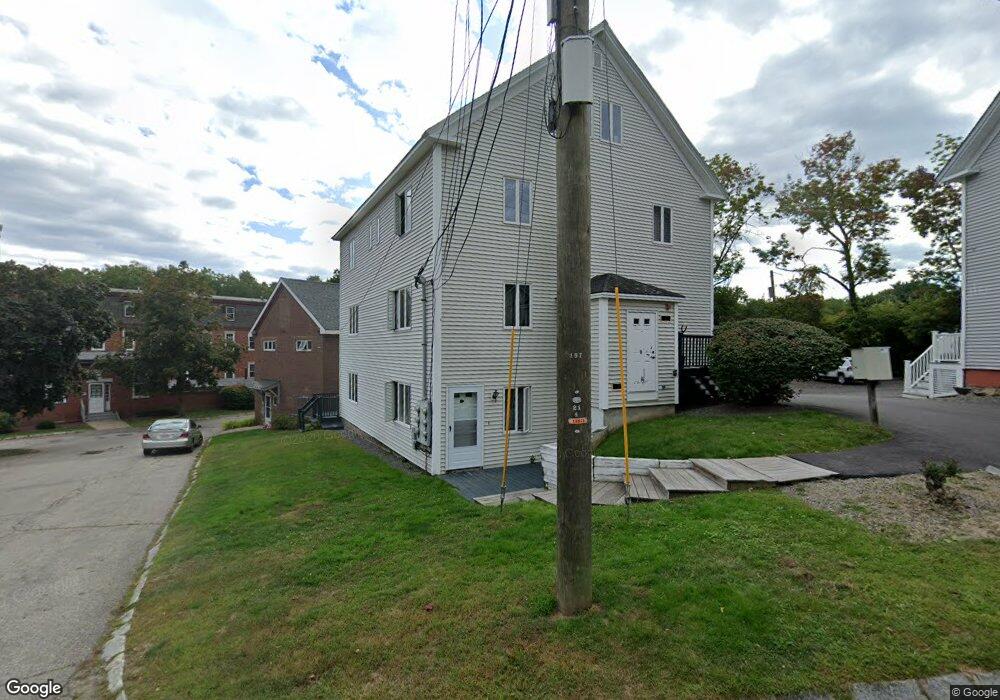
This home is located at 20 Charles St Unit F, Dover, NH 03820 and is currently estimated at $335,591, approximately $291 per square foot. 20 Charles St Unit F is a home located in Strafford County with nearby schools including Woodman Park School, Dover Middle School, and Dover Senior High School.
Ownership History
Date
Name
Owned For
Owner Type
Purchase Details
Closed on
Feb 9, 2001
Sold by
Leahy Amy J and Leahy Daniel J
Bought by
Barksdale Jonathan
Current Estimated Value
Home Financials for this Owner
Home Financials are based on the most recent Mortgage that was taken out on this home.
Original Mortgage
$63,100
Interest Rate
7.13%
Create a Home Valuation Report for This Property
The Home Valuation Report is an in-depth analysis detailing your home's value as well as a comparison with similar homes in the area
Home Values in the Area
Average Home Value in this Area
Purchase History
| Date | Buyer | Sale Price | Title Company |
|---|---|---|---|
| Barksdale Jonathan | $78,900 | -- |
Source: Public Records
Mortgage History
| Date | Status | Borrower | Loan Amount |
|---|---|---|---|
| Open | Barksdale Jonathan | $102,910 | |
| Closed | Barksdale Jonathan | $63,100 |
Source: Public Records
Tax History Compared to Growth
Tax History
| Year | Tax Paid | Tax Assessment Tax Assessment Total Assessment is a certain percentage of the fair market value that is determined by local assessors to be the total taxable value of land and additions on the property. | Land | Improvement |
|---|---|---|---|---|
| 2024 | $4,486 | $246,900 | $52,000 | $194,900 |
| 2023 | $4,078 | $218,100 | $45,000 | $173,100 |
| 2022 | $4,206 | $212,000 | $56,000 | $156,000 |
| 2021 | $4,062 | $187,200 | $50,000 | $137,200 |
| 2020 | $3,971 | $159,800 | $46,000 | $113,800 |
| 2019 | $3,892 | $154,500 | $43,000 | $111,500 |
| 2018 | $3,686 | $147,900 | $37,000 | $110,900 |
| 2017 | $3,611 | $139,600 | $32,000 | $107,600 |
| 2016 | $3,426 | $130,300 | $26,900 | $103,400 |
| 2015 | $3,294 | $123,800 | $23,000 | $100,800 |
| 2014 | $3,220 | $123,800 | $23,000 | $100,800 |
| 2011 | -- | $119,300 | $23,000 | $96,300 |
Source: Public Records
Map
Nearby Homes
- 2 Shamrock Ln
- 73 Rutland St
- 35 Lenox Dr Unit B
- 20 Lenox Dr Unit c
- 31 Lenox Dr Unit B
- 22 Lenox Dr Unit D
- 29 Lenox Dr Unit B
- 16 Lenox Dr Unit C
- 25 Lenox Dr Unit A
- 17 Lenox Dr Unit A
- 56 Durham Rd Unit 19
- 21 Lenox Dr Unit A
- 26 Lenox Dr Unit D
- 15 Lenox Dr Unit A
- 23 Lenox Dr Unit A
- 32 Lenox Dr Unit D
- 181 Central Ave
- 12 Zeland Dr
- 36 Court St
- 15 Dover Point Rd
- 20 Charles St Unit H
- 20 Charles St Unit G
- 20 Charles St Unit E
- 20 Charles St Unit D
- 20 Charles St Unit H
- 20 Charles St Unit 20E
- 5 Charles St
- 20 Charles St
- 20 Charles St Unit 20D
- 20 Charles St Unit H
- 9 Charles St
- 8 Central Ave
- 14 Charles St Unit 16
- 10 Charles St Unit 12
- 13 Charles St Unit 15
- 13 Charles St
- 17 Charles St Unit 19
- 17-19 Charles St
- 18 Charles St Unit C
- 18 Charles St Unit B