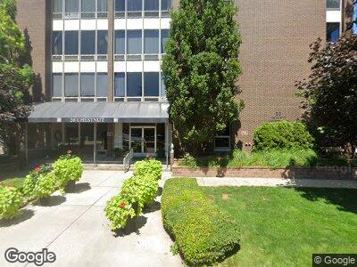
20 Chestnut St, Unit 801 Wyandotte, MI 48192
Estimated Value: $114,000 - $139,000
1
Bed
1
Bath
750
Sq Ft
$173/Sq Ft
Est. Value
About This Home
This home is located at 20 Chestnut St Unit 801, Wyandotte, MI 48192 and is currently estimated at $129,466, approximately $172 per square foot. 20 Chestnut St Unit 801 is a home located in Wayne County with nearby schools including James A. Garfield Elementary School, Woodrow Wilson School, and Roosevelt High School.
Ownership History
Date
Name
Owned For
Owner Type
Purchase Details
Closed on
Nov 26, 2008
Sold by
Cholette Karin L and The Dorothy Evans Revocable Li
Bought by
Rushman Ryan N
Current Estimated Value
Home Financials for this Owner
Home Financials are based on the most recent Mortgage that was taken out on this home.
Original Mortgage
$42,400
Interest Rate
6.49%
Mortgage Type
Unknown
Purchase Details
Closed on
Jun 27, 2007
Sold by
Evans Dorothy M and Page Linda L
Bought by
Dorothy Evans Revocable Living House Tr
Create a Home Valuation Report for This Property
The Home Valuation Report is an in-depth analysis detailing your home's value as well as a comparison with similar homes in the area
Home Values in the Area
Average Home Value in this Area
Purchase History
| Date | Buyer | Sale Price | Title Company |
|---|---|---|---|
| Rushman Ryan N | $53,000 | Michigan Title Insurance Age | |
| Dorothy Evans Revocable Living House Tr | -- | None Available |
Source: Public Records
Mortgage History
| Date | Status | Borrower | Loan Amount |
|---|---|---|---|
| Open | Rushman Ryan N | $17,000 | |
| Open | Rushman Ryan N | $42,092 | |
| Closed | Rushman Ryan N | $42,400 |
Source: Public Records
Tax History Compared to Growth
Tax History
| Year | Tax Paid | Tax Assessment Tax Assessment Total Assessment is a certain percentage of the fair market value that is determined by local assessors to be the total taxable value of land and additions on the property. | Land | Improvement |
|---|---|---|---|---|
| 2024 | $1,576 | $47,200 | $0 | $0 |
| 2023 | $1,503 | $43,500 | $0 | $0 |
| 2022 | $1,741 | $41,500 | $0 | $0 |
| 2021 | $1,707 | $42,100 | $0 | $0 |
| 2020 | $1,683 | $39,000 | $0 | $0 |
| 2019 | $1,660 | $36,600 | $0 | $0 |
| 2018 | $1,325 | $34,200 | $0 | $0 |
| 2017 | $580 | $34,200 | $0 | $0 |
| 2016 | $1,602 | $32,600 | $0 | $0 |
| 2015 | $2,859 | $30,300 | $0 | $0 |
| 2013 | -- | $27,700 | $0 | $0 |
| 2012 | $1,174 | $27,700 | $10,100 | $17,600 |
Source: Public Records
About This Building
Map
Nearby Homes
- 20 Chestnut St
- 20 Chestnut St Unit 401 & 408
- 2715 Biddle Ave
- 2551 Biddle Ave
- 2543 Biddle Ave
- 221 Oak St
- 335 Poplar St
- 3301 Biddle Ave Unit 9A
- 428 Vinewood St
- 423 Maple St
- 512 Poplar St
- 3352 4th St
- 254 Cedar St
- 616 Superior Blvd
- 618 Walnut St
- 523 Orange St
- 541 Mulberry St Unit 58
- 449 Spruce St
- 3634 4th St
- 682 4th St
- 20 Chestnut St Unit Bldg-Unit
- 20 Chestnut St Unit 23 (402)
- 20 Chestnut St Unit 23
- 20 Chestnut St Unit 902
- 20 Chestnut St Unit 201
- 20 Chestnut St Unit 905
- 20 Chestnut St Unit 808
- 20 Chestnut St Unit 702
- 20 Chestnut St Unit 108
- 20 Chestnut St Unit 307
- 20 Chestnut St Unit 404
- 20 Chestnut St Unit 403
- 20 Chestnut St Unit 803
- 20 Chestnut St Unit 907
- 20 Chestnut St Unit 801
- 20 Chestnut St Unit 704
- 20 Chestnut St Unit 703
- 20 Chestnut St Unit 1005
- 20 Chestnut St Unit 107
- 20 Chestnut St Unit 106