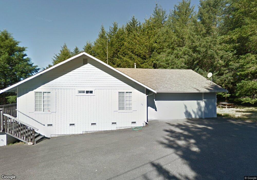
20 Cinch Ct Whitethorn, CA 95589
Shelter Cove NeighborhoodEstimated Value: $287,000 - $429,000
--
Bed
--
Bath
1,124
Sq Ft
$301/Sq Ft
Est. Value
About This Home
This home is located at 20 Cinch Ct, Whitethorn, CA 95589 and is currently estimated at $338,622, approximately $301 per square foot. 20 Cinch Ct is a home located in Humboldt County.
Ownership History
Date
Name
Owned For
Owner Type
Purchase Details
Closed on
Feb 8, 2021
Sold by
King Daniel H and King Family Revocable Trust
Bought by
Graham Cindy L and Graham David Wendy
Current Estimated Value
Purchase Details
Closed on
Mar 16, 2018
Sold by
King Robert J and King Family Revocable Trust
Bought by
King Robert J and King Family Revocable Trust
Purchase Details
Closed on
Feb 2, 1998
Sold by
King Robert J and King Glendine D
Bought by
King Robert J and King Glendine D
Create a Home Valuation Report for This Property
The Home Valuation Report is an in-depth analysis detailing your home's value as well as a comparison with similar homes in the area
Home Values in the Area
Average Home Value in this Area
Purchase History
| Date | Buyer | Sale Price | Title Company |
|---|---|---|---|
| Graham Cindy L | -- | None Available | |
| King Robert J | -- | None Available | |
| King Robert J | -- | -- |
Source: Public Records
Tax History Compared to Growth
Tax History
| Year | Tax Paid | Tax Assessment Tax Assessment Total Assessment is a certain percentage of the fair market value that is determined by local assessors to be the total taxable value of land and additions on the property. | Land | Improvement |
|---|---|---|---|---|
| 2025 | $2,183 | $176,652 | $42,477 | $134,175 |
| 2024 | $2,183 | $173,190 | $41,645 | $131,545 |
| 2023 | $2,191 | $169,795 | $40,829 | $128,966 |
| 2022 | $2,161 | $166,467 | $40,029 | $126,438 |
| 2021 | $2,089 | $163,204 | $39,245 | $123,959 |
| 2020 | $2,100 | $161,531 | $38,843 | $122,688 |
| 2019 | $2,055 | $158,365 | $38,082 | $120,283 |
| 2018 | $2,024 | $155,261 | $37,336 | $117,925 |
| 2017 | $1,891 | $152,217 | $36,604 | $115,613 |
| 2016 | $1,881 | $149,234 | $35,887 | $113,347 |
| 2015 | $1,872 | $146,993 | $35,348 | $111,645 |
| 2014 | $1,771 | $144,115 | $34,656 | $109,459 |
Source: Public Records
Map
Nearby Homes
- 48 Cinch Ct
- 776 Upper Pacific Dr
- 865 Upper Pacific Dr
- 825 Upper Pacific Dr
- 489 & 508 Humboldt Loop Rd
- 87 Tern Rd
- 245 Albatross Rd
- 443 Humboldt Loop
- 7 Seaview Point
- 680 Redwood Rd
- 19 Seaview Point
- 199 Spring Road 166 Debbie Ln
- 80 Eel Ct
- 68 Eel Ct
- 30 Fir Ct
- 133 Eel Ct
- 189 & 177 Hickory Rd
- 37 Spur Ct
- 15 Wave Dr
- 170 Wave Dr