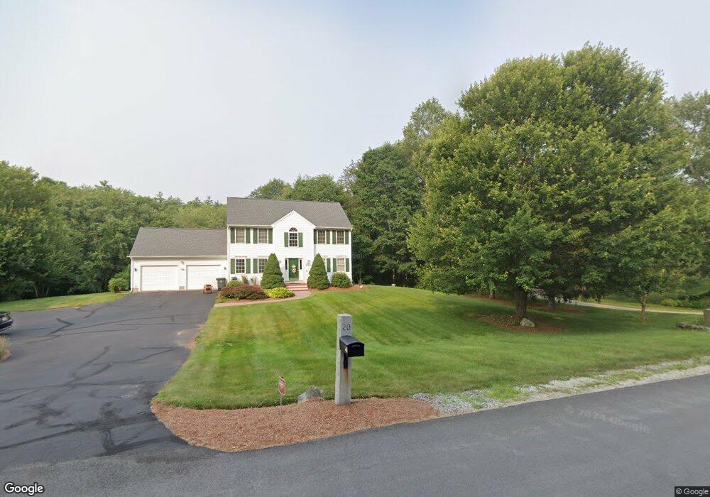
20 Cindy Dr Hooksett, NH 03106
Estimated Value: $647,000 - $813,000
3
Beds
2
Baths
1,920
Sq Ft
$373/Sq Ft
Est. Value
About This Home
This home is located at 20 Cindy Dr, Hooksett, NH 03106 and is currently estimated at $716,921, approximately $373 per square foot. 20 Cindy Dr is a home located in Merrimack County with nearby schools including Fred C. Underhill School, Hooksett Memorial School, and David R. Cawley Middle School.
Ownership History
Date
Name
Owned For
Owner Type
Purchase Details
Closed on
Apr 22, 2022
Sold by
Kushner Matthew
Bought by
Matthew Kushner Ft
Current Estimated Value
Purchase Details
Closed on
May 7, 2007
Sold by
Rogers Theresa L
Bought by
Kushner Matthew B
Home Financials for this Owner
Home Financials are based on the most recent Mortgage that was taken out on this home.
Original Mortgage
$268,000
Interest Rate
6.23%
Mortgage Type
Purchase Money Mortgage
Purchase Details
Closed on
Aug 9, 1996
Sold by
Cindy Dr Rlty Corp
Bought by
Rogers Theresa L
Home Financials for this Owner
Home Financials are based on the most recent Mortgage that was taken out on this home.
Original Mortgage
$96,000
Interest Rate
8.24%
Create a Home Valuation Report for This Property
The Home Valuation Report is an in-depth analysis detailing your home's value as well as a comparison with similar homes in the area
Home Values in the Area
Average Home Value in this Area
Purchase History
| Date | Buyer | Sale Price | Title Company |
|---|---|---|---|
| Matthew Kushner Ft | -- | None Available | |
| Kushner Matthew B | $335,000 | -- | |
| Rogers Theresa L | $144,700 | -- |
Source: Public Records
Mortgage History
| Date | Status | Borrower | Loan Amount |
|---|---|---|---|
| Previous Owner | Rogers Theresa L | $240,000 | |
| Previous Owner | Rogers Theresa L | $258,900 | |
| Previous Owner | Rogers Theresa L | $268,000 | |
| Previous Owner | Rogers Theresa L | $96,000 |
Source: Public Records
Tax History
| Year | Tax Paid | Tax Assessment Tax Assessment Total Assessment is a certain percentage of the fair market value that is determined by local assessors to be the total taxable value of land and additions on the property. | Land | Improvement |
|---|---|---|---|---|
| 2024 | $9,650 | $569,000 | $178,700 | $390,300 |
| 2023 | $9,093 | $569,000 | $174,300 | $394,700 |
| 2022 | $8,050 | $334,700 | $119,300 | $215,400 |
| 2021 | $7,437 | $334,700 | $119,300 | $215,400 |
| 2020 | $7,534 | $334,700 | $119,300 | $215,400 |
| 2019 | $7,213 | $334,700 | $119,300 | $215,400 |
| 2018 | $7,404 | $334,700 | $119,300 | $215,400 |
| 2017 | $7,003 | $261,900 | $102,000 | $159,900 |
| 2016 | $6,912 | $261,900 | $102,000 | $159,900 |
| 2015 | $6,474 | $261,900 | $102,000 | $159,900 |
| 2014 | $6,503 | $261,900 | $102,000 | $159,900 |
| 2013 | $6,149 | $261,900 | $102,000 | $159,900 |
Source: Public Records
Map
Nearby Homes
- 15 Joanne Dr
- 14 Overlook Cir
- 22 Sunrise Cir
- 10 Harvard Ave
- 192 Londonderry Turnpike
- 36 Prescott Heights Rd
- 146 Brookview Dr
- 13 Johns Dr
- 191 Brookview Dr
- 135 Brookview Dr
- 100 Dartmouth Dr
- 80 Dartmouth Dr
- 41 Golden Gate Dr
- 2079 Wellington Rd
- 267 Londonderry Turnpike
- 1409 Wellington Rd
- 6 Golden Gate Dr
- 543 Fox Hollow Way
- 55 the Cliffs at Evergreen Cliffside Dr Unit 55
- 52 the Cliffs at Evergreen Dr
Your Personal Tour Guide
Ask me questions while you tour the home.