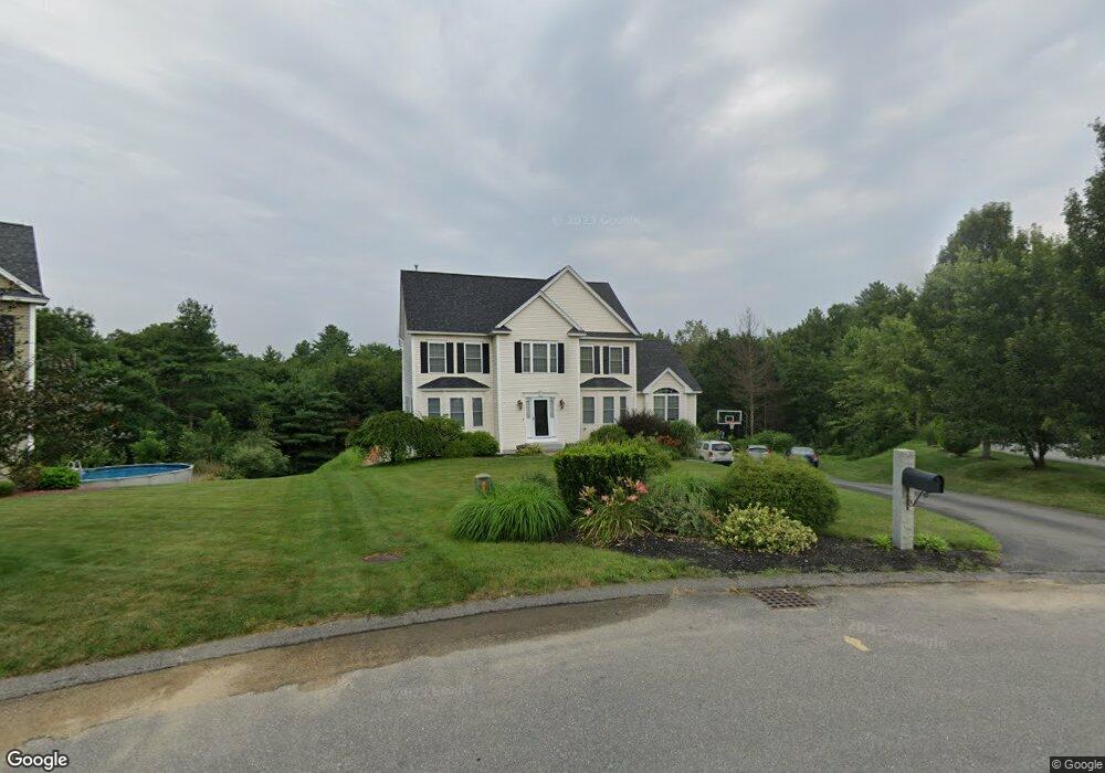
20 Clarke Farm Rd Windham, NH 03087
Estimated Value: $969,536 - $1,356,000
4
Beds
4
Baths
3,210
Sq Ft
$352/Sq Ft
Est. Value
About This Home
This home is located at 20 Clarke Farm Rd, Windham, NH 03087 and is currently estimated at $1,128,384, approximately $351 per square foot. 20 Clarke Farm Rd is a home with nearby schools including Golden Brook Elementary School, Windham Middle School, and Windham High School.
Ownership History
Date
Name
Owned For
Owner Type
Purchase Details
Closed on
Apr 29, 2008
Sold by
Polpis Development Llc
Bought by
Labonville Thomas A and Labonville Stephanie A
Current Estimated Value
Home Financials for this Owner
Home Financials are based on the most recent Mortgage that was taken out on this home.
Original Mortgage
$352,000
Interest Rate
6.22%
Create a Home Valuation Report for This Property
The Home Valuation Report is an in-depth analysis detailing your home's value as well as a comparison with similar homes in the area
Home Values in the Area
Average Home Value in this Area
Purchase History
| Date | Buyer | Sale Price | Title Company |
|---|---|---|---|
| Labonville Thomas A | $170,000 | -- |
Source: Public Records
Mortgage History
| Date | Status | Borrower | Loan Amount |
|---|---|---|---|
| Open | Labonville Thomas A | $341,300 | |
| Closed | Labonville Thomas A | $349,350 | |
| Closed | Labonville Thomas A | $350,000 | |
| Closed | Labonville Thomas A | $352,000 |
Source: Public Records
Tax History Compared to Growth
Tax History
| Year | Tax Paid | Tax Assessment Tax Assessment Total Assessment is a certain percentage of the fair market value that is determined by local assessors to be the total taxable value of land and additions on the property. | Land | Improvement |
|---|---|---|---|---|
| 2024 | $14,175 | $626,100 | $184,100 | $442,000 |
| 2023 | $13,399 | $626,100 | $184,100 | $442,000 |
| 2022 | $11,894 | $601,900 | $184,100 | $417,800 |
| 2021 | $11,207 | $601,900 | $184,100 | $417,800 |
| 2020 | $11,514 | $601,900 | $184,100 | $417,800 |
| 2019 | $10,959 | $486,000 | $169,700 | $316,300 |
| 2018 | $9,424 | $486,000 | $169,700 | $316,300 |
| 2017 | $9,817 | $486,000 | $169,700 | $316,300 |
| 2016 | $10,605 | $486,000 | $169,700 | $316,300 |
| 2015 | $10,556 | $486,000 | $169,700 | $316,300 |
| 2014 | $10,375 | $432,300 | $175,000 | $257,300 |
| 2013 | $10,660 | $451,700 | $175,000 | $276,700 |
Source: Public Records
Map
Nearby Homes
- 7 Buckhide Rd
- 2 2nd St
- 4 Elijah Hill Ln
- 87 Oakridge Dr
- 69 Oakridge Dr
- 33 Griffin Rd
- 63 Mammoth Rd
- 6 Lancaster Rd
- 1 Westwood Dr
- Lot 5 Plan at Highclere
- 24 Griffin Rd
- 21 Griffin Rd
- 97 Kendall Pond Rd
- 19 David Dr
- 138 Castle Hill Rd
- 18 Hawthorne Rd
- 6 Lund Dr
- 11 Park St
- 23 Ryan Farm Rd
- 24 Del Ray Dr Unit 25
- 21 Clarke Farm Rd
- 18 Clarke Farm Rd
- 109 Clarke Farm Rd
- 101 Clarke Farme Rd
- 110 Clarke Farm Rd
- 16 Clarke Farm Rd
- 19 Clarke Farm Rd
- 17 Clarke Farm Rd
- 14 Clarke Farm Rd
- 15 Clarke Farm Rd
- 11 Clarke Farm Rd
- 12 Clarke Farm Rd
- Lot 103 Clarke Farm Rd
- Lot 101 Clarke Farme Rd
- 16 Buckhide Rd
- 19 Buckhide Rd
- 7 Clarke Farm Rd
- Lot # 119 Buckhide Rd
- 10 Clarke Farm Rd
- 14 Buckhide Rd